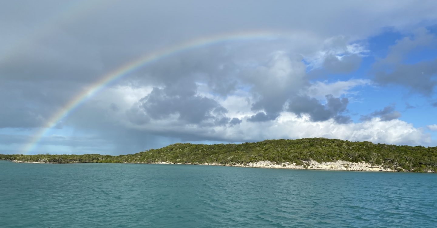
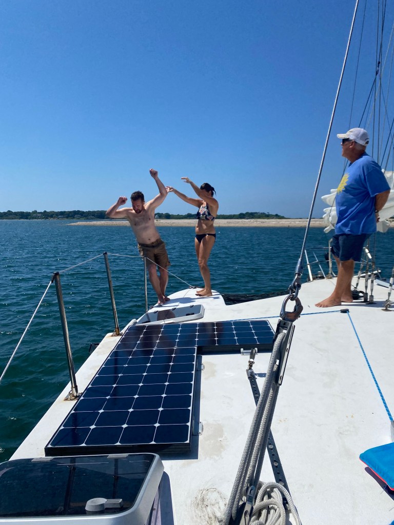
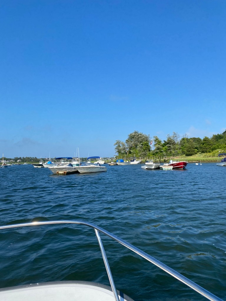
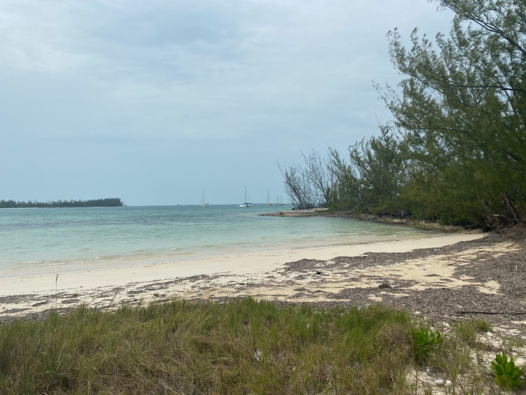
This was our very first time sailing the US east coast south of Beaufort, North Carolina. We did not have a time line or a plan, although we did not plan to motor down the ICW. We sailed down the coast as weather permitted. We considered options for the next port based on weather and appeal of the town. We also considered inlet conditions after the Winyah Bay saga that was described in the last blog.
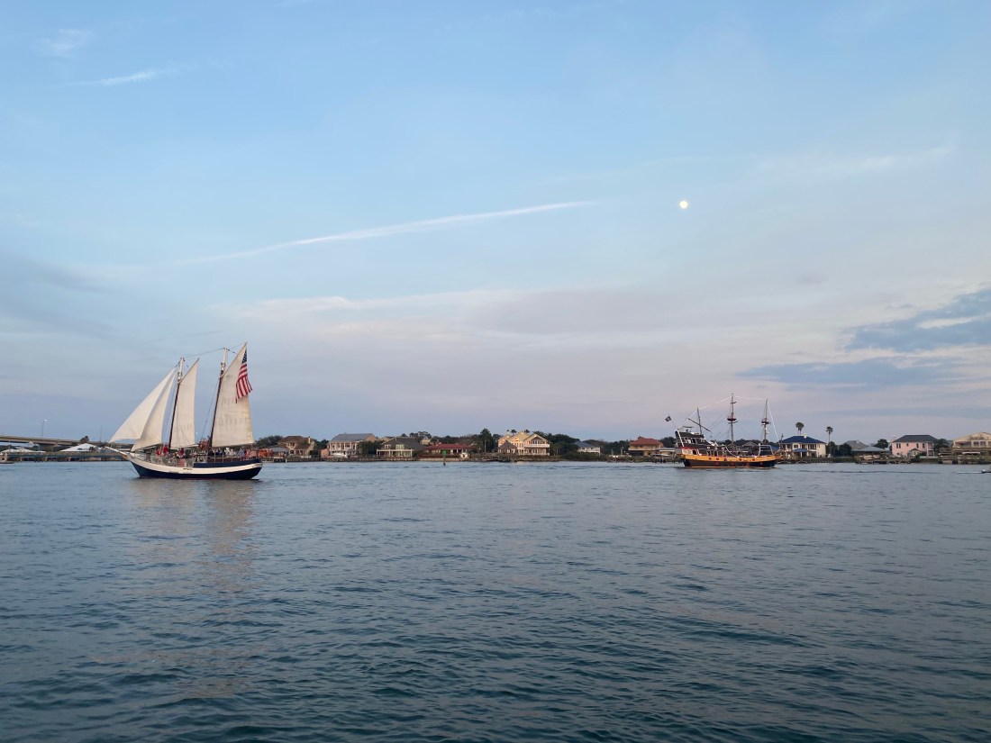
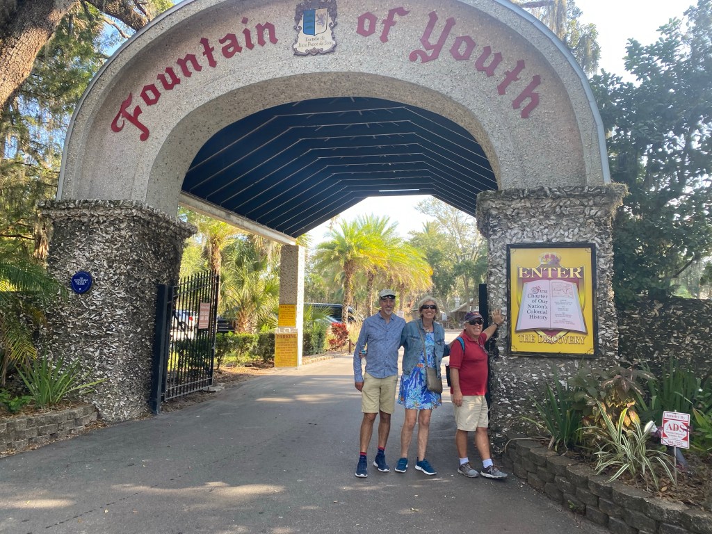
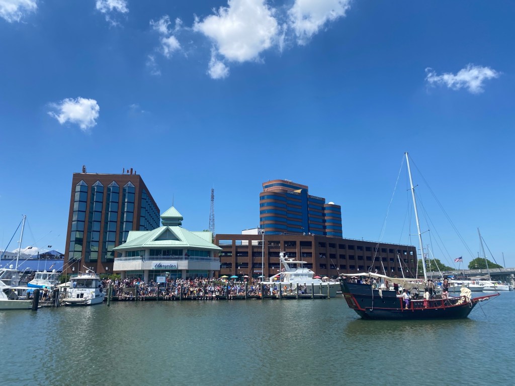
St. Augustine, Florida
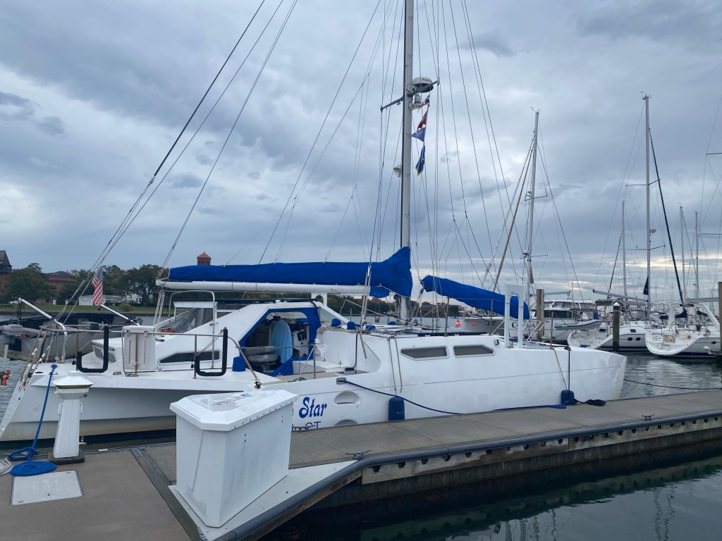
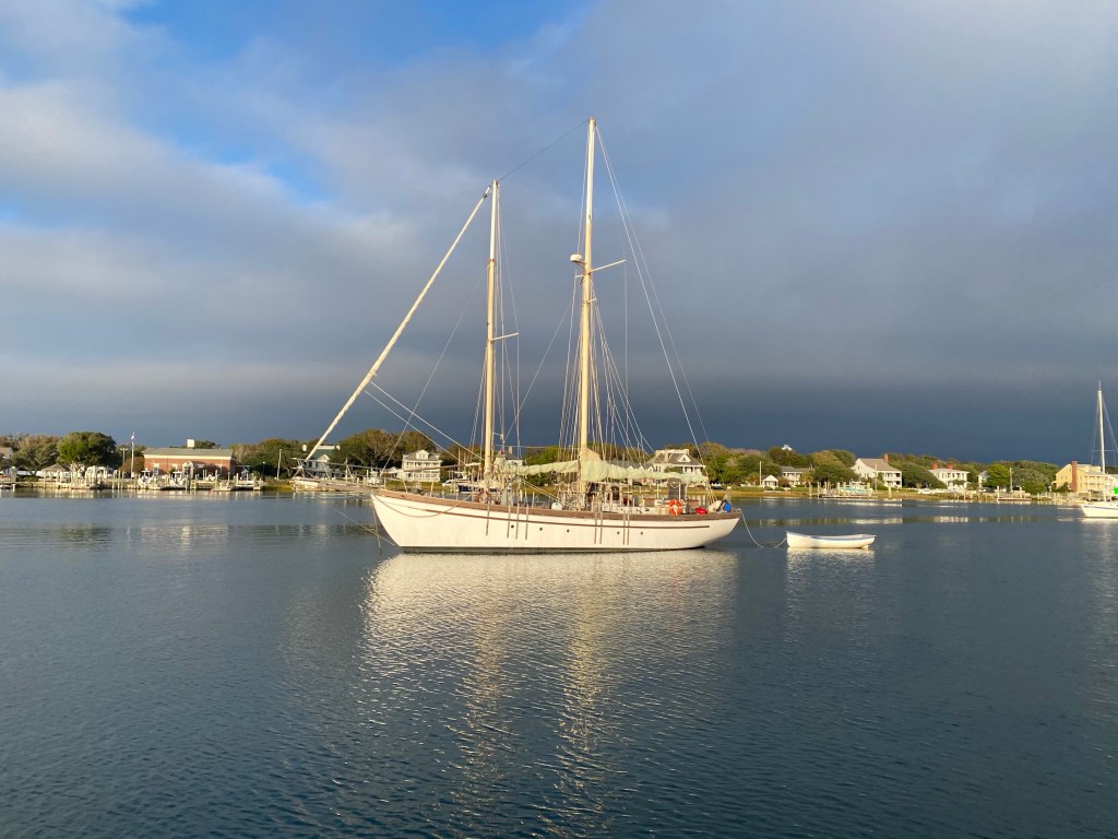
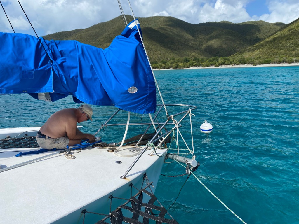
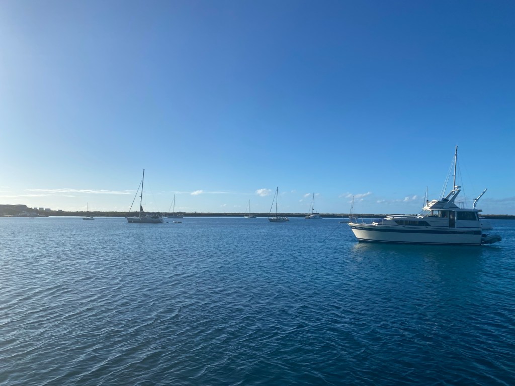
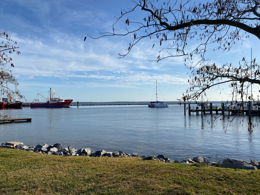
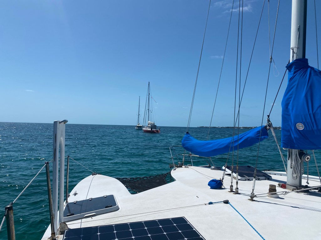
Lone Star moored north of the bridge of Lions in St. Augustine, FL
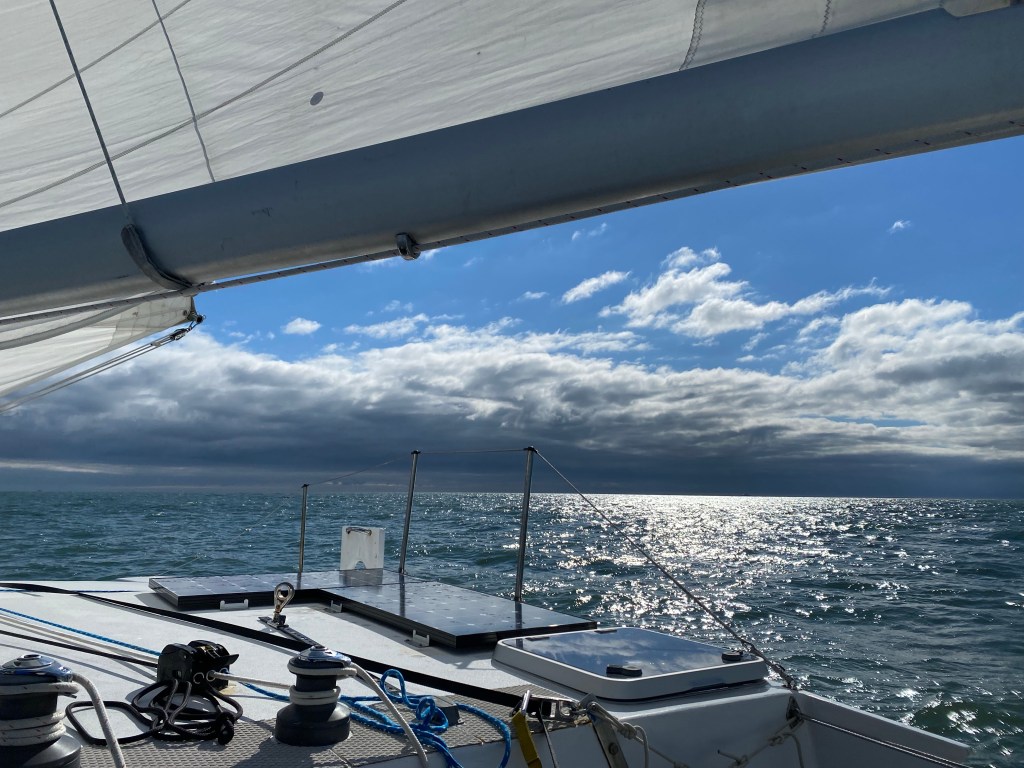
The 60 mile sail from Cumberland Island, Georgia to St. Augustine, Florida was longer than a day sail. As we wanted to arrive in daylight, we chose to leave in darkness. St. Mary’s Inlet is well lit and wide. We left with the out going current and had no problems. Wild Iris sailed with us and quickly sailed past us. We motored through the inlet, then enjoyed an easy sail the rest of the night.
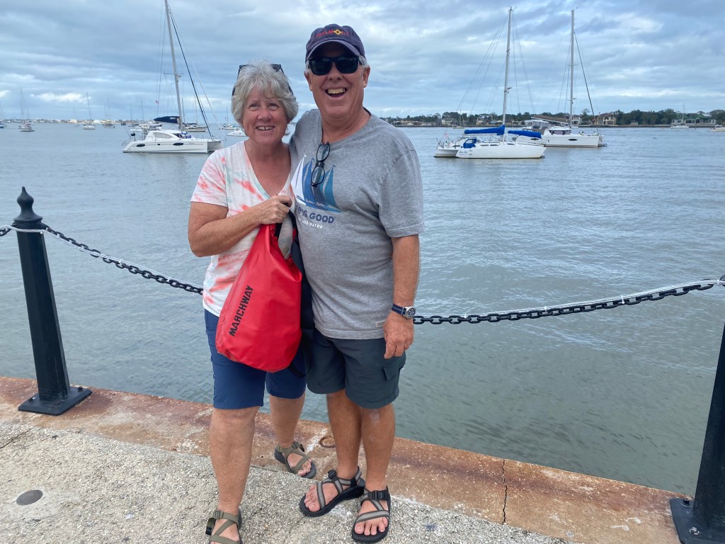
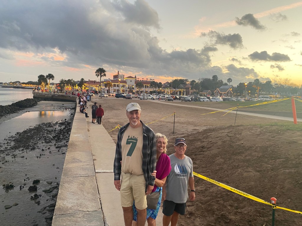
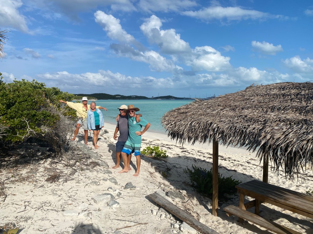
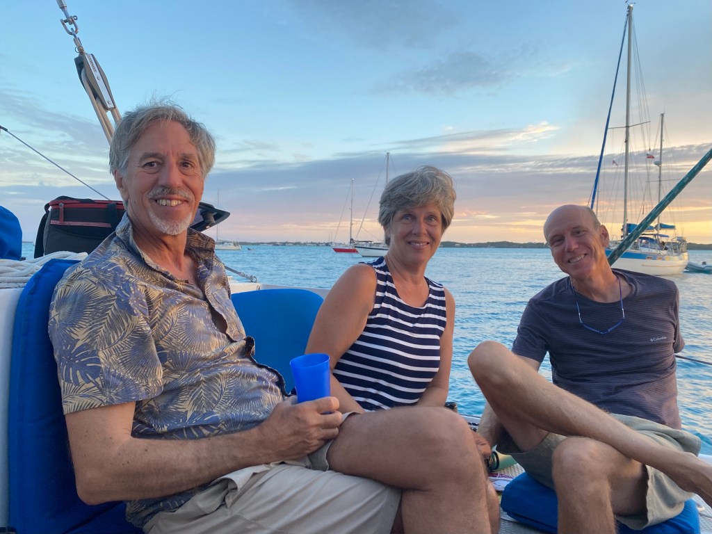
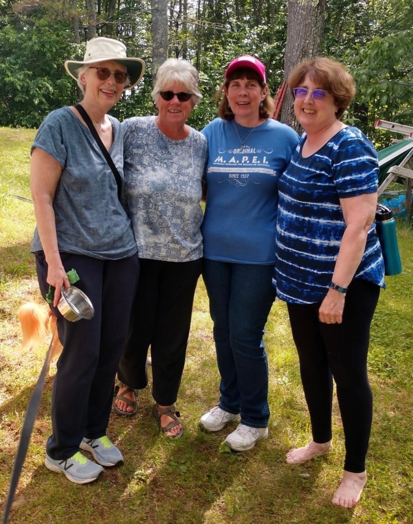
Walking around St. Augustine with friends
We spent six nights on a mooring. The Intercoastal Waterway (ICW) is just beyond the boats. Many boaters stop here! St. Augustine is said to be the oldest settlement in North America. We found it to be a very welcoming and interesting place to visit. There were so many things to see and do that it was difficult to choose.
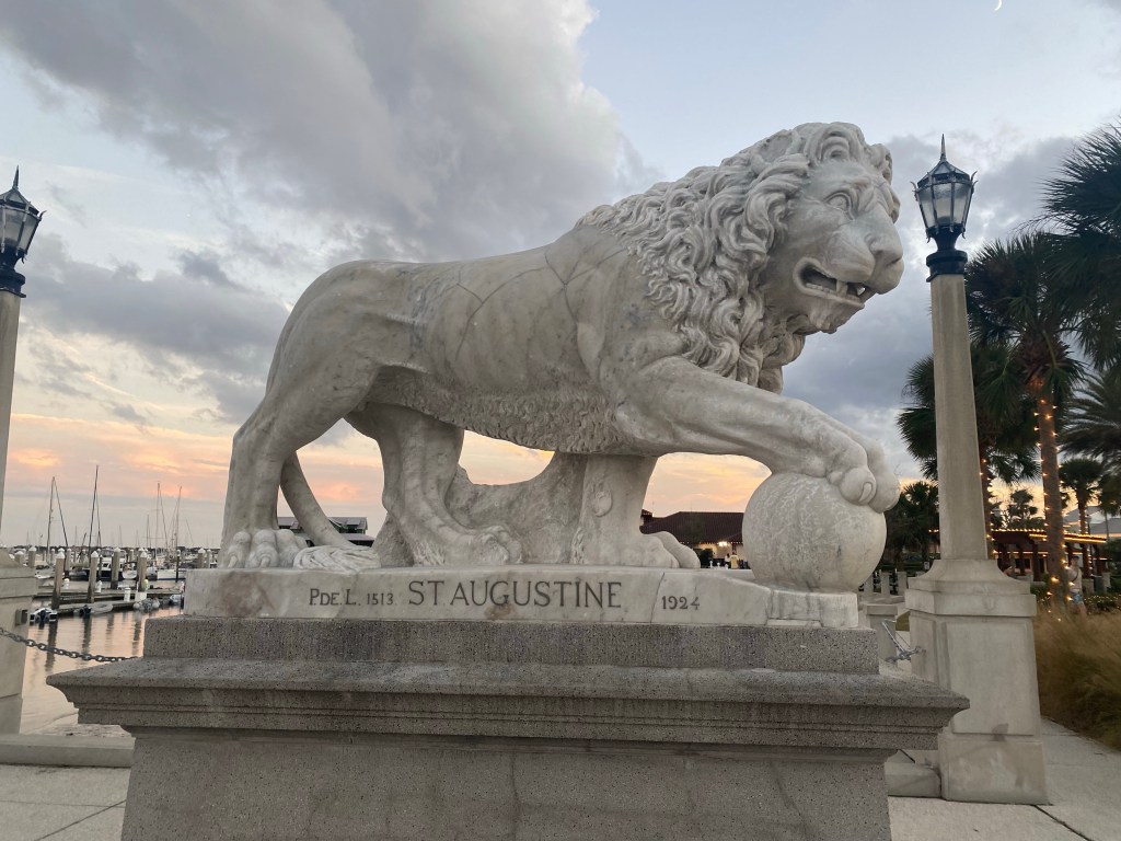
A pedestal on the Bridge of Lions
We enjoyed meeting up with cruising friends at various musical events around town. Stopping for a nibble, drink, or famous pizza. Yes, it was justifiably good!
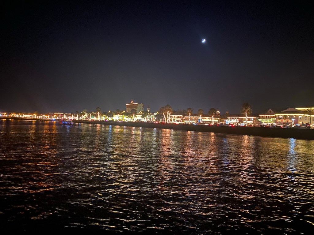
Walking to Castillo de San Marcos at sunset. The occasional cannon blasts from their tourist demonstrations were close enough to our mooring that we jumped a few times.Christmas lights of St. Augustine. They had a large generator in a trailer to run all these beautiful lights.Swinging to the wind on the mooring, often we swung with the current and against the wind.
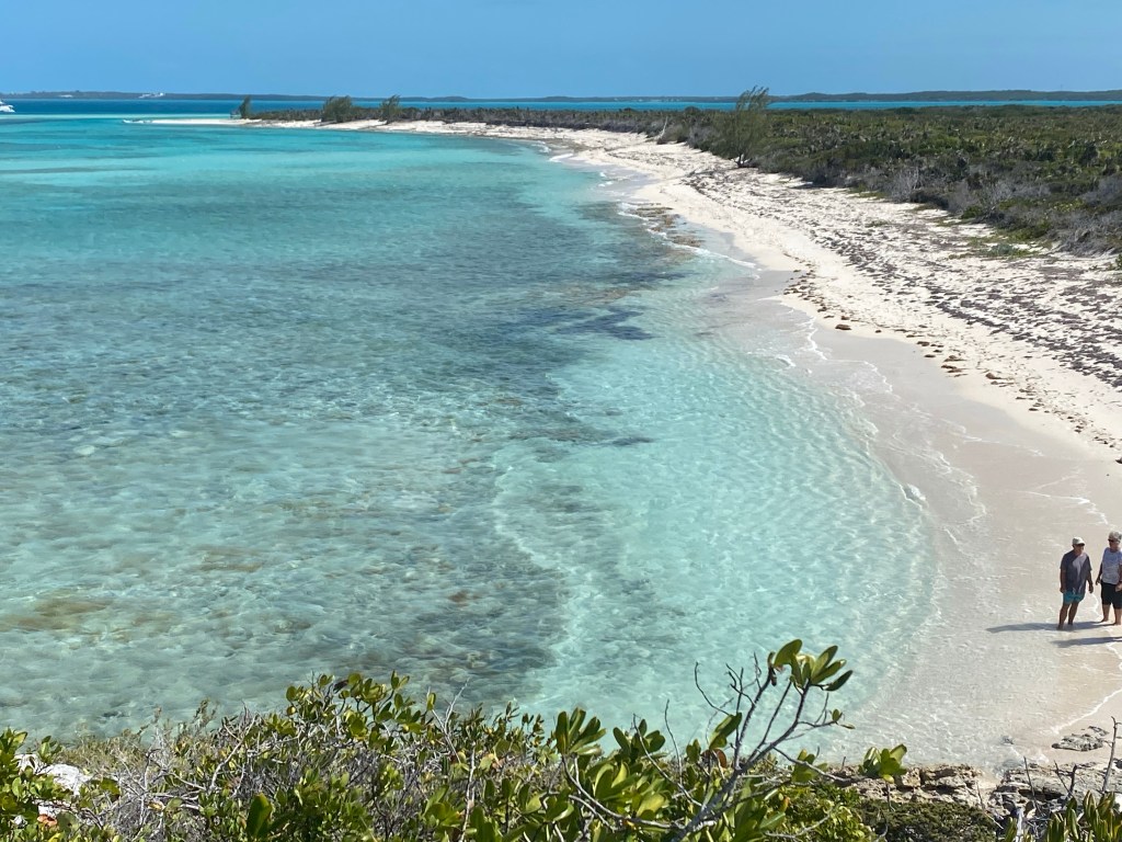
The weather was not good enough to head south. So when our mooring stay ended we motored north a few miles and anchored just south of Vilano Bridge. We found a beautiful beach to explore on the Eastern shore of the river. We also found a Publix supermarket for fresh supplies.
Public dinghy dock with access to Vilano Beach.
The following day we took the dinghies to Vilano Boat Ramp on the western shore.
We found this museum during a hike on the western shore. It was too late in the day to wander in. There are steep fees for all the attractions in this historical town. Best to start early!Interesting history!
Our hike took us all the way back into the Old City of St. Augustine where we found more historical treasures to explore.
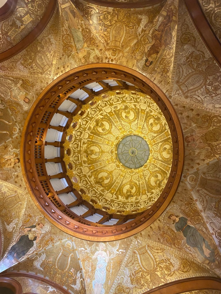
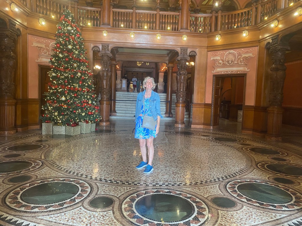
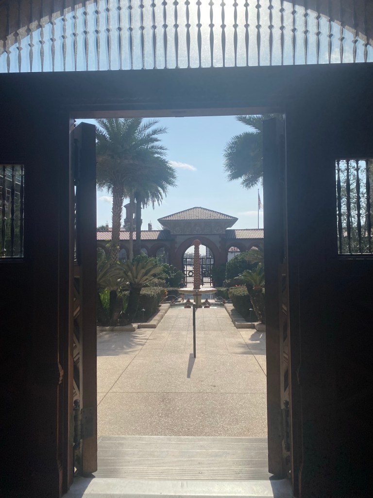
Ceiling of a very old Spanish building, now part of St. Augustine CollegeLisa admires the beautiful tile work in St. Augustine CollegeLooking back through the entrance at St. Augustine College. The fountain was lovely.
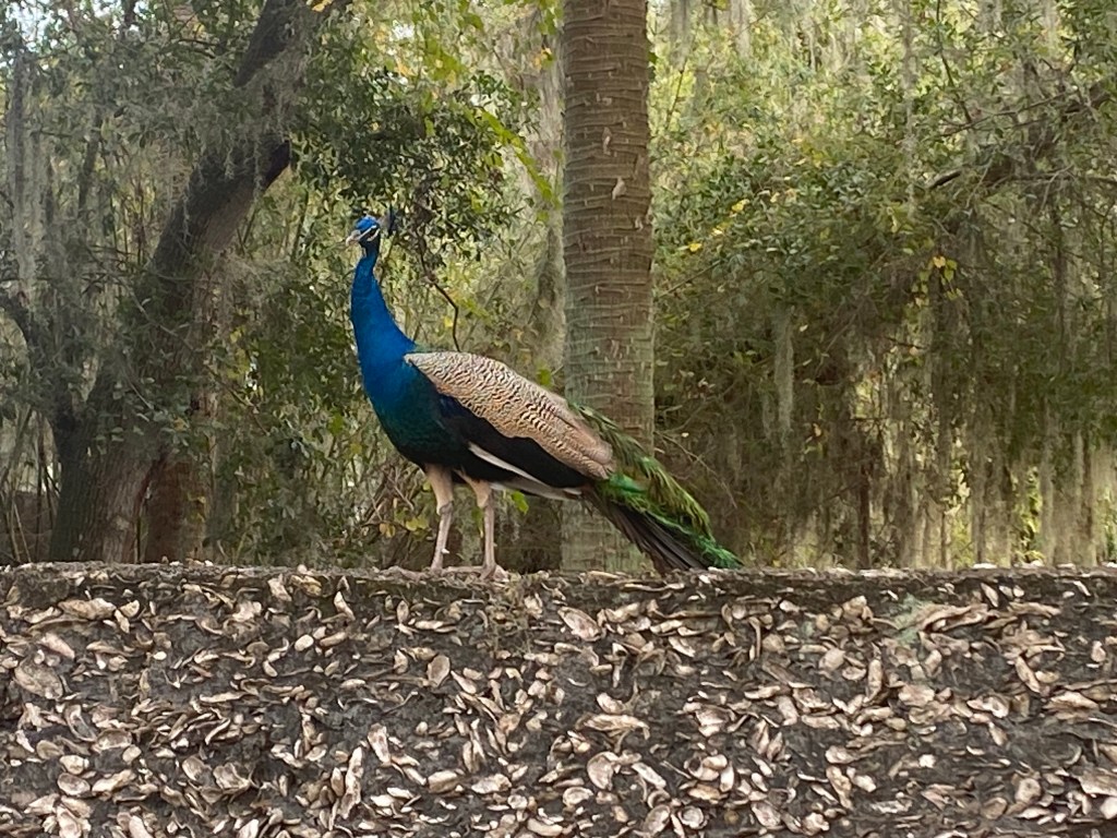
And on our hike back we saw this lovely Peacock on a unique border fence made of local materials.
Wild Peacock on a fence
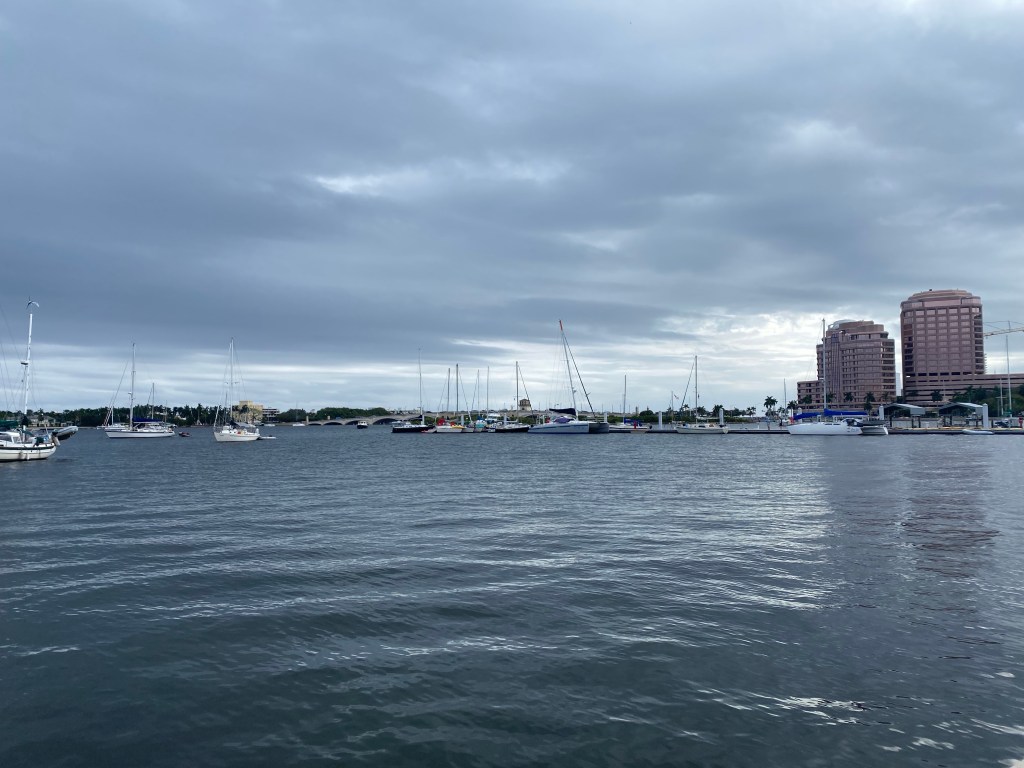
West Palm Beach, Florida
Our sail from St Augustine area to West Palm Beach was 209 miles. This ended up being a very slow passage with too much motoring: 52 hours total with 23 hours of motor-sailing. I sure wish we had a faster engine and/or a big light air sail!
Tom and I had a great time hiking around Peanut island. Gorgeous views and nice paved walking paths.Majestic palms line a park in West Palm Beach
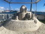
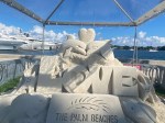
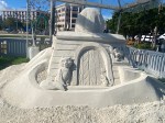
Sand Castles in West Palm Beach, Florida
Part of the winter festival is to have a sandcastle contest. Here are a few of our favorites.
In mid December we decided to motor 3.5 miles south down the InterCoastal Waterway (ICW) and through the Flagler Bridge to a very secure anchorage across from West Palm Beach.
Lone Star at the public dock in West Palm.
We had scheduled a serviceman to come aboard for our water maker. They recommended we pull in to the public dock.
We enjoyed wandering around this open air market in West Palm BeachWe’ve endured a lot of cloudy, cool weather this Autumn. The locals said it has been unusually cold for this time of year.
Marathon, Florida
We enjoyed a beautiful 30 hour, 160 nautical mile offshore sail to Marathon on Boot Key. It was a downwind run on the tails of yet another cold front.
Next morning, underway toward Marathon, Florida
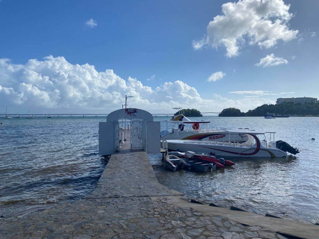
We heard Marathon was a cruiser’s must stop as their is an organized group here similar to George Town in the Bahamas and featuring things like a morning radio net, activities, assistance, etc. There is a large protected inner anchorage that is filled with moorings. Tom called several times to reserve a mooring. They needed to see us in person to make the reservation. We motored 2 miles by dinghy into the dinghy dock at the cruiser’s marina headquarters. They charged $22 a day to land the dinghy, and for each day you are on the waiting list. After the paperwork for landing the dinghy was handed to us, we changed our minds and did not reserve a mooring. Too many rules and too expensive to wait. We won’t have that much time here anyway. Marathon seems to be a place for boaters to stay put for the entire winter season. It’s not set up for cruisers just passing through. Thankfully the weather was calm enough to stay outside the harbor for a few days. We took showers and did laundry here and walked to a local grocery. Package pickup was very convenient, although the system for finding your packages and mail was confusing.
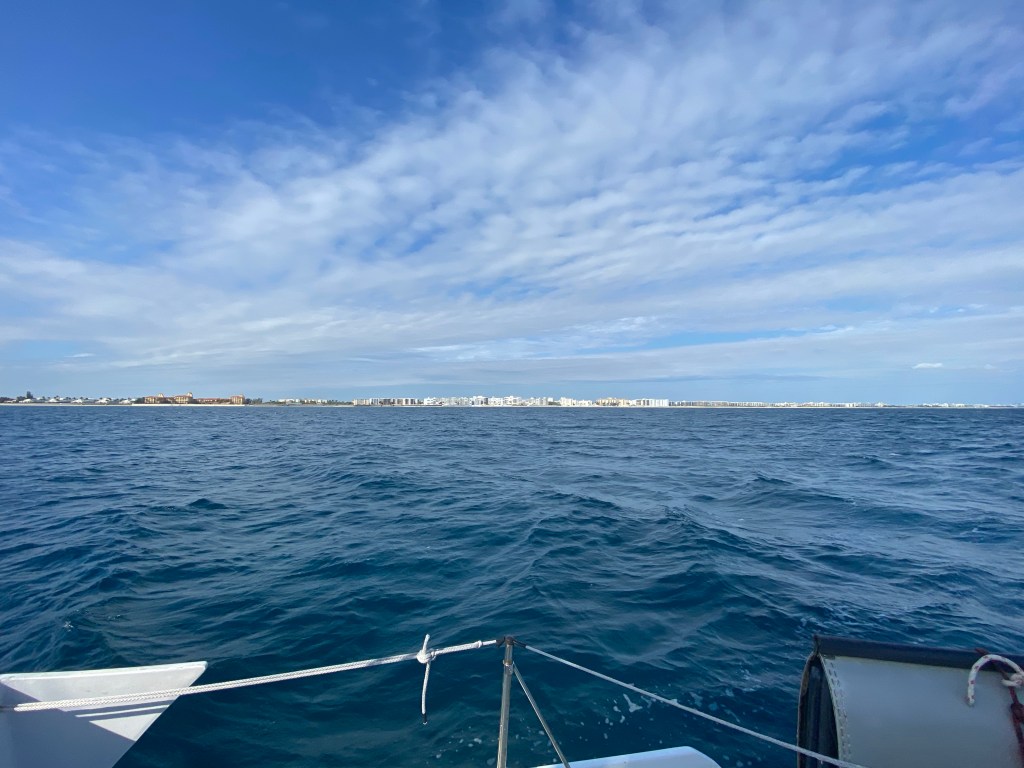
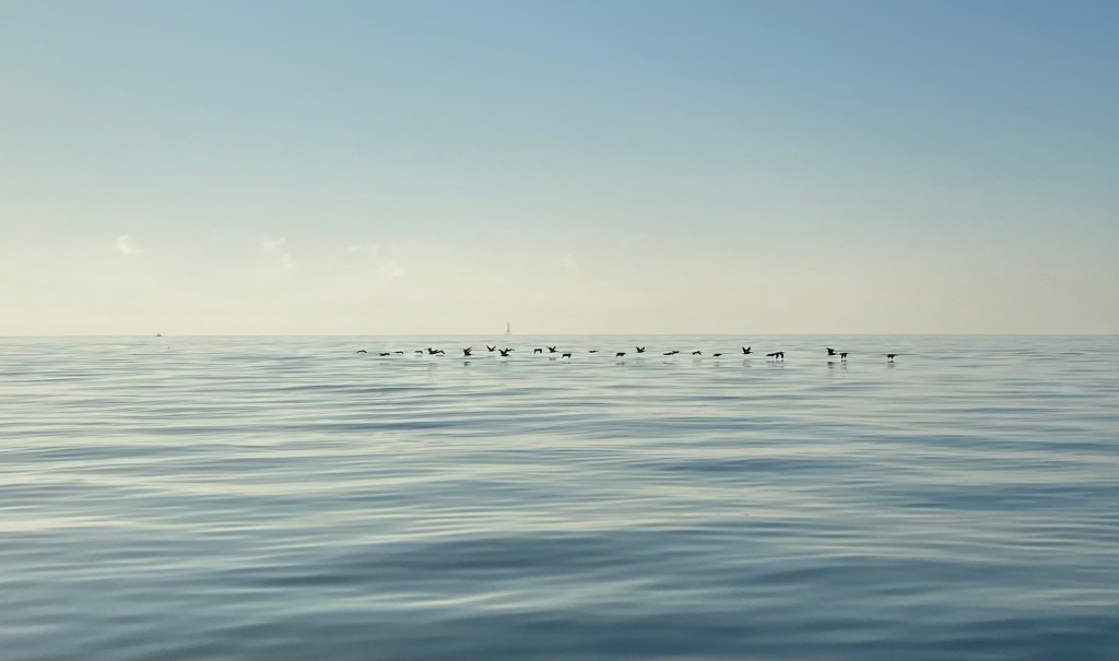
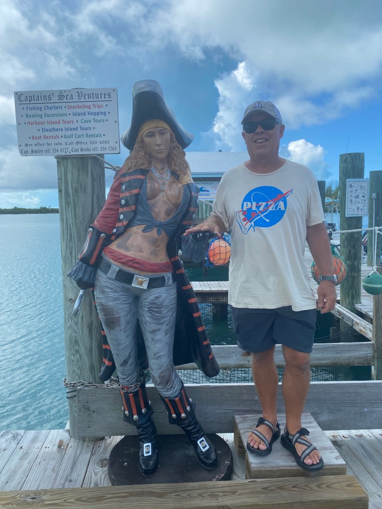
Key West, FL
A flock of birds on a calm sea
The 42 miles to Key West was accomplished under motor. We rendezvoused with Wild Iris once again. They had picked up their son Jack in Miami. We were all looking forward to celebrating Christmas together.
Arrival in Key West
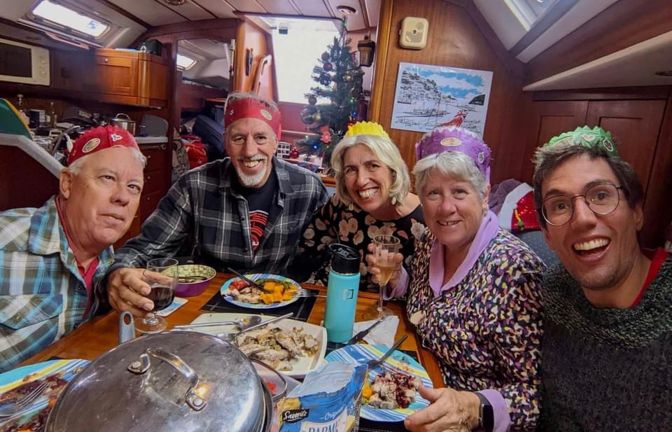
The weather was beautiful when we arrived. However, a 3 day front kept us on our boats in windy weather. We still managed to gather for Christmas Day dinner and games (Monopoly Deal).
Festive Christmas dinner on Wild Iris
2022 Year End Statistics
4,310 nautical miles traveled (16,782 nm since we started cruising in 2018) 18 nights at sea 230 nights at anchor 22 nights on a rented mooring 87 nights on our own mooring 3 nights at a dock 5 nights hauled out on land, still on board 8 States in the USA: NC, VA, CT, RI, NY, SC, GA, FL 3 Island groups in the Bahamas: Exumas, Eluethera, Abaco’s 5 Countries and territories: Puerto Rico, Dominican Republic, Bahamas, USA, Mexico
Farewell to our homeland. We are off to visit Mexico and the Honduras Bay Islands this winter.
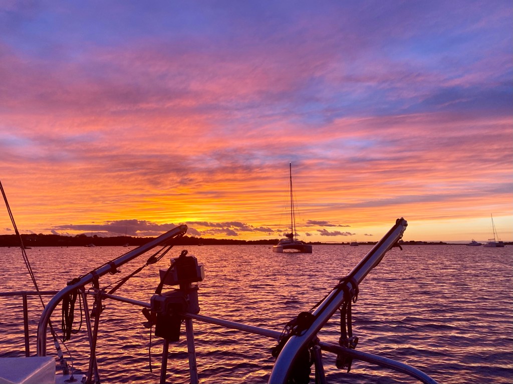
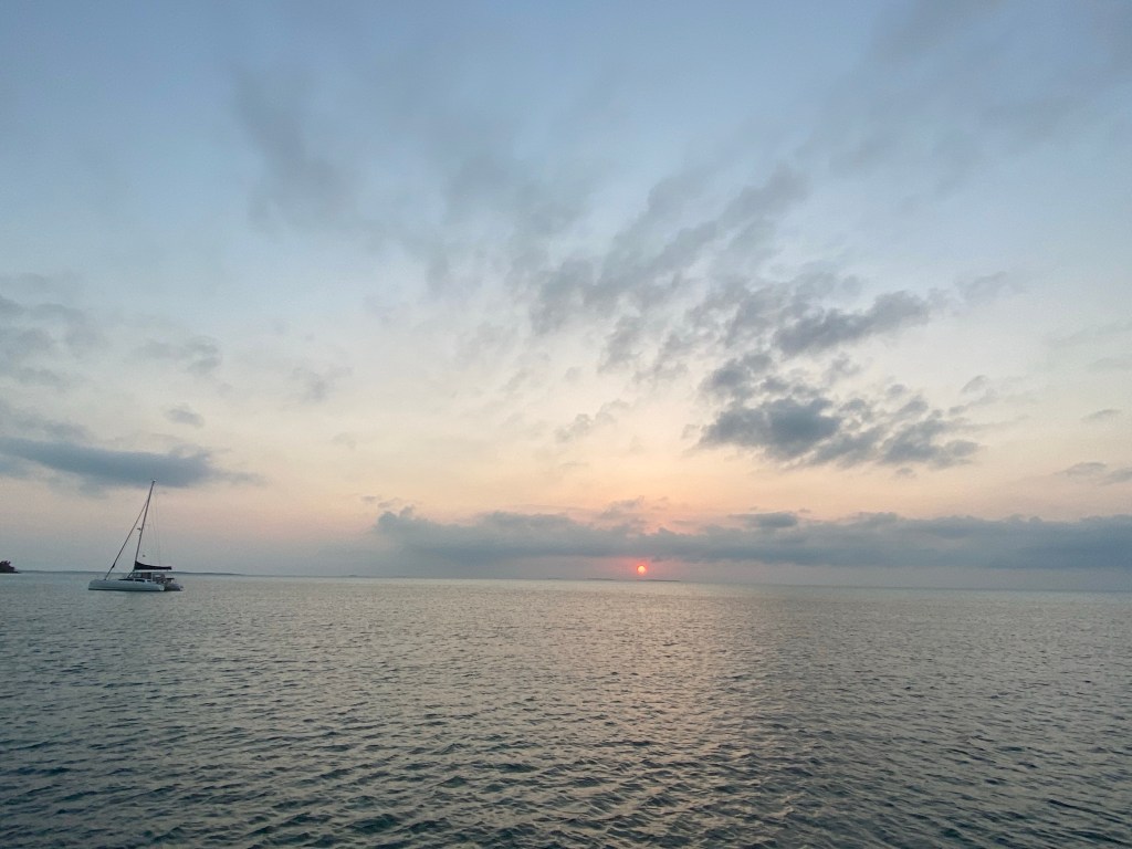
Caption for main photo: Spoiler alert! Tom models our sailing attire this autumn wearing many layers including down vests, long pants, and wool hats. Baby it’s cold, even in Georgetown, South Carolina where this picture was taken.
We began our journey of sailing south for the fifth time, by sailing to Block Island, Rhode Island on a late September afternoon. Wind and current were with us. It was a beautiful short sail of less than four hours. We thought this would be a quick overnight stop before heading out to sea and straight for Hampton, Virginia.
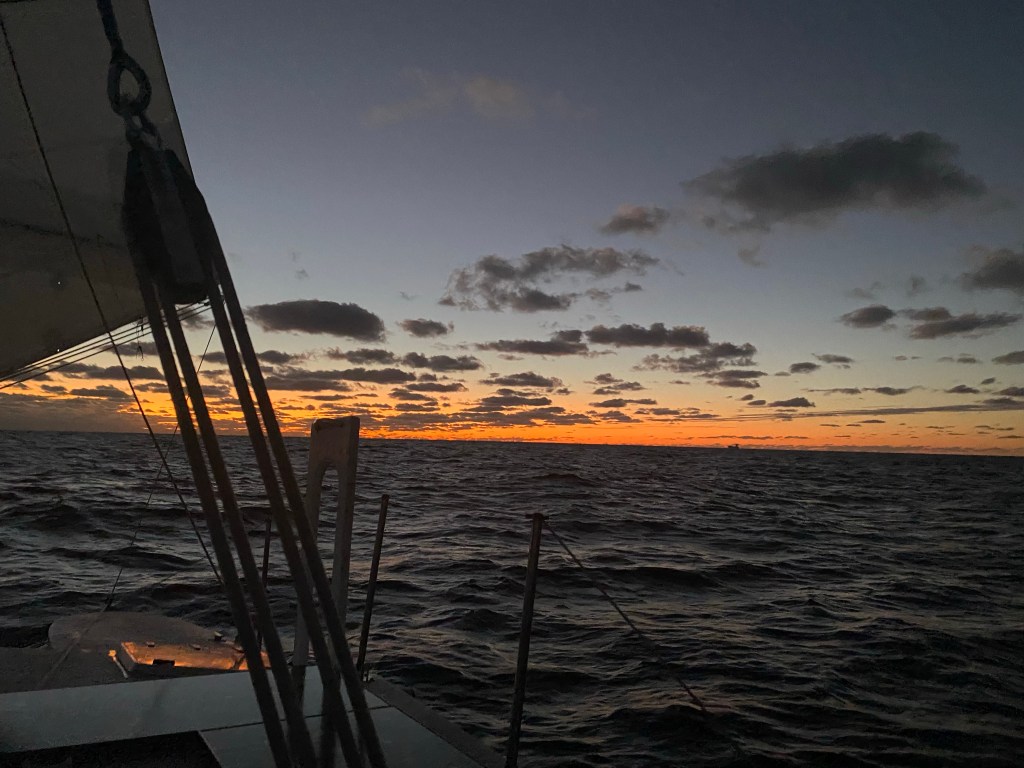
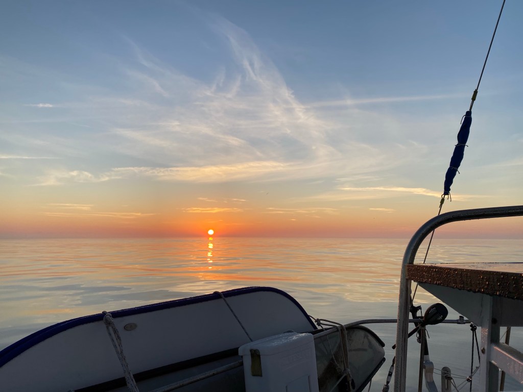
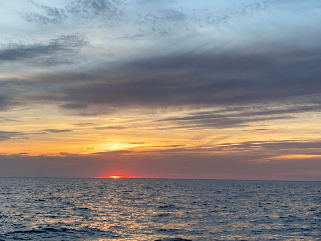
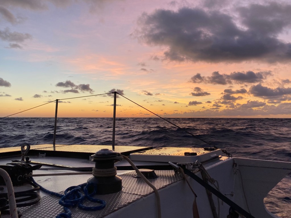
Red skies at night sailors delight, right?
The forecast in the morning, was a shock, and turned out to be true! We were stuck for a full week in beautiful Block Island, with no hope of even getting ashore. Temperatures were cold, mostly 40’s and low 50’s. It rained a lot, inches! The skies were completely overcast and it was very windy with frequent 50 knot gusts. Even if we wanted to, we could not assemble our dinghy on deck in these conditions. The good news was we did not have big waves in the harbor as we were hugging the windward shore, close to “dinghy beach” where there is a wooden walkway across the marsh grass.
Mast-less windsurfer (kite sailor?) enjoying the high winds on our last day in Block Island Raising the anchor after a week in Block Island
We stayed busy with small projects and chores. We ran the diesel cabin heater in the mornings to take the chill out of the cabin while constantly checking the weather for a break! We finally took Chris Parker’s advice and left on an overnight reach down Long Island Sound towards NYC. The predicted west winds would not have allowed us to go offshore from Block Island for another week. These same winds would work very well from NYC.
Setting off from Port Washington
Our 106 mile overnight sail to Port Washington was completely overcast and really cold. We were thankful for our pilot house which allows us to stay out of the wind and rain. We arrived as Pegu Club was leaving to go through NYC. We stayed on a mooring for one night and used the included water taxi to walk around a bit and shop for fresh produce. Sticker shock! We didn’t buy much. The next morning we left with the current to get flushed through New York City.
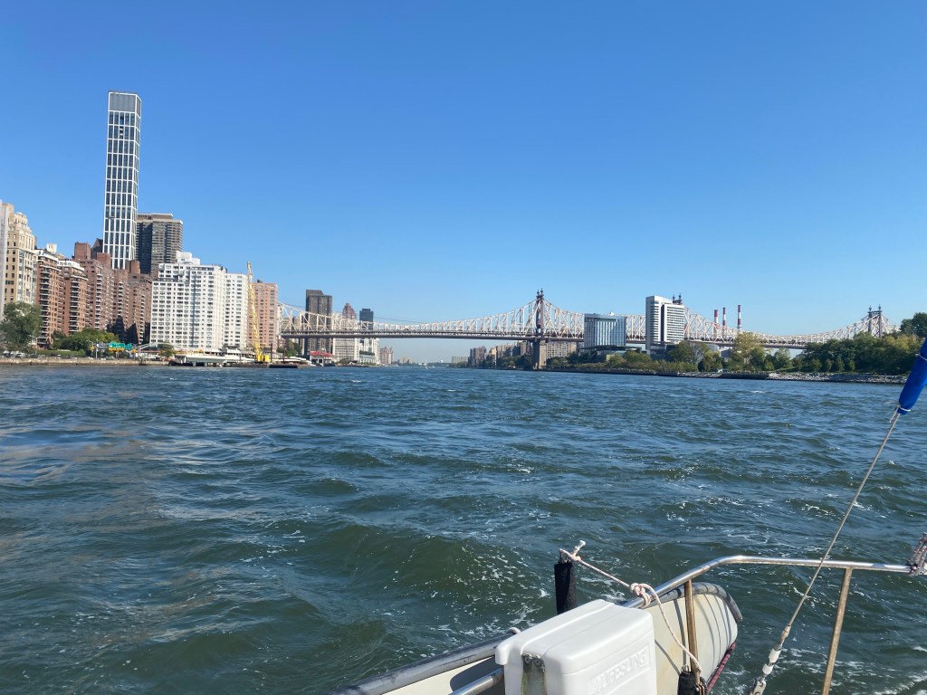
Riding the current, through NYC
It’s been 36 years since we sailed through New York City. It was not as scary as our memories. We remember many tugs and barges which needed plenty of space to maneuver in the narrow twisting rivers with 4-6 knot currents. This time we mostly saw ferry traffic. There were many fast moving small catamaran passenger ferries and of course the enormous Staten Island car ferry once we were through the city. I would go this way again.
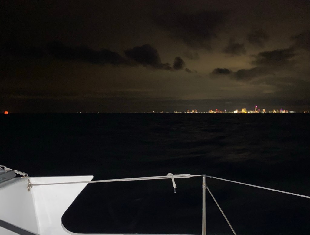
There she is, Lady Liberty New Jersey by night, ahh finally offshore!
The west winds were perfect for this passage! We could stay close to shore with good wind and no waves.
Cold weather persists in early October
We arrived in Hampton Virginia after two nights (295 miles) at sea. Still no relief from cloudy and cold weather as another reinforcing cold front was approaching.
Lone Star at the friendly Hampton Yacht Club
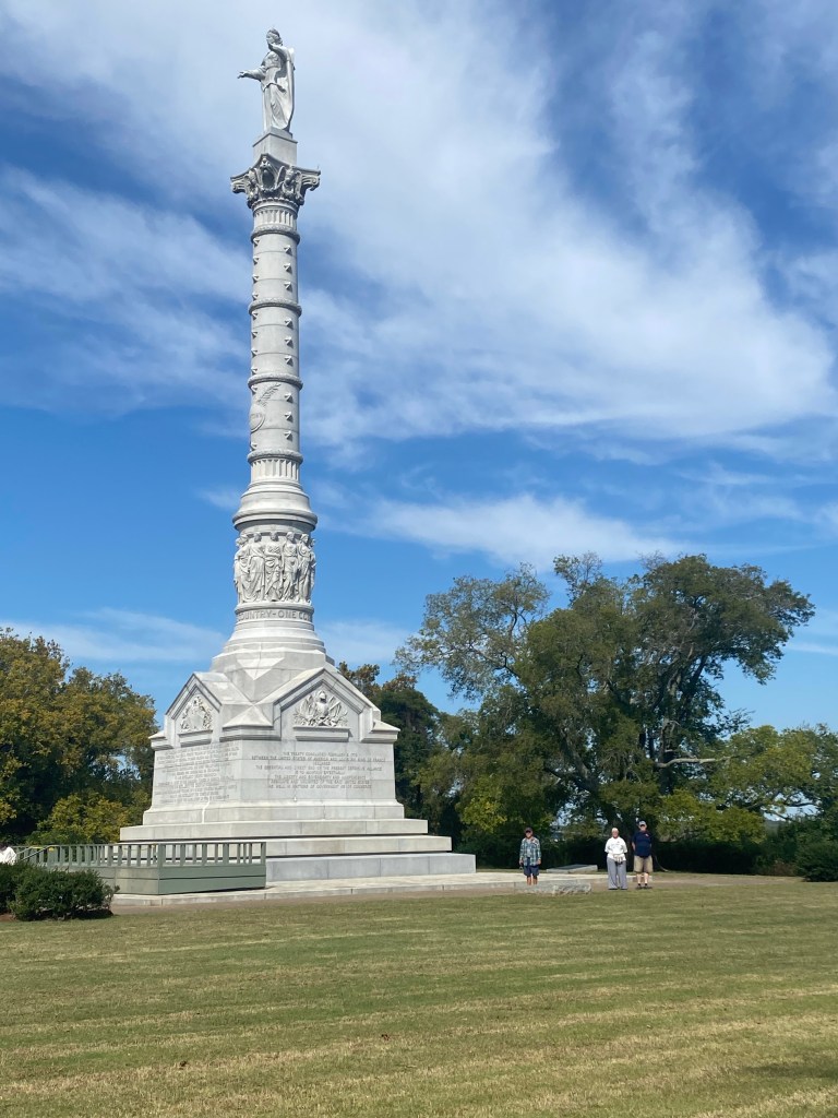
We don’t often splurge for a dock, but it was fun for a change and made our visit with my sister Janet and her husband Dale more enjoyable. Since they had a car we spent a day exploring the colonial parks at nearby York Town and Jamestown. Great history lessons! We really enjoyed their visit. It flew by too fast.
Monument at Colonial Park, York Town Battlefield
Soon we were sailing south again for Beaufort, NC. We had light winds on this 228 mile, two night passage around Cape Hatteras. We ended up motor-sailing about half the time. The benefit to motoring was enjoying a hot water shower in fairly calm seas, right before an off-watch sleep! That’s a four hour snooze on Lone Star. The hot shower is a sailors dream come true.
Anchored a bit too close to Carrot Island
When the full moon low tide arrived the rudder touched the soft mud. We moved Lone Star out a bit further after that.
Love the Wild Horses on Carrot IslandThe sunset provided amazing lightBeaufort, NC a favorite stop for us
After three weeks, we finally had a weather window to continue south offshore, along the east coast of America. We decided to explore the western Caribbean this year, in particular the small islands offshore of Mexico and Honduras. We will be sailing off and on with our buddy boats, UJAM’n and Wild Iris. They were both still freezing up in Deltaville, Virginia. They were planning to leave there on this same weather window and plan to catch up with us soon.
The 186 mile overnight sail from Beaufort, NC to Georgetown, SC was a bit challenging. The inlet to leave Beaufort was rough and very bouncy for about a half hour, until we reached deeper water. When we turned south the elevator ride began in earnest. The seas were 4-7 feet. Although Lone Star is a trimaran and doesn’t roll like a monohull, we sure do ride the waves and surf. The inlet into Winyah Bay, SC was terrifying! We had wind, current, and six foot seas behind us. The inlet is fairly narrow with broken underwater sea walls along the edges of the channel that are a hazard rather than a help. The power of the seas locked the rudder and sometimes tried to turn the boat. Time seemed to stop as we hung on a wave. We found ourselves often looking at the sky through a salt covered windshield for 6-9 seconds, when we really wanted to see the navigational buoy that was right in front of us. After another mile and a few turns inside the inlet the waves and froth finally calmed down. Whew, glad that’s behind us! Sorry no pictures… too busy hand steering.
Lone Star anchored near the Steel mill in Georgetown, SC.
We enjoyed lunch out at a local restaurant with Jeff and Kimberly on Pegu Club. It is always fun to catch up with each other. We never fail to learn from each other’s experiences. This time we were picking their brains on where to go down the coast as this is our first time seeking shelter south of Beaufort, North Carolina. Thanks friends, we know you’ll enjoy the Bahamas this winter.
We are the big white boat with a green center, heading south into a fleet of anchored cargo ships near Savannah, Georgia Ships are much farther apart in reality. Here we have smooth sailing down wind and riding the waves
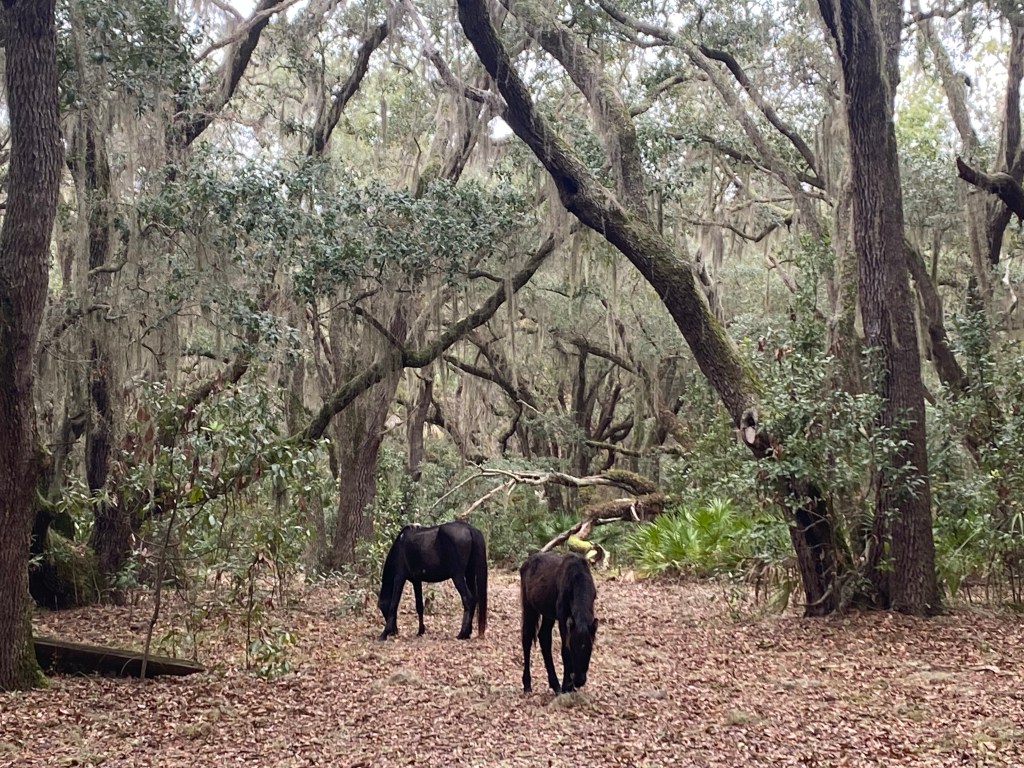
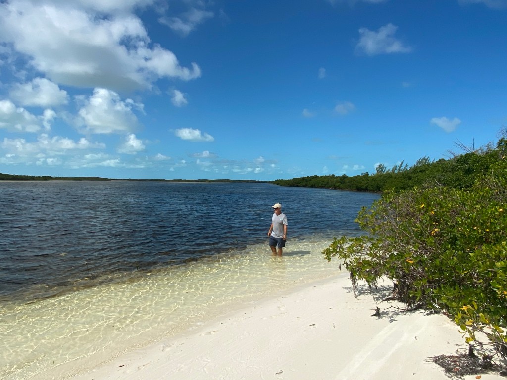
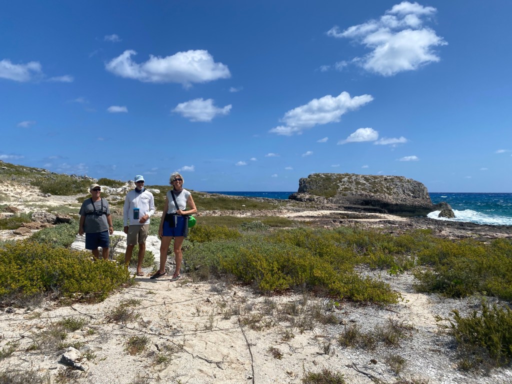
Our next passage was two nights and 214 miles to St. Mary’s Inlet on the Florida/Georgia border. This leg was much more sedate. We elected to head north, once through the inlet. We had heard great reviews about the trails and history at the National Seashore on Cumberland Island, GA. Four other cruising boats we know went south to anchor at the small town of Fernandina Beach, FL. The next day, Wild Iris joined us. What a fabulous place! We stayed here for a week and enjoyed many long walks around the park.
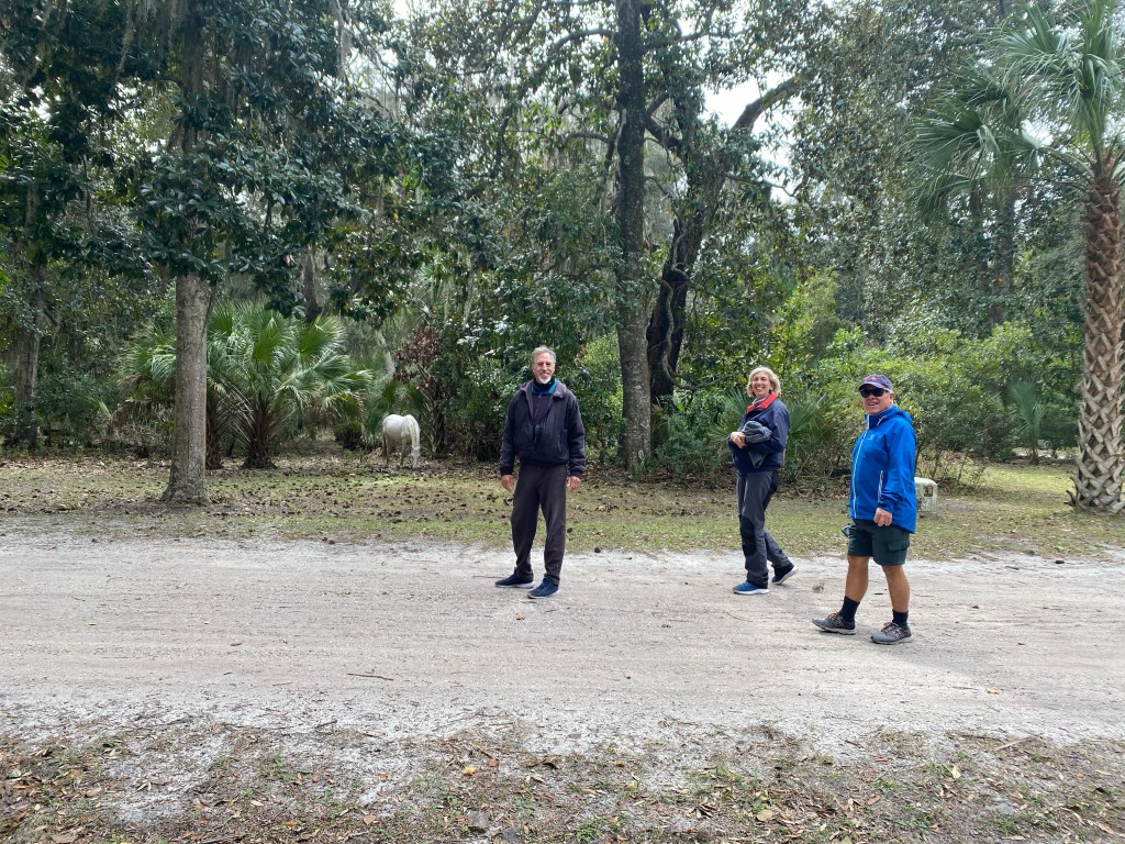
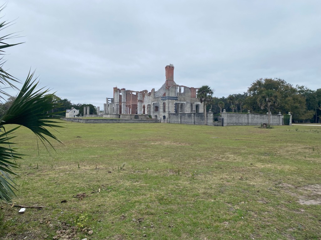
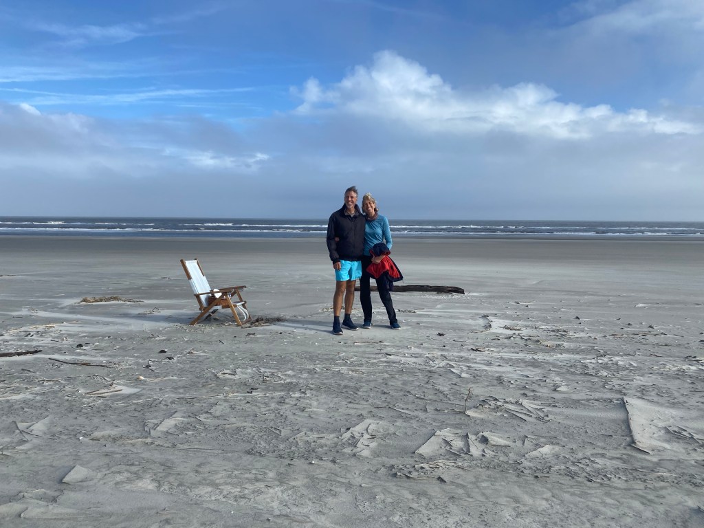
Mark, Lisa and Tom, with an albino horse in the background We got to see a lot of wild Armadillos up closeAnd many Wild horses among the majestic Live Oak treesDungeness Castle ruins at the south end of the islandMark and Lisa on the flattest longest beach I’ve ever been on!
Beach walking on the eastern side of the island was a must. Many trails led across to the beach. It was really fun to have Steadfast join us the day before Thanksgiving and host a potluck on their boat that evening. Great times!
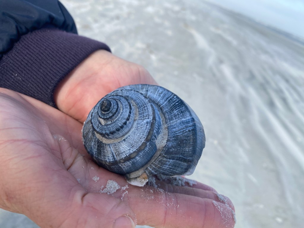
Lisa and Janice (Steadfast) on a cold windy long beach walk. We pretended the beach was snow!Rather than collect this beautiful shell, we took a picture!
There were bird sanctuaries here too, I have pictures of crows, egrets, flamingos, and others. Running out of space in this blog!
Walkways among the Live Oaks
We spent a week here and still didn’t see even half of the island. Nor did we make it to the two nearby towns that are a must see: St. Mary’s and Fernandina Beach. We will have to return!
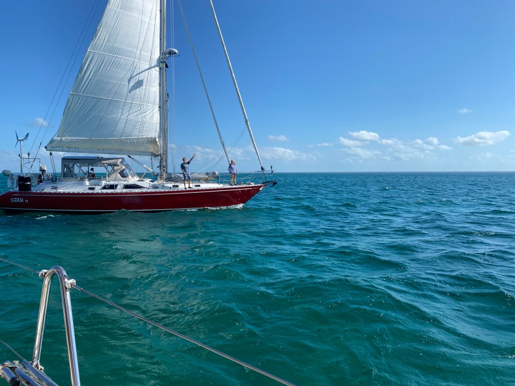
Having too much fun cruising with buddy boats. Spring season in the Bahamas is a lot less crowded than winter season and the cold fronts do not come this far south very often in April. We arrived with our Buddy Boat UJAM’n from Luperon, Dominican Republic. We traveled 370 miles in two and a half days. Well UJAM’n arrived before dark. We anchored just outside Kidds Cove, George Town on April 7 after 9 pm, using radar and chart plotter, to distance ourselves from nearby boats. We promptly went to bed. In the morning, we covered the sails and discovered we were anchored right in front of UJAM’n and Steadfast. Three of the SSCA Caribbean Safety and Security Net Relays anchored in one place! The guys took turns as the relay for the day for the next week. We ended up at Customs and Immigration for check in together as well.
Hiking with Janice from Steadfast and Marcia and Jeff from UJAM’n
Having too much fun in George Town. This is the fourth year in a row we visit the Bahamas. Our first stop was George Town on Great Exuma. There are over 20 anchorages in a 2 mile radius. What draws us back each year you ask? Beautiful water color, awesome beaches and numerous walking trails, friendly locals, access to good supplies, and a cruising community that is helpful to each other; even in the spring season. Tom continued to assist with the local cruisers net on the VHF radio.
The view from the hill, looking toward Great Exuma from the south end of Stocking Island.
Having too much fun on the beaches. We played beach games like the Scandinavian Molkky and took hikes on the beaches or trails. Swimming and snorkeling as well!
South Monument anchorage in mid-April
Soon U’JAM’n and Steadfast were heading north to visit the Exuma islands. We stayed to welcome Wild Iris and catch up on their news from their home visit to the UK and share a few anchorages around George Town.
Sundowners on Lone Star, Lisa (Wild Iris) and Tom
Having too much fun with other buddy boats. We enjoyed meeting their friends on Bebe, sharing sundowners, snacks and music on various boats.
Mark (Wild Iris) and Lori and Dan (BeBe)Friends helped us gather rocks on Monument to add our Boat name to all the rest!Wild Iris and Bebe at anchor. Yeah, the Family Island Regatta was allowed to compete this year! Nice windy conditions for these great little boats.Music and sundowners on Wild Iris
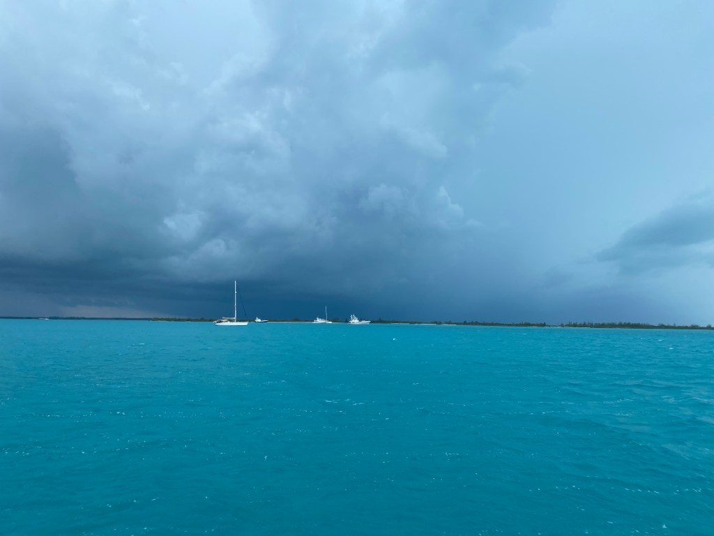
Wild Iris and Bebe sailed north to the Exuma’s while we stayed and greeted UK friends on Sunset Trader. So proud of David & Lizzie for letting us urge them to make an over night passage from Rock Sound, Eleuthera to George Town. They unfortunately encountered a frightening thunderstorm! Thankfully they experienced no boat problems from the storm.
Our favorite beach, Goat Island with David and Lizzie (Sunset Trader)
Having too much fun with our favorite power boaters. Meeting new cruisers, hikes and sundowners, ahh the life of a cruiser. We had a fun dinghy excursion and short hike to Prime Island Meats to refill our freezer with good quality chicken, pork and beef. Their extra large hotdogs are the best! We got lucky and new produce had arrived as well. It was hard to believe we had spent a little more than a month in this beautiful George Town area. It is early May already, time to say farewell and head north ourselves.
Rock Sound, Eleuthera
Having too much fun sailing. The timing was right for us to sail over night straight to Rock Sound in the south end of Eleuthera. Surprisingly, the next afternoon we sailed in with Wild Iris and Bebe, just before another thunderstorm approached.
The heavy rain just missed us!Rock Sound, Eleuthera: for the mile+ commute to town we shared a dinghy!
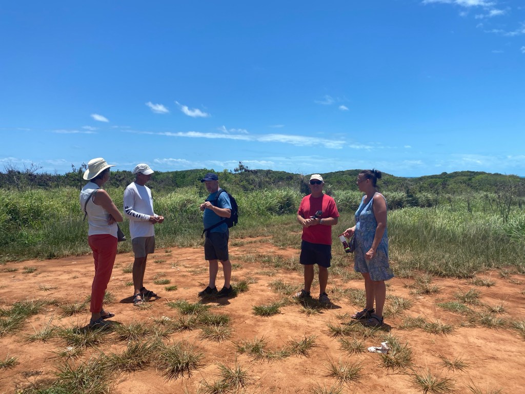
Having too much fun being a tourist. We rented a car for a day with Mark & Lisa and enjoyed touring Eleuthera by land.
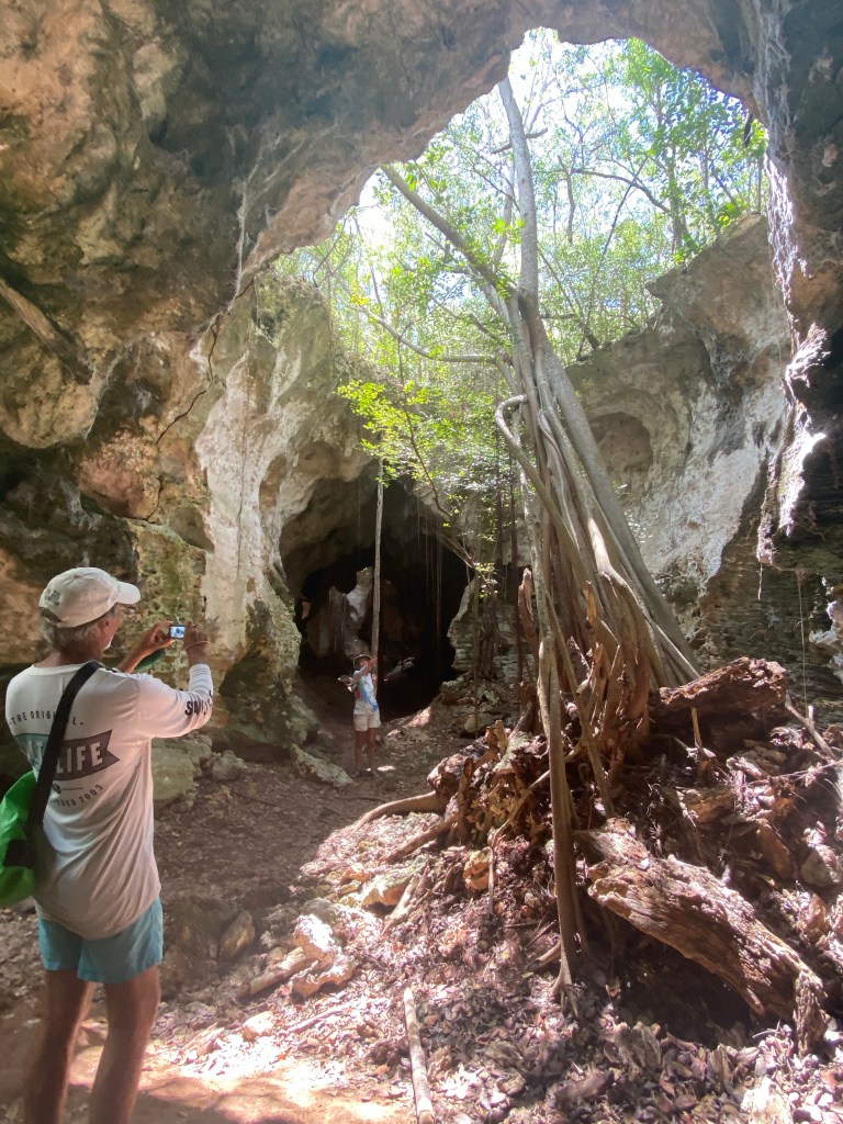
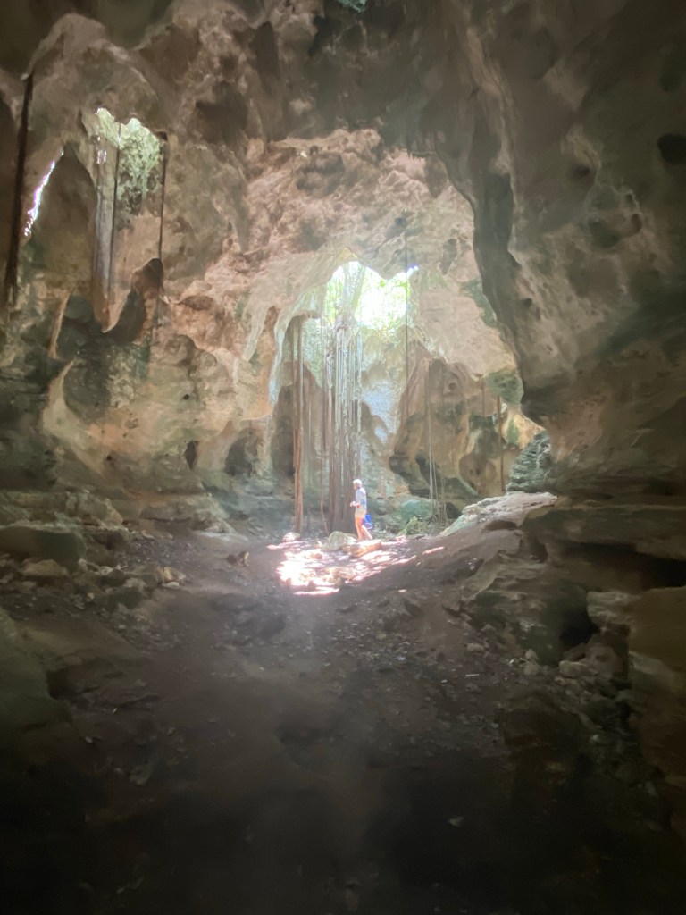
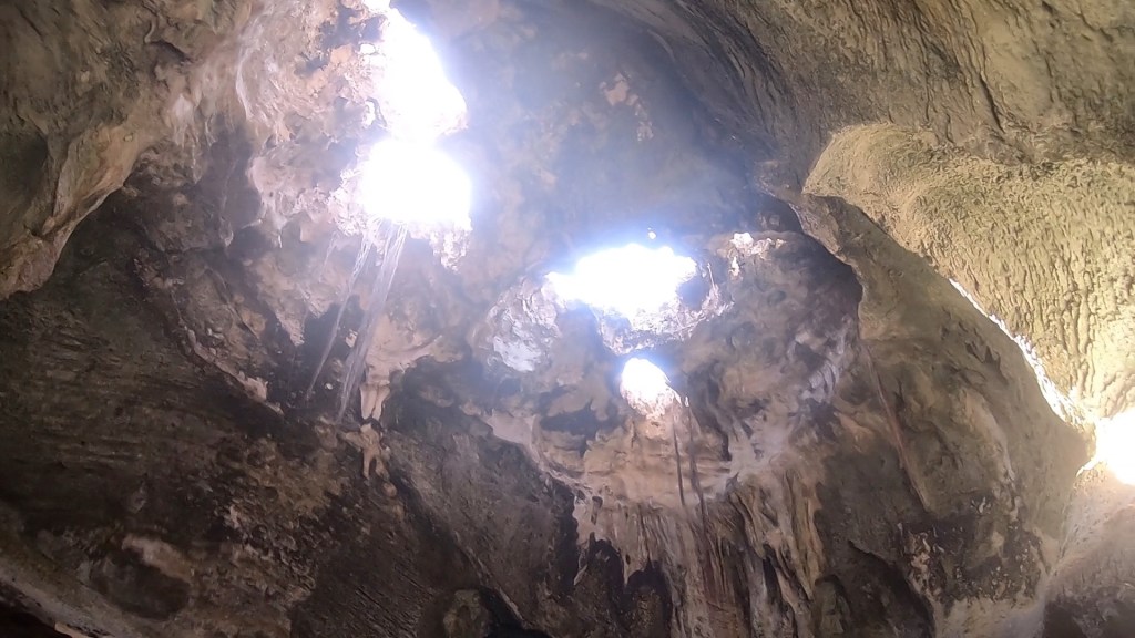
Chatting with some land tourists who explored the mostly under ground mile long Hatchet Bay Cave with Mark.
Meanwhile, Lisa, Tom and Anita did not walk the mile in the dark with lots of bats!
Cathedral Cave in Rock SoundLisa exploring Cathedral Cave
Governor’s Harbor, Eleuthera
Having to much fun exploring. We next sailed on to Governor’s Harbor. One morning we decided to take a walk toward a nature preserve that we did not have time to stop at with the car. We had hoped to get a ride, but that didn’t happen. So we walked more than five miles that day.
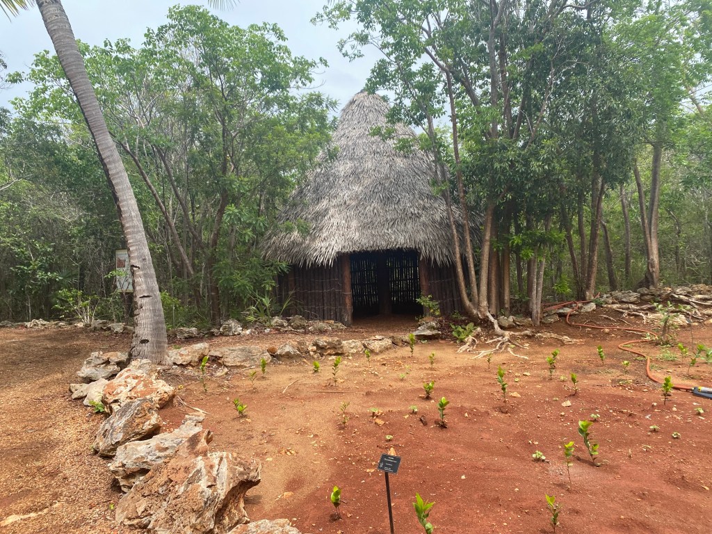
Leon Levy Native Plant Preserve The trail map. Well worth a whole day trip!Well maintained walkways Informative placardsA replica of the Lucayan hut and garden. Lots of gardens!Sunset, ahh the beauty!
Mother Nature at her finest!
And in the east at sunset, a rainbow whose colors were overwhelmed but the pink sunset
Meeks Harbor and Spanish Wells
From Governors Harbor we chose to sail through Current Cut and up toward Spanish Wells. We left just before sunrise, and had prepared the boat for the 42 mile trip the night before. Neither of us checked the dinghy on davits in the morning. Apparently, it was not secured properly. Around 10 am, just a couple miles from Current Cut, the bow davit line broke with a bang. Anita was on watch and looked back and saw the orange life jackets floating away. The bow of the boat was being dragged through the water. We stopped to rescue the dinghy. We removed the engine from the stern first. Then attached a halyard to the stern of the 80 pound dinghy and hoisted the halyard while loosening/removing the davit line. Then lowered the Porta-bote onto the port side deck.
The aftermath of breaking a davit line while underwayWe lost 2 orange life jackets, half an oar, a small paddle, a bilge pump, and a squeegee. We retained the anchor and an oar and a half!
Yes, we even had fun figuring out how to rescue our very important and much loved dinghy! New procedure is to sling a harness made of webbing under the dinghy any time it is on the davits and we are underway. We always fold it up and stow the dinghy when we head out to sea.
Welcome to Spanish Wells
We walked around Spanish Wells on a nearly deserted hot summer Sunday.
No grass to mow!The Thinker! This is all that’s left of a house 🤷♀️ on Spanish Wells!
Passage to America
We didn’t see a weather window for heading north so we and the crew on Wild Iris decided to visit the Abaco’s and check out in Marsh Harbor when a weather window became available.
Abaco’s
Having too much fun eating out and buying supplies. First we anchored just outside Little Harbor and made the requisite stop for a meal at Pete’s Pub. The next day we sailed up to Man O’ War Cay and anchored outside the western entrance to the inner harbor. It was the weekend so not many folks around. We discovered they had not repaired the fuel dock yet, so we would need to get fuel in Marsh Harbor. The next day we took Lone Star across to Marsh Harbor with the crew of Wild Iris. We both checked out listing departure time as the same afternoon. Then did a final grocery shop run and fuel run. We motored back to Man O’ War and readied our boats for a few nights at sea. For us that meant dismantling the dinghy and stowing some gear. We hauled the anchor at 3:30 pm on May 23rd and headed our bows North to America.
Ahh, passage making our happy place! Definitely fun for us.
Lone Star at sea heading North Picture courtesy of Wild Iris
We never know when we leave how long a passage will take or if we will be able to sail straight home. We speak with Marine Weather Center on the SSB radio to help us make informed decisions about our route.
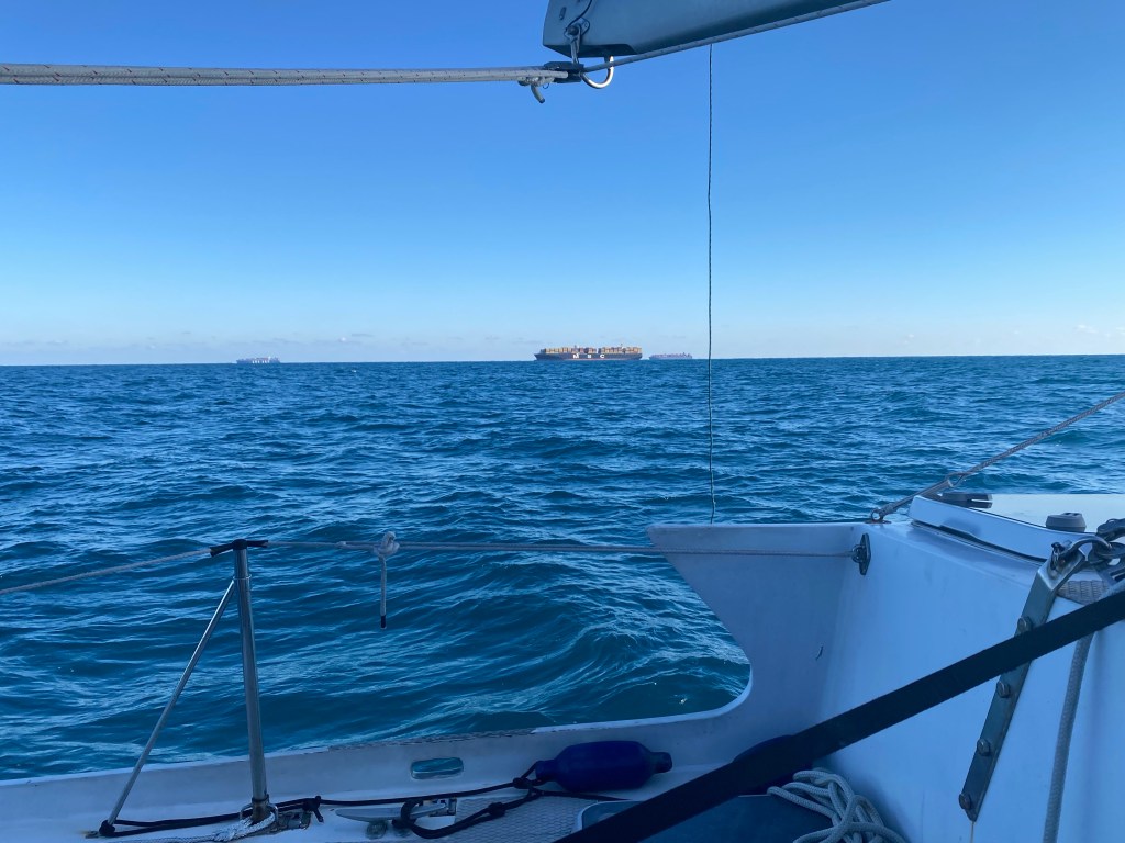
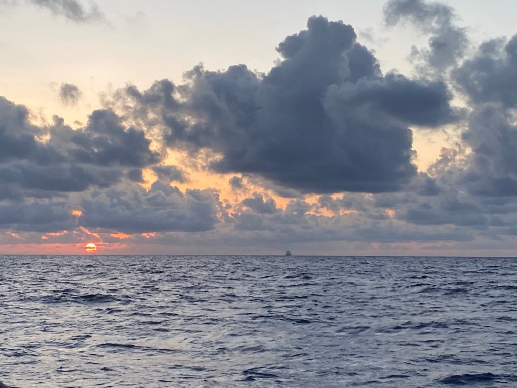
Container ships look small on a big ocean at sunrise
First leg: From Man ‘O War to Cape Lookout. May 23, 2022 to May 27. 505 miles, 94.5 hours, just under 4 days, 40 hours with the engine on. We lost the wind after a day and a half, but it picked up on the last day. Arrival was in rain squalls and we had to wait a few days for the seas to die down before continuing north.
Cape Lookout at anchor with Flash and Wild Iris at sunset
We enjoyed a few days of beach walks at Cape Lookout. It was Memorial Day weekend so we saw lots of truck campers parked on the beach in small communities. Many said they’d been coming here for years!
Second leg: From Cape Lookout to Hampton, VA. May 31 to June 2. 214 miles, 47.5 hours, or 2 days, under 12 hours motoring.
Blackbeard reenactment in Hampton, VA
The Pirate Festival lasted for three days in Hampton, with a variety of food, crafts, costumes and demonstrations. There were lots of fun things to see and do. We felt like we were in the middle of the sea battle one time! We finally moved to the Old Point Comfort Anchorage the afternoon before we left on the last voyage home. We found a quiet anchorage right next to the tunnel. An added benefit, we have five fewer miles to motor through narrow winding channels tomorrow.
Third leg: From Hampton, VA to Groton, CT. June 6 to June 9. 353 miles, 68 hours, or 3 days, 19 hours motoring.
Container ship up close, near Virginia Beach
Home Port
We had so much FUN cruising with friends in the Bahamas, we had no time to write about it or take many pictures. Our passage home was thankfully uneventful this year. We made it safely home to New England and enjoyed a very busy summer visiting with family, working on the boat and sailing short distances.
Family visit in Nobleboro, Maine. Photo courtesy of JaneSister time while camping in South Bristol, Maine. Picture courtesy of PaulineDay sail with grand puppies, and Jenna & AlexCovered up those hot black dinghy seats and added storage pockets.Mark on Sea Ya Sooner at Block Island at sunset. Thanks for dinner Mark!
We sailed to Block Island to rendezvous with Sea Ya Sooner. Our son, Alex and his wife Jenna took the early ferry out to Block Island for the day. We enjoyed breakfast at Aldo’s bakery, then a walk on the beach before sailing home together.
Block Island with Jenna & AlexA day sail and swim at Flat Hammock, with nephew Brian and guests from Germany
We had scheduled a mid-summer haul-out at Essex Boat Works to refresh Lone Stars bottom paint, replace the cutlass bearing, and clean her up. The yard needed to reschedule us to late August. Unfortunately, the rig inspection late in the week, immediately showed we needed to take the mast off and rebuild the mast step; where it is attached to the deck. This extended our stay in Essex for two extra weeks to effect repairs and upgrades. We made extra trips to Defender, a good marine chandlery, to purchase new lines and blocks. So thankful we had a borrowed van at this time, thank you Anna Marie and Tom!
New bottom paint for Lone StarMast removal, stepping two weeks later
Anita enjoyed house and dog sitting for our son over Labor Day weekend. The kids flew to Florida for a mini vacation with family.
House sitting with my Grand puppies
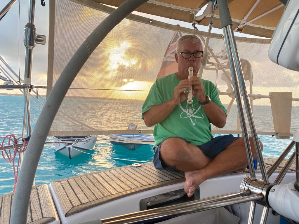
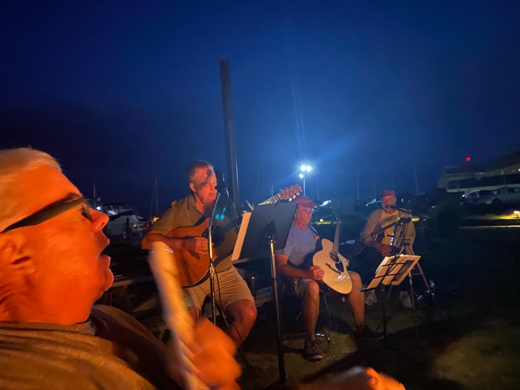
Having fun with music. We enjoyed a sing-along by the camp fire at Shennecossett Yacht Club. Three guitar players and Tom with his recorder and lots of singers.
Music night at Shennecossett Yacht Club (our summer home)
See why we are so late in posting this? We really were having too much fun!
We are preparing to head south again for the winter. We are not sure yet where we will go? We are considering the western or eastern Caribbean. Wherever we go, we will be warm this winter and we will enjoy the journey under sail as much as the new places and people we will see. The cruising life is very good for us.
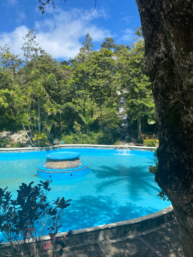
Thirty three years ago we reluctantly sailed past the Dominican Republic. We wanted to explore this beautiful and mountainous country. However, it was too late in the spring season. Hurricane season was approaching. This time around, we were determined to pay Hispaniola a visit, and see what treasures it had to offer. Our passage from Puerto Rico took us across the Mona Passage. Check out this video of our very pleasant sail and another clip of us entering Samana harbor. We completed the 141 mile downwind sail in 25 hoursarriving at 9:00 AM on February 21.
Samana
Samana waterfront from observation tower
The officials were very welcoming. Before long, a local entrepreneur, Luis came alongside Lone Star in a long boat. Luis is an agent and interpreter that many visiting cruisers hire. He brought a navy officer to inspect the boat. Then took us on a walk around town, to the various customs and immigration offices. We used his services again to have a new custom cover for our jib sewn. The Spanish language that is used here sounds different and English is not as prevalent as in Puerto Rico. We soon became adept at using Google Translate to ask questions and gain answers.
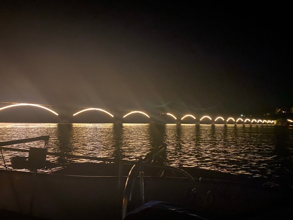
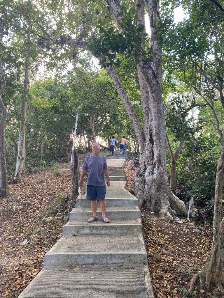
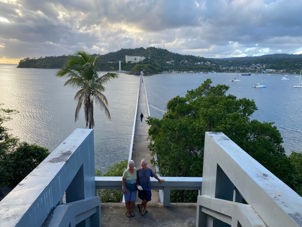
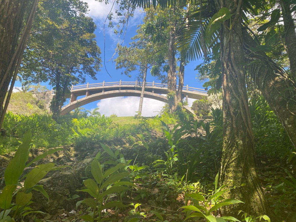
Samana walking bridge is lit up at night
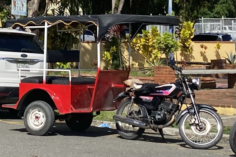
One day we decided to hike to the farmers market. We brought our trolley as it was a mile hike. It was a challenging walk up busy streets and past three rotaries or round-abouts. Every street crossing involved crossing an open drainage ditch. Now we know why Luis recommended using a TukTuk. Later we discovered the produce in the flatbed trucks on the waterfront street were often better quality than at the market.
TukTuk in Samana
Warning: Thar’ be technical boaters lingo ahead, Ye’ be warned, 😁. The anchorage across from the town of Samana is much deeper than our chart suggests, i.e. around 25-35 feet. Adding in our height above the water and the desired scope of 6:1, we needed to deploy over 160 feet of anchor rode. We do not like to anchor in water that deep as we currently only carry 90 feet of chain. This means that we had to let out ALL of our chain, and dip into the reserve rope attached to the chain for such occasions. All added together, we have 240 ft of available anchor rode. We prefer to use as little as possible, as it is a slow and dirty job to haul it all back in and flake it into the bow locker. In addition, the boat swings in a much wider circle. Side note: boy are we glad we have an electric anchor windlass now! We plan to replace the chain this summer and will have a much longer length in the near future.
Sunset over Samana anchorage from walking bridge
We spent many an afternoon or evening taking our dinghy to the nearby beach on Santa Barbara Island and walking across the bridge or up and down the many stairs on the island trails.
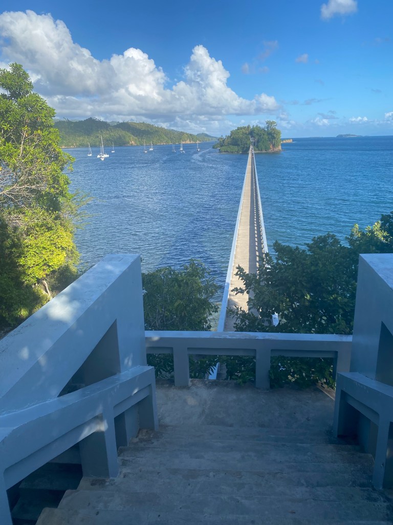
Samana from hiking trails on Santa Barbara Island
There were many stairs on the hilly island. This was a good workout!
Fabulous hiking trails, notice the runners behind Tom
There were also several flights of stairs to get to these gorgeous overlooks at either end of the walking bridge.
Sunset looking from Santa Barbara to mainlandOpposite view from mainland to Santa Barbara
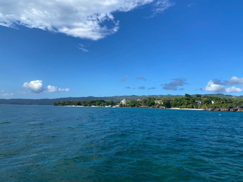
One day we decided to move anchorages to the outer harbor so that we could desalinate water and fill our tank. This is much better for the watermaker if you do it in deep clear water, where there isn’t as much sediment to clog up the filters. We motored to Lovantado Island and stayed for the afternoon. There were plenty of tourists on the beaches and fishermen in the sea.
Small cruise ships come to visit Samana. Although the harbor is too small for them, they anchor near Lavantado island and utilize small excursion boats to bring passengers ashore. We saw a couple ships make port during our stay. There are many local boats that are used to bring tourists to see the whales in the winter season or to the National park just to the south. Of course there are also many popular tourist destinations on land as well. Like waterfalls, zip lines, tropical rainforests, shopping, etc.
Samana’s super small dinghy dock, shared with local tour boats
After two weeks visiting this fine port, we got the wandering itch again. A quick painless check out with the authorities and we were sailing on toward Luperon.
Luperon
We sailed 138 miles in 24 hours. The first 7 hours we motor-sailed into head winds. Then it was smooth downwind sailing for the rest of the trip. Luperon is a completely enclosed harbor, protected on all sides by hills, with only a narrow, twisting entrance. Due to this security, many cruisers stop here to provision, wait for weather, or to stay for the hurricane season. It is surrounded by mangroves and the nearby mountains often disrupt those big storms.
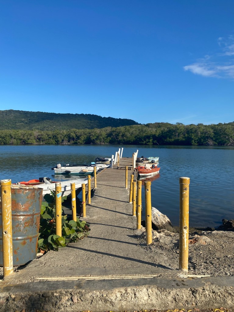
Cruiser/Fisherman dock in Luperon
We were very happy to see Stephen and Janet on Little Sister again. We last spent time with them in Georgetown, Bahamas two years ago. The same time frame for our rendezvous here with Emily and Clark on Temptress. The latter have a YouTube channel to help new cruisers prepare and to help pay there way in the lifestyle. Check out #emilyandclarksadventure on YouTube. Stephen hired a taxi driver to take the four of us (Stephen & Janet, Tom & Anita) on a tour of nearby Puerto Plata. Our first stop was a cable car that smoothly lifts its passengers to Isabela de Torres mountain just south of the city. Here’s a clip of us passing a cable car as we ascended.
Cable Car to an overlook of Puerto PlataIn the cable car leaving the baseView of Puerto Plata from the topOur tour guide for a short hike around the top; taught us how to wake a flower
Our next stop was a rum factory. My, they had a lot of rum to sell and darn we still have a lot on board! The tour was a winding path through a very dark warehouse. We had no idea we’d be sampling nine different varieties of rum. No, we do not remember the names of all nine. I’m very sure we should not have done this right before lunch!
Rum factory
Our lunch stop had gorgeous scenery! I believe I have pictures of this same island with a statue on it from a couple other visits to the DR. We flew in for a long weekend all-inclusive resort stay in September 2016 and took a cruise ship that stopped in Puerto Plata in December 2017.
The view at our lunch stop
Our next stop was for ice cream and a gander at Central Park and its surroundings. Then we had a tour of a chocolate factory. The free samples of brownies and hot chocolate had the inexorable effect of us each purchasing various chocolate treats to bring home. Then it was on to a cigar factory.
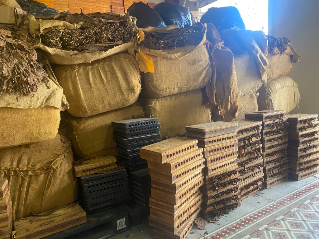
Cigar factory, rolls of tobacco in pressesThe finished cigars waiting to be purchased or shipped
They also had a smoking lounge in this factory. However, none of us are smokers. That was the last stop on our tour apart from a quick stop in Luperon to pick up some local beer: Presidente makes a pretty good stout called Bohemia. Does anyone not understand why we nicknamed this our Vice tour?
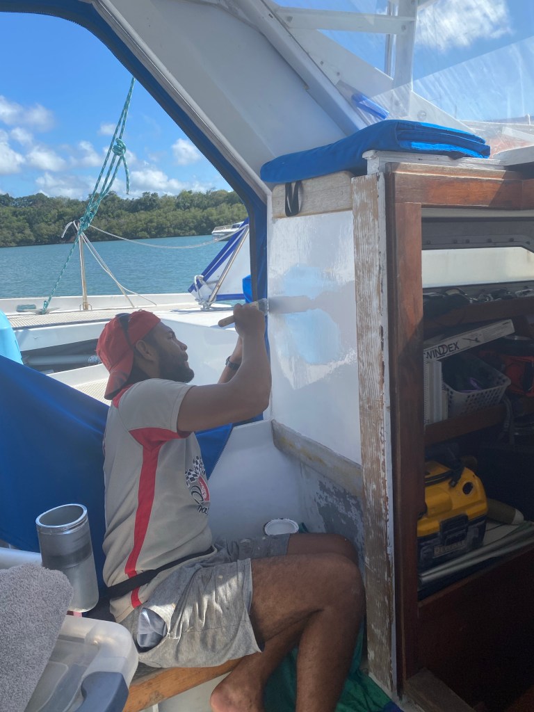
Employed a local to paint on Lone Star
Stephen introduced us to a local man who was earning his living working on boats. We gladly hired Manuel for a week to sand and paint our shower and the inner cockpit. A few weeks later, he and a friend scrubbed the bottom of our boat. Tom had last scrubbed it in Puerto Rico. There are so many nutrients in the enclosed mangrove waters of Luperon weeds grow very fast! We make it a habit to scrub just before a passage to ensure our best speed through the water.
Crowded dinghy dock means climbing from boat to boat when we returned from town
UJAM’n sailed in to Luperon early one morning. We went ashore together to walk around town, get them a SIM card, and have lunch.
Movie night on Lone Star with Jeff and Marcia
We watched one of our favorite sailing movies, ‘Riddle of the Sands’ and had popcorn of course!
Anita decided to visit a Swedish trained chiropractor that several cruisers recommended. Hans was a TukTuk ride out of town. He uses massage and gentle adjustments. Really helped her knees, lower back, and mid-back. Best chiropractic experience ever! She’s tried maybe 30? The Dominican Republic as a whole is well known for medical tourism. Many folks fly from all over the world into the larger cities to have normally expensive procedures done here. We recommend you look into it. This is a very friendly and inexpensive place.
We booked another four person taxi tour to Puerto Plata with a slightly different agenda this time. This was a weekend day so more people around. While we waited for our turn on the cable car we enjoyed a local band.
Rake and scrape band at the cable carMap of the hiking trails on Isabel de Torres mountain
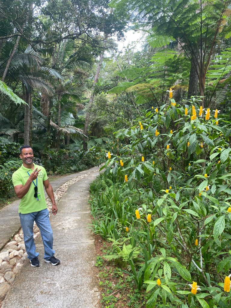
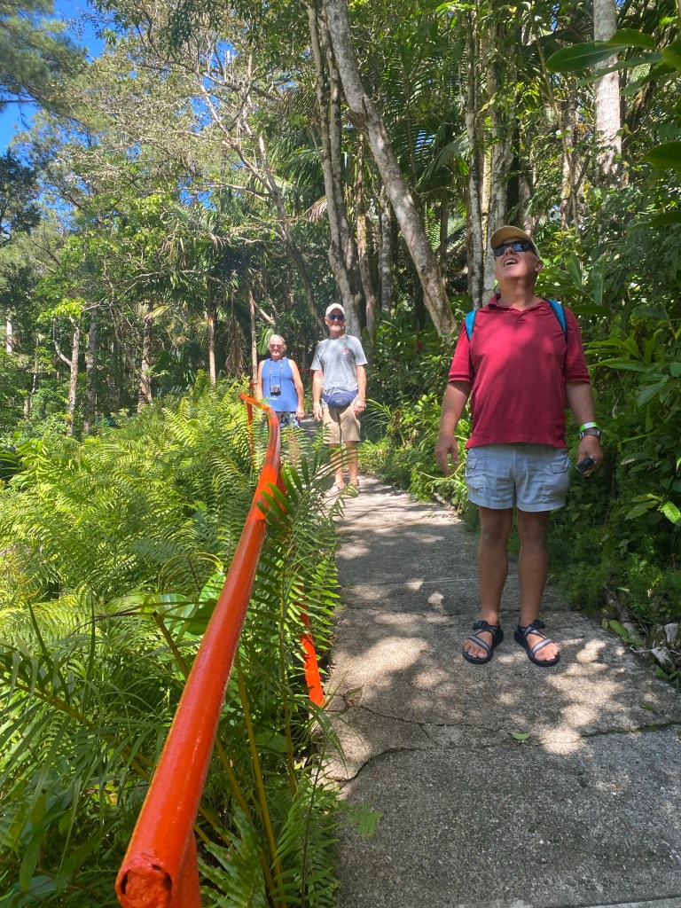
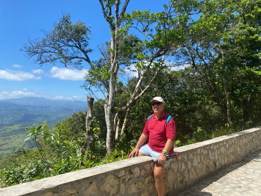
This time we were all eager to hike the many trails at the top of the mountain. Some of the areas are so quiet and others filled with tropical birds and lovely views of flora and fauna. Real nice place to explore and a bit cooler than seaside.
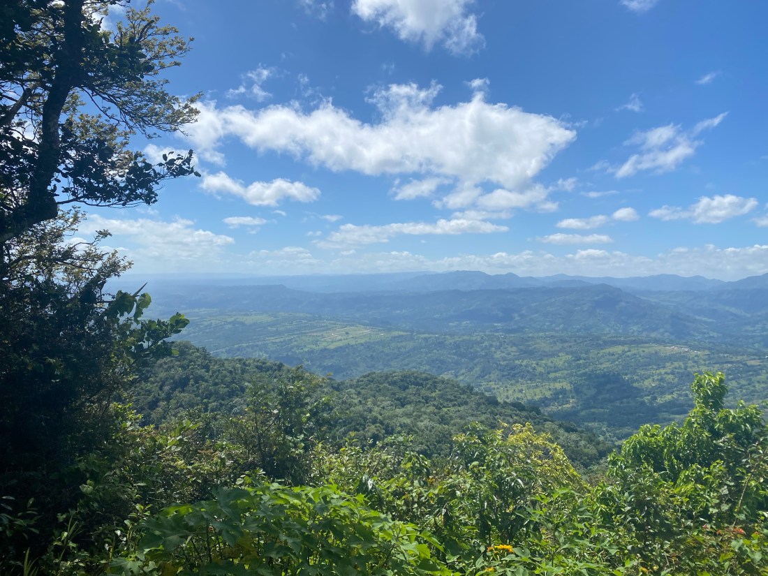
Gorgeous scenery at the topWalking the paths with Jeff and MarciaExploring a small caveYes, he went in using his cell phone lightFlowers and sunshine make this girl very happy A lot of work went into creating these trailsRest stop, the view from here is the highlighted photo at the top of this blog and here’s a videoThere are two fish ponds in this parkA cool looking bridge that is a walking pathA view from the bridge
We asked our taxi driver to take us to a restaurant that he thought served good local food as we all love to try new things. Sadly, his first three choices were all closed on the weekends. We ended up at a cafeteria style place that did serve tasty local food, just not the atmosphere we were looking for.
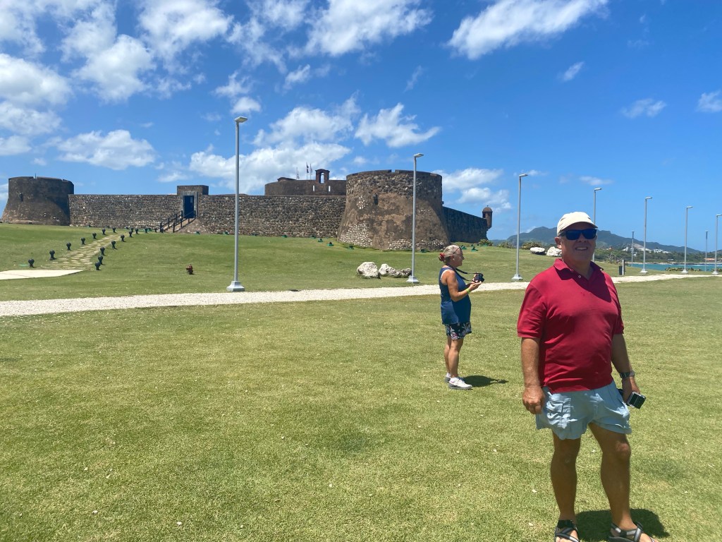
Fort at Puerto Plata
Next we drove to the San Felipe Fort that guards the entrance to Puerto Plata harbor. We chose not to go inside the museum/fort, as time was too short. We wandered everywhere outside and enjoyed the view.
A statue of General Luperon at the fort in Puerto PlataA shallow reef at the entrance to Puerto Plata, clip
Our last stop on the tour was to a large grocery store in the city. We all took the opportunity to restock on a few staples.
We found the fresh produce in Luperon to be plentiful and a great variety. Stephen brought us to a meat store to get smoked pork chops that were so delicious we went back several times! The prices here were so reasonable. This is a great place for cruisers to stock up. We ate out often as well! Their ‘plata de dia’; special of the day, was often only $3.00. We met a few cruisers here, especially when we attended a happy hour one evening at Wendy’s Bar. Great mojitos! It was a friendly crowd, and we exchanged lots of sea stories.
Leaving Luperon at sunrise
We enjoyed our month long stay in Luperon, DR. It flew by so fast! Before we knew it we were heading out of the harbor in tandem with UJAM’n on our way to the Bahamas. Farewell for now; we will return one day.
Featured picture for this blog: We purchased a string of lights in St Thomas to decorate Lone Star for the holidays.
Culebra
We enjoyed an easy 20 mile downwind sail to Culebra, Puerto Rico from Brewer Bay, St. Thomas. It’s only five days until Christmas and we were excited to spend the Holidays with Jeff & Marcia on UJAM’n.
UJAM’n in Ensenada Honda, Culebra
We made several trips ashore to walk around Ensenada Honda, learning the town and where things are. A highlight was shopping at D’s Garden, across the harbor from town. A plethora of fresh tropical vegetables and fruits, like pomegranate, melons, and decent salad vegetables. A little disconcerting to have no prices listed and sticker shock at checkout. The fresh smoothies were a big hit at this store as well! However, so very thankful for this fresh bounty before the holidays.
Almodovar Bay with UJAM’n and Tethys
A few days before Christmas we motored around the corner to the east and picked up some moorings behind a shallow reef.
Calm anchorage with wind coming across this reef, no waves in the anchorage.
On Christmas Day we gathered in the late morning on Lone Star for appetizers: a fresh fruit salad, raw vegetables with homemade dips and mixed nuts. Stories of past holidays and cruising grounds were shared.
Christmas Day, appetizers on Lone Star
…with crew of Tethys and UJAM’n
A few hours later, we continued the fun with Christmas dinner on UJAM’n. Grilled steak or chicken, chili, twice baked potatoes, steamed vegetables, and wine. Topped it off with lemon squares and turtles for desert.
Vieques
The sail to Vieques was also 20 miles, a reach to the east end and then downwind to another Ensenada Honda (translation: deep cove). This one had twists and turns, a very protected anchorage, and some rocks for snorkeling that looked like and were named the Turtles.
Sunset near our buddy boat in Ensenada Honda, Vieques
When the winds calmed a bit, we sailed 3 miles to La Chiva. Mother Nature provided a beautiful canvas to capture.
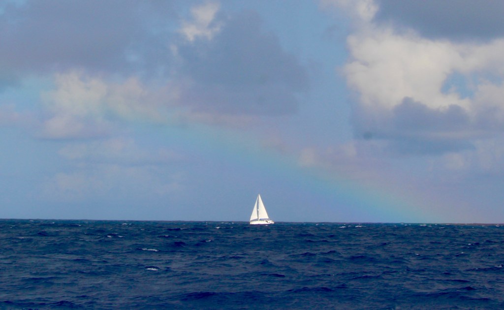
A full rainbow in La Chiva
Rather than the oh so common and protective mangroves hugging the bay, we finally had a beach to admire and to stretch our legs!
Ahh, beach walking in La Chiva, Vieques
Our next stop was Sun Bay. There was a very nice park here with shelters and marked swim areas along a couple mile beach. They even had a section of storage lockers so the locals did not have to cart chairs and beach equipment home every time they visited.
Sun Bay park shelters, our boats in center
This was a well protected harbor and we enjoyed some lighter winds while here. Time for laundry and boat maintenance. Tom climbed the mast and while up there he discovered a single strand, of a nineteen strand wire that is our back stay, was broken at the top fitting. Luckily, there is plenty of rigging wire in the turnbuckles, so we only need to redo the top fitting. After checking our spares he discovered we did not have the right size replacement cones. We ordered some and will have them shipped to a Marina in Salinas, Puerto Rico. In the meantime, we rigged two running back stays to help support the mast in that direction.
Maintenance time, Tom climbed the mast stairs.
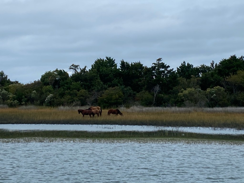
There are many wild horses on this beautiful island. They have plenty of room to roam and graze. There are also some working horses on farms or available for rides.
Wild horses that are quite used to peopleThey like the fresh rain water puddles
On our last full day on the island of Vieques, we took a long walk down the beach to Esperanza with Jeff and Marcia. We enjoyed a relaxing lunch and a walk around the town. This is an absolutely beautiful island.
Tom, Marcia, and Jeff on our hike to Esperanza
We spent nearly three weeks in the Spanish Virgin Islands rekindling our love for these remote and picturesque islands. We last visited Culebra in 1989. Let’s hope we return before another 33 years go by.
Photo above: The hills and beach of Brewer Bay, St. Thomas
We spent two weeks in December exploring St. John, Great St. James, and St. Thomas in the USVI. The rules at the time allowed us to spend only two weeks in the USVI, without filing a prepaid anchoring permit. COVID rules, regulations, and fees made a visit to the British Virgin Islands difficult and cost prohibitive; so we’ll reluctantly skip that this year. We plan to go where the wind takes us, generally west in the northern Caribbean Sea. We’ll move on to the Spanish Virgin Islands of Puerto Rico after two weeks.
Sunset in Caneel Bay St. John, USVI
Tom had a bit of maintenance to do after our ocean passage. He spent hours in the engine room chasing the fuel line air leak. He replaced every washer and the entire fuel filter assembly. After weeks of successful cold engine starts we are finally confident the problem is fixed. It’s a huge relief to have this problem behind us!
We made a quick stop in Cruz Bay (west coast of St. John) to check in with the National Guard with our printed health visas. Then we had a wander around town. There are very narrow streets in this old village. We found a market to purchase fresh produce. No haircut was available for Anita, so she finally cut it herself a few weeks later. No laundry services were readily available either. We have several loads of winter wear, including down vests, flannel sheets and blankets. Too big and heavy to wash in a bucket on board!
Trunk Bay, St. John, arggh embarrassing photo. Just look at the beach and beautiful water color!!
At the National Park Museum in Cruz Bay we learned Tom could obtain a senior pass for US National Parks at Trunk Bay (north coast of St. John). So that became our next destination. Many of the anchorages in St. John are part of the National Park system. To protect the coral reefs and wildlife, anchoring is not allowed, one must pick up a mooring and pay $26/night in advance. With the senior pass it is half price. We prefer to anchor, but still want to see these beautiful protected waters. After obtaining the pass, we sailed on to Francis Bay for a less bouncy and more protected anchorage.
Coral Bay is outside the park, anchoring is allowed
We recall Coral Bay (southeast coast of St. John) as a popular stop for cruisers. It offers a fairly well protected harbor and a small friendly town. Sadly, the harbor was predominantly occupied by abandoned hurricane wrecked boats. The town had little to offer as most places closed due to COVID. We did find a take out breakfast place that was open and doing very well with takeout offerings.
Beautiful downwind sail to Great Lameshur Bay
Our next destination was Great Lameshur Bay on the south coast of St. John. Beautiful bay!
Finally getting the hang of picking up park moorings
The water was a bit chilly, Tom needed a cup of tea after a hot shower to warm up after his two hour swim to clean the bottom.
Time to mow the grass!
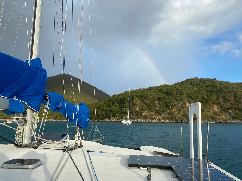
The steep peaks of St. John are a challenge for the cruising sailor. The wind accelerates between the hills and creates shifty strong winds we call willywaws. We had numerous small rain squalls daily while visiting this mountainous island. Warm air rises and creates clouds, which dump rain and provide lots of rainbows.
With the rain, comes a rainbow 🌈
Our next stop was in Christmas Cove on Great St. James Island. We enjoyed another beautiful downwind sail to get there.
Boat name is PI, and they make/sell takeout pizza in Christmas CoveYummy
Sailing to St. Thomas is a trip down memory lane. We last visited here on a cruise ship ourselves. Of course we visited all these islands in Sundsvalla back in 1988-89 as well as four different bareboat charter excursions.
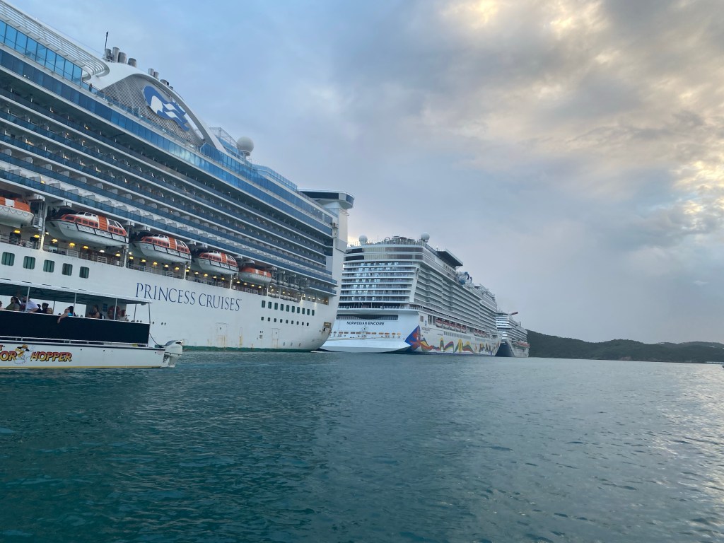
Three cruise ships in Charlotte Amalie
One of the very special things we enjoyed in this busy harbor was the afternoon and evening entertainment of a steel drum orchestra. We heard them nearly every day, but we never saw them.
Our anchorage in Charlotte Amalie
We scheduled our COVID booster shots at Walgreens and found a Budget Marine store where we could obtain needed spare parts. The best way to get there was to travel on the local bus system, called safari. Although, by the end of the day we were tired and settled for a private taxi to get us the rest of the way back.
Riding the Public Safari (open air bus) to Red Hook and back
When the weather finally settled down, and our errands were complete we moved on to our final stop in St. Thomas, Brewer Bay.
Brewer Bay, where we anchored near a boat similar to our previously owned White BirdSunrise over Brewer Bay as we sail off anchor, toward Culebra, Puerto Rico
In summary, the harbors in the USVI were not over-crowded this early in the season. The majority of the boats we saw were charter boats and shoreside facilities and the authorities seem to cater to that style of tourism. It was a fun and all too brief visit. We are happy to be a bit further south this winter season. We are enjoying the steadier trade winds that most often come from the east. This makes for some very pleasant sailing! Also, the cold fronts with their accompanying wind shifts generally don’t get this far south.
Does anyone recognize this 1980’s song by The Clash? The line: if I stay there will be trouble, if I go it will be double, may be particularly poignant for us this month.
It’s November, the clocks have been turned back, daylight is diminishing, cooler weather is here. Yikes, we need to escape winter! Should we stay in Hampton, VA to wait for the next offshore weather window to the USVI or just go a bit south around Cape Hatteras? Or should we go down the ICW to Beaufort, NC to get warmer weather and wait for the next weather window?
Can’t leave without a trip to the Bakery for a couple cinnamon buns, and one Boston cream donut. All those little ones were free, honest!
Our friends on Wild Iris and U’Jamin picked November 8th as their weather window to head offshore for the Caribbean. They left from Deltaville, VA; the former heading for Dutch Ste Maarten, the latter for Puerto Rico. A cold front had just blasted through for days and the seas were higher than we wanted, plus the forecast was for multiple days of light or no wind, and some south winds. Not our kind of window, but we were really bummed to give it a pass. Note: both boats arrived safely at their destinations after 11+ days at sea.
Go outside around Hatteras
We saw an opportunity to go offshore 240 miles to Beaufort, NC by leaving the following morning. We had a prediction of a whole day of pretty good winds, then light winds for 12-24 hours, then building winds from the south. We hoped to get around Cape Hatteras before the wind died, motor around the next corner, then use those south winds to sail into Beaufort.
Becalmed near Oregon Inlet
Five and a half hours out of Hampton, we had exited the Chesapeake. It’s 8:30 at night. Tom had just settled into the bunk for a rest. Anita was contemplating setting sails. The engine oil alarm blipped, then beeped. Anita immediately shut it down and started raising sails. Tom took a peak in the engine room and saw black engine oil in the bilge. The bottom of the oil pan was wet and slippery. He turned the automatic bilge switch off, so we don’t accidentally discharge this small amount of oil. Then Tom helped finish raising the sails and heading south. Tom wondered aloud if we should head back to Hampton, but the wind was dead against us for that scenario. We sailed 104 miles in the first 24 hours, but we’d lost the wind about 12 miles south of Oregon Inlet.
The afternoon of our second day at sea, Tom called the Coast Guard to advise them of our non-emergency predicament, becalmed near Oregon Inlet with a disabled engine. They commented that they could assist with arranging a tow if required. We were still hopeful the wind would fill in overnight to get us around the cape. It didn’t.
Sipping my morning coffee and watching Dolphin frolic in the fog off Oregon Inlet
Trouble
Due to the expected south east winds, we decided that it would be unsafe to continue to try to round Diamond Shoals at Cape Hatteras. For the first time in 43 years of ocean sailing, we called for a tow. We also want the help of a mechanic, not something we do very often as Tom is very handy mechanically.
Starting the tow, we centered the boom right after this picture was taken
Anita was hand steering to keep Lone Star centered behind the tow boat.
Oregon Inlet is a massive sand bar with 65’ bridge clearance, we need 55’
The breaking surf heading in the inlet was nearly a solid line. Our Sea Tow captain Stuart, at one time informed the coast guard via VHF that he may need them to take us through the surf and under the highway bridge where he would pick up the tow. However, Stuart persevered and we made it through. As we were driving just 100 feet off a beach, his comment over VHF, “My pits are dripping (sweat) to my waist,” made me laugh and broke my tension and the strong grip I had on the steering wheel.
Quick video clip right after the worst part
Stuart switched to a working VHF channel after the bridge. In the next 2 hours of this tow, he provided an awesome tour of our surroundings. The first tidbit of news is that the rusty metal bits of the old bridge that was being deconstructed and removed was dumped in the exact location he picked us up. Next was how the islands on either side of this narrow channel were created by dredge spoils. Some of these man made islands were 20 feet high covered with flora and fauna and a home for multiple species of wildlife. There were a few more stories, you get the picture.
Safely docked in Manteo on Roanoke Island, Sir Walter Raleigh ship replica and Lost Colony museum across the channel
Having never experienced a tow before, I was very impressed by the professionalism and helpfulness of both the Coast Guard to engage a tow and the Sea Tow Captain who arranged the Marina dock and provided recommendations for a mechanic. A few days later, we received another big dose of southern hospitality when our Tow Captain brought us a couple Carolina barbecue dinners from a local fund raiser on Sunday. Pulled pork, crispy fried chicken wings, cole slaw, baked beans and a dinner roll. Delicious!
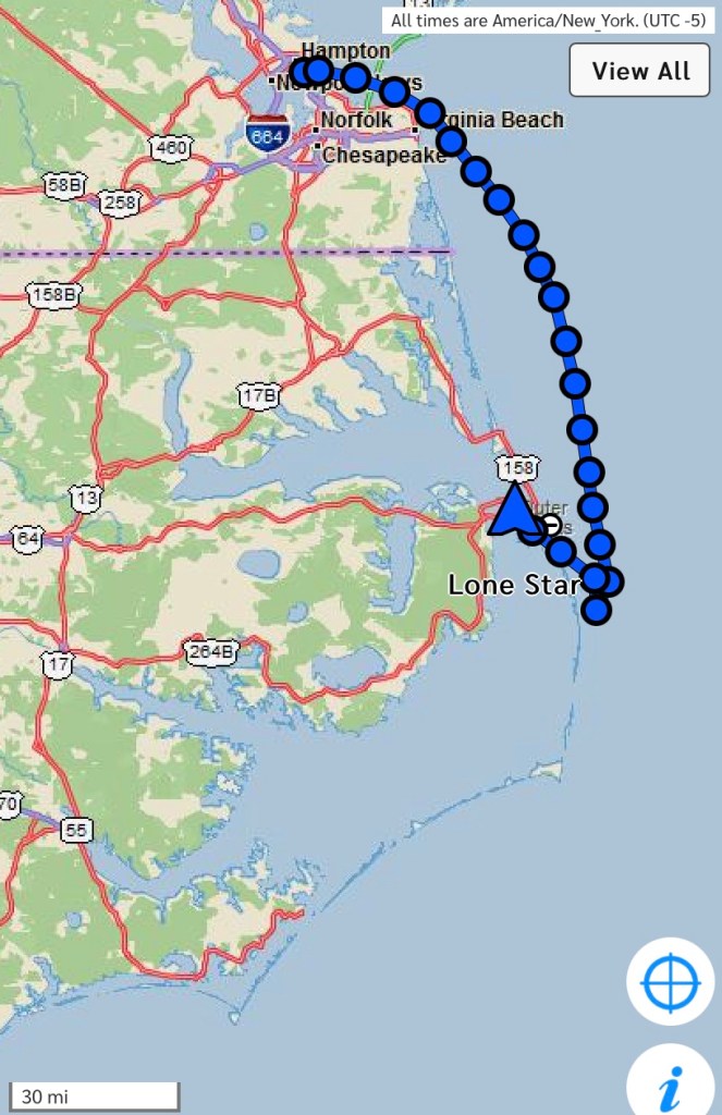
Track of Lone Star on this passage, Beaufort, NC is at the southern tip of this map
We arrived in Manteo on Thursday, Veterans Day. The earliest we could schedule a mechanic was the following Monday. That gave us time to hike, explore the town, do laundry, and catch up on computer logging and blogging 😁.
Fabulous miles of boardwalks around Manteo
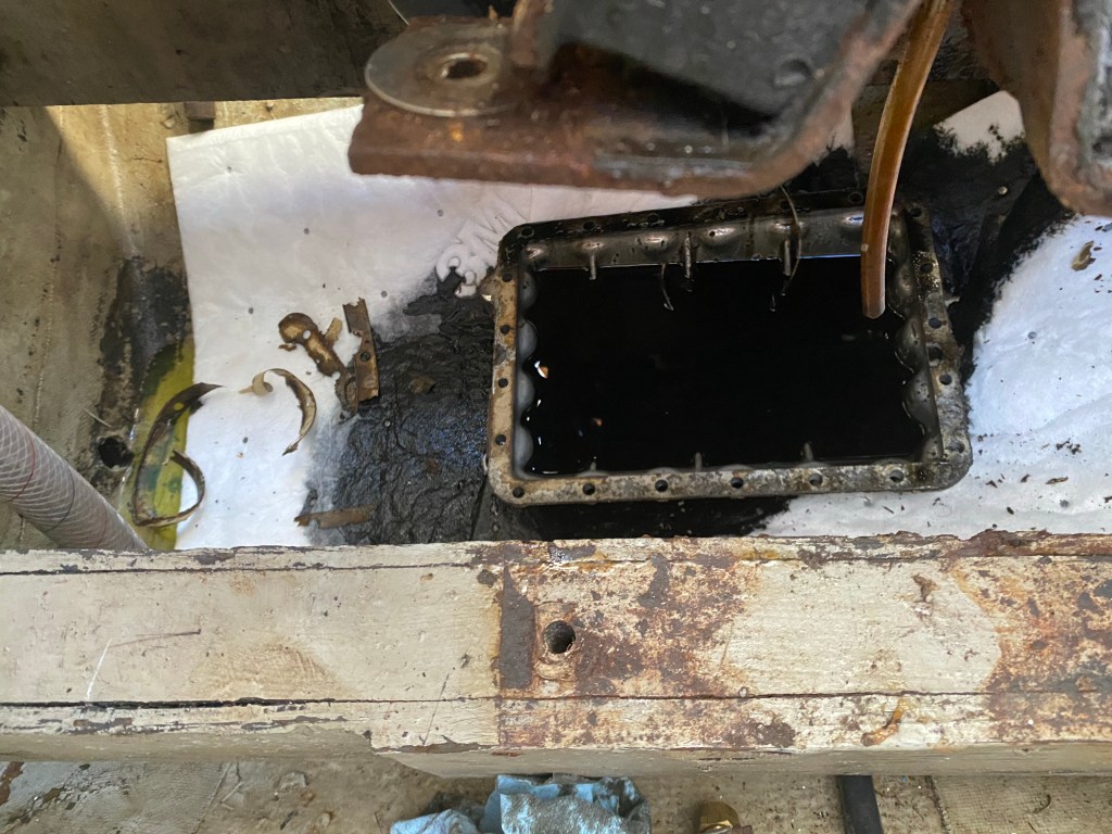
Tom had purchased a new oil pan, gasket and hardware this summer as he noticed some corrosion in the area. We engaged a mechanic and helper to lift the engine and replace the oil pan. There was no proof this was the source of the oil leak, just a strong suspicion. Raising the engine off its mounts then tipping it to one side allowed easier access to the oil pan. There were 21 fasteners and a few were rusty and hard to remove. It took the mechanics 3 hours to remove the old oil pan.
Surprise! The oil pan is still half full
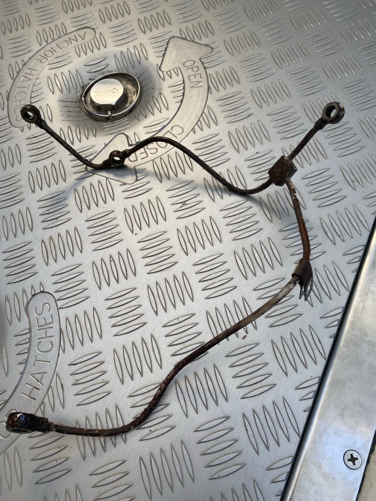
After lunch, they installed the new oil pan, remounted the engine and hooked everything back up, topped up engine oil and coolant, primed the filters, then started her up. Uh oh, she’s squirting clean engine oil from a high pressure metal tube that wraps around the back of the engine. We immediately ordered the new part and requested overnight shipping.
The leaky part!
Go inside
Two days later, the new part was installed. The engine runs with no leaks, although shifting into reverse is a little difficult. We elected to continue our journey south via the Intercoastal Waterway (ICW). Winds were too strong and from the wrong direction to go south and west through Pamlico sound, so we went north, west, then south. We left Manteo early Thursday morning, a week after we arrived.
Manteo Town dock, playground, and shopping
We had a pretty tough first day of ICW traveling. There is a super shallow channel leaving Manteo, Anita remembered going aground briefly here 3 years ago. There were more crab pots on this northwest stretch than Casco Bay Maine. The crab pots plagued us all the way to the Alligator river entrance. Many were small, dark in color and hard to spot. Thankfully, we didn’t hit any. Just lots of hand steering to avoid them all. We were definitely making a snake wake, not something I’m proud of. Next we had to motor-sail all the way south directly into the wind in the Alligator river. However, on the positive side; we are 41 miles closer to Beaufort, NC. We made it to our chosen destination for the night. The anchor was down just after sunset. We saw a mini 🌈 as we entered the harbor.
Enjoying the autumn colors in the Alligator-Pungo river canal
The next day was very close to ideal conditions. We raised the jib right after the anchor. In the less sheltered area of the canal it gave us an added 1-2 knots of boat speed; 5-7 knots is acceptable.
It was actually a very windy day, not in the canal.
Double Trouble
Beautiful sailing conditions continued past Bellehaven, crossing the Pamlico river, and south down Goose Creek, 49 more miles done. As we turned upwind to drop the mainsail in our chosen Gale Creek anchorage, the engine was revving, but we had no forward momentum? “Tom, drop the anchor now, no propellor or forward thrust from engine!” He lowered the anchor, then finished the mainsail. Turns out the transmission cable broke. It was bent by the mechanic stepping on it. Bending it back only works for a little while. Tom was up until 1AM replacing that cable. Yes, we had a spare on board.
Sailing in Pamlico Sound to Oriental, NC
The next day we enjoyed another beautiful 19 mile sail to Oriental. We assembled our Pota-bote dinghy and went ashore to walk around and shop in the Provision Company. Then stopped for refreshments at the coffee shop.
Anchored in Oriental
Our final 21 miles to Beaufort was under motor. Light to no winds and mostly through narrow bodies of water. We chose a more direct route this time through Town creek to Taylor creek rather than around Radio Island. Nice shortcut, much less traffic too. We had scheduled appointments for a drive through COVID test, required for USVI entrance. So soon we were on shore calling Old Town Taxi and on our way to Walgreens and Lidl for our final stock up.
Anchored in Beaufort, NC, final stock up done
We Should Go
The temperature was 39 this morning, November 23rd and predicted 33 on the 24th. We should go south. The weather apps we use and our weather router agree there is a good weather window to head for the USVI starting tomorrow morning. We should be warmer as soon as we cross the Gulf Stream. We and Lone Star are ready for a passage to escape winter and enjoy the Caribbean this season. Please no more trouble. As you can see like the ocean, we roll with whatever comes our way.
Downwind sail from the Berries to Great Abaco. Note the old baggy sails.Rounding the southern tip of Great Abaco, very shallow water near land, so pretty
We continued to enjoy great sailing in May. Fewer storms, lots of sunshine, and not too hot. The cold fronts that come off the USA east coast affect the Bahamas less frequently at this tome of year.
Our first stop in the Abaco’s at Little Harbor was brief, just a couple nights. We visited Pete’s Pub for a yummy outdoor lunch. Folks are still friendly from a distance. No reports of COVID here at this time.
We enjoyed a 17 mile sail to Matt Lowe’s Cay just north of Marsh Harbor. What a neat remote anchorage! One other boat anchored nearby late in the day. Although we did not snorkel it looked like it would be a nice place for that.
The next morning we raised anchor right after the morning radio net. We went to Marsh Harbor for supplies for us and our buddy boats. Maxwells is so well stocked, it’s the largest grocery we’ve seen since being in the USA. We sailed to Crab Cay, just past Green Turtle Cay to rendezvous with U’Jammin and Wild Iris and deliver their groceries.
U’Jammin sails back to USA
Sad to say goodbye to Jeff and Marsha on U’Jammin, but happy to see their big smiles as they head out for a few nights sail to the south coast of the USA.
The weather report was not yet right to head straight for Beaufort, NC and beyond. The weather fronts were still affecting most of the east coast regularly and the temperatures were much lower than normal. So we stayed in Crab Cay/ Manjack Cay with Wild Iris, hiking, singing, cooking and eating.
Who doesn’t love a rainbow?
Lone Star made a quick trip to Green Turtle Cay Club to checkout of the Bahamas. That was new this year due to COVID! We’ve never had to check out in the past. We purchased one spare can of diesel to spend the rest of our Bahamian dollars and donate the change.
Lone Star track sailing the Bahamas
Statistics for our third winter in the Bahamas:
1192 miles sailed, more than previous two years combined! (2019-852 miles, 2020-337 miles)
We visited the Abaco’s, Eleuthera, Exuma’s, Long Island, Jimentos and Ragged Islands, Great Exuma, Cat Island, Exuma’s again, Rose Island, Andros, the Berry Islands, and the Abaco’s again.
No problems filling out the Health Visa for each move between the island groups.
Passage North
When we finally chose a weather window, we began by beating and bouncing into a head sea for the first 12 hours or so. Alex was able to act as liaison between us and Wild Iris, so we could keep in touch once we were out of VHF range. We arrived about 5-6 hours behind our buddy boat.
At sea May 18, 2021
First leg: Green Turtle Cay to Beaufort, NC in company with Wild Iris. We arrived at 7:30 AM on May 22. By 10:30 AM all 4 of us had appointments at CVS in Morehead City to get our first COVID vaccination. We celebrated with Mark and Lisa with lots more music and pizza. We enjoyed a nice walk around town and dinner served outside with friends, Len and Robin. Amazing and a bit daunting to see Americans socializing again. Many are vaccinated in this area. Three days later a weather window appeared to head north again.
Flying fish found on deck in the morning
495 nautical miles
81.5 hours
6.1 nm. average speed
3.5 hours motoring
Enjoying the sunset in Beaufort, NC
Second leg: Beaufort, NC to Cape Henlopen or Lewis, Delaware; the southernmost point of Delaware Bay. Glad to be at anchor behind the breakwaters! Nasty weather front kept us in the cabin. Cold, windy, and rainy. Long underwear and many layers of clothing at the end of May! Changed back to flannel sheets, extra blankets and put the cabin heater on. Welcome to New England, where it is not yet summer.
Dodging rain squalls!Celebrating our arrival at Cape Henlopen
327 miles
57.75 hours
5.7 nm. average speed
21.5 hours motoring
Trying to stay warm with baked Uglies!
Third leg: Cape Henlopen to our home port in Mystic, CT. Expected to motor for 24 hours. Very thankful it was a lot less than that!
Passing big ships
228 miles
46.5 hours
4.9 nm. average speed
9.25 hours motoring
The storm has passed, time to finish this passage!
Summer 2021
We’ve had a very busy summer. Not a lot of time for sailing this year.
Our son, Alex married his lovely bride Jenna in July. Congratulations to the happy couple!!
Welcome to the family Jenna Kintz!
A short break to sail Lone Star to Block Island during the week…
Block Island
… and to Watch Hill to join friends from Shennecossett Yacht Club for the weekend.
Hands-on demonstration with Fire Department
We made time for a few daysails with friends and family. Found out Alex and Jenna’s dog Nani is quite comfortable as a sailing dog!
Fun day sails in Fishers Island Sound
A week long visit with Mark and Lisa after they delivered a friends boat to Newport, RI to escape the heat in Deltaville, VA in early August. Thanks for more great times dear friends!
We toured Fort Trumbull and Fort Griswold
Then visited long time friends on Cape Cod for a few nights. Thanks Tim and Alex for the wonderful motorboat tour of Chatham harbor. I had no idea there were so many boats anchored there! Tom really enjoyed the small boat sailing too!
The dock between the boats is moored!
Anita’s sister Jane and husband Dave celebrated their 25th wedding anniversary in Maine in August. Congratulations!!
Happy 25th Anniversary Jane and Dave!
And last, but not least boat projects! New Sails, and new below deck auto pilot. New running lights too. We purchased a few more items to take with us. There are always more projects waiting in the wings.
We followed this up with our second drive to New Hampshire to visit Tom’s Dad. More fun with small boat sailing and card games, or was it barricade? Fun times!
New sails and a new stack pack for the main sail
Life is good with us. Keep in touch and let us know how you are doing!
We were enjoying cruising in company to Rose Island near New Providence and Nassau. Sadly, in mid-April it was once again time to bid farewell and part ways with our buddy boats. They were starting to plan their departure from the Bahamas. We planned to stay another month.
U’Jammin and Wild Iris depart for the Abaco’s
While our friends enjoyed an overnight sail north we left the next morning sailing west for Andros Island. We enjoyed a mostly downwind sail across the north side of New Providence. So happy with our boats performance: 46.2 miles in 9 hours, despite having to motor for 3 hours midday when the wind died. We anchored in Morgan’s Bluff at the north end of Andros at 5 PM.
Sunset our first night at Andros
Steve and Janice on Steadfast invited us over for a delicious dinner made by Janice: fresh caught fish! She is a marvelous chef. We were also happy to meet up with Steve, another long range radio relay. Great to put a face with the voice we hear every morning and fun to get to know them a bit better.
The next morning the local Customs official gave us a ride to a small local grocery as we were out of fresh produce. They sure didn’t have much, but something is better than nothing. We purchased diesel at a reasonable price here too. The next day we hiked around to enjoy the uniqueness of the area.
Morgan’s Caves believed to have been used by the pirate captain himselfLone Star at anchor in Morgan’s Bluff
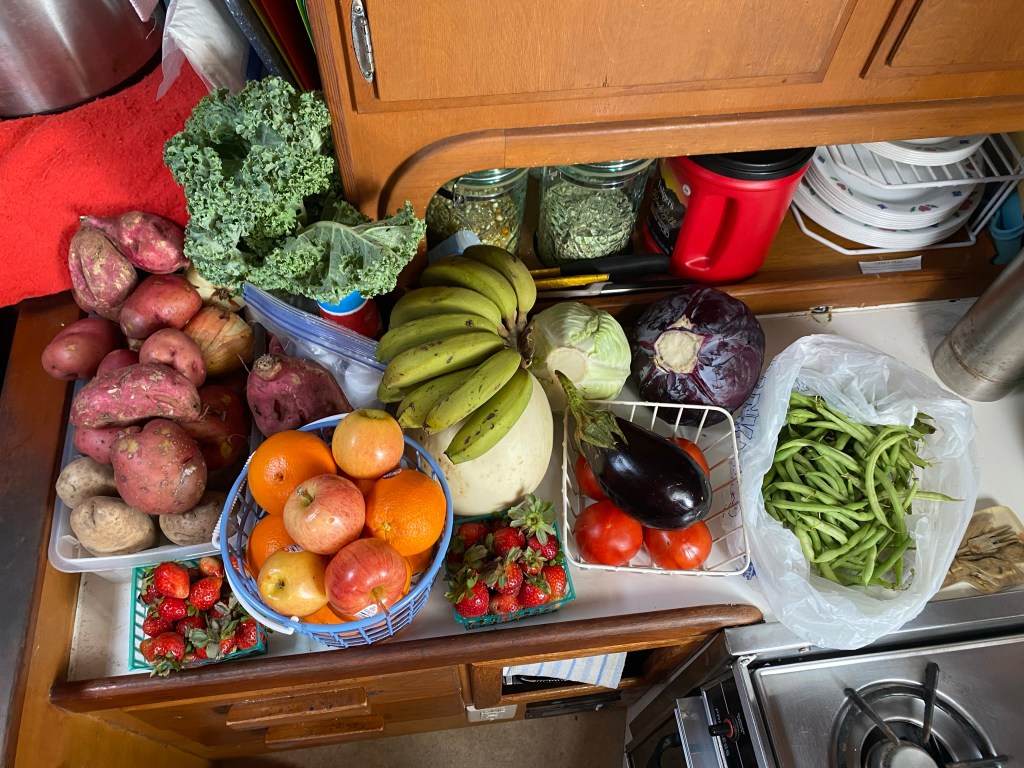
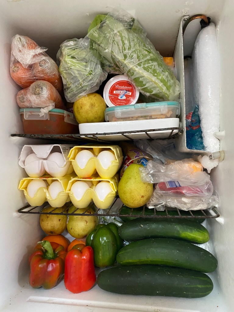
Sully gave us a guided tour to the Mennonite farm early on our last morning in Andros. I highly recommend other cruisers ask for Sully, he is not a taxi driver, just a friendly local that enjoys people. What a nice load of fresh produce!! Well worth the trip!
Bananas, melon, cabbages, green beans, tomatoes, eggplant, fresh picked strawberries, apples, oranges, white & sweet potatoes, onions, and kaleCarrots, broccoli, romaine, pears, farm fresh eggs, bell peppers, cucumbers, celery and scallions Yes, the refrigerator needs to be defrosted!!
Right after lunch we sailed the 16 miles to Chub Cay in the Berries. Regrettably, I took no photos here. However, we were here several years ago with Jenna & Alex on board.
2019 photo of Chub Cay2019 photo sunset at Chub Cay
Time to explore new places in the Berries! We sailed east and north up a shallow bay to anchor a mile or so from Cockroach Cay.
Cockroach Cay in the Berries
This was a secure and beautiful anchorage to hide from a north east blow. No waves for us in this harbor. We saw an occasional fisherman, but no other cruising boats here. We stayed for 3 nights, then motored 15 miles to Bonds Cay. Ironically, we were now a couple miles north east of Cockroach Cay and still received a good cell signal from Chub Cay.
Full moon well risen before …… Sunset anchored at Bonds Cay, looking toward Cockroach Cay
After three more days of moderately high winds keeping us on board, we were starting to crave a walk on shore. No beaches at all on the west side of this long skinny island, just coral. We could see a small beach toward the north end. So we pulled up the anchor and motored a couple miles north and re-anchored.
After a mile plus dinghy ride we found a small beach
We walked back and forth a few times until it looked like a whole lot of people had landed on the beach. Haha, we haven’t seen a soul. However, there was a very large flock of people shy birds!
It was a pretty small beachPicturesque none the lessHeading back to the speck that is Lone Star
The next day we sailed 23 miles to Hawks Nest Bay. We only used the engine to set the anchor upon arrival. We were so pleased to see we were surrounded by beautiful beaches on three sides. Yeah! Let’s go for a walk!!
Hawks Nest Bay was surrounded by beach!Now that is a nice beach to walk on!!Looking for turtles in a nearby warm riverAhh, our happy place!Beach walking at Hawks NestLife is Good… in the Berries
We enjoyed four days filled with beach walking and turtle spotting and dolphins in the bay. Then we saw an ideal weather window for a long day sail east then north to the Abaco’s. Lately, the northern islands have experienced stronger winds than we’ve had from three passing cold fronts. Perhaps we can catch up with our buddy boats again?
Caption: Looking out to sea after entering the Exuma banks via Dotham Cut between Bitter Guana and Great Guana.
Considering there are fewer boats in the Bahamas due to COVID this season, we decided to spend more time exploring the northern Exuma islands and the Land and Sea park. We occasionally found it challenging to find safe anchorages to hide from pesky cold fronts coming off the US east coast. Life is good, we all need a challenge now and then. It keeps life interesting.
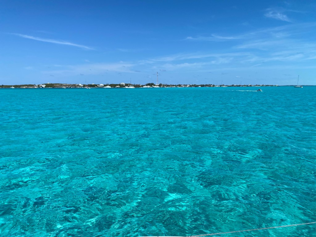
Sailing on these shallow banks is easy and fun with our 3.5 foot draft trimaran
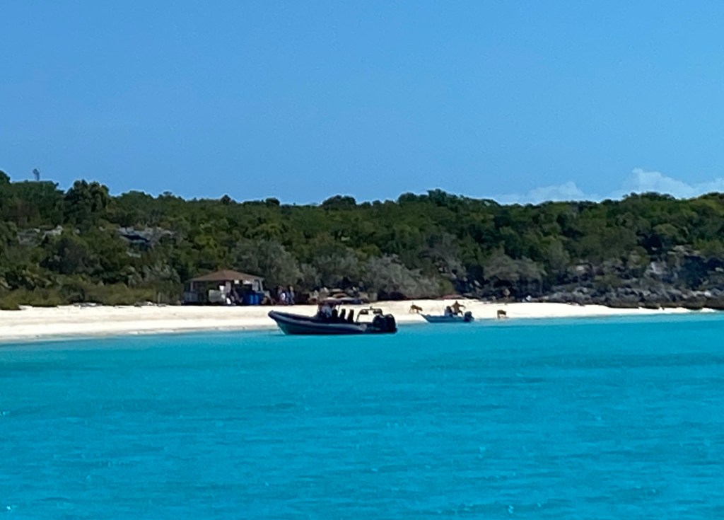
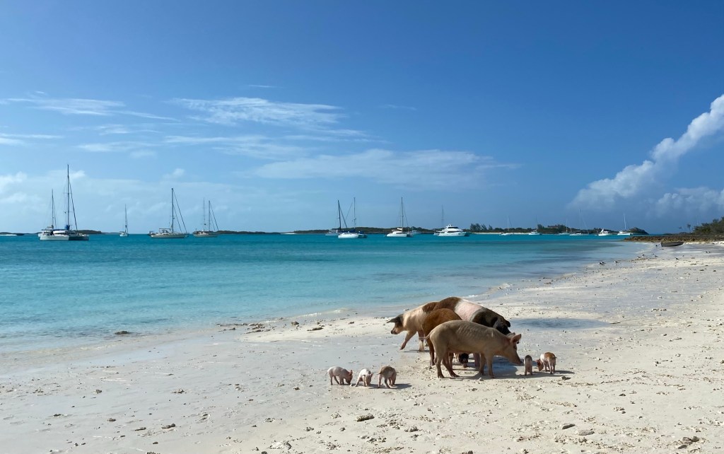
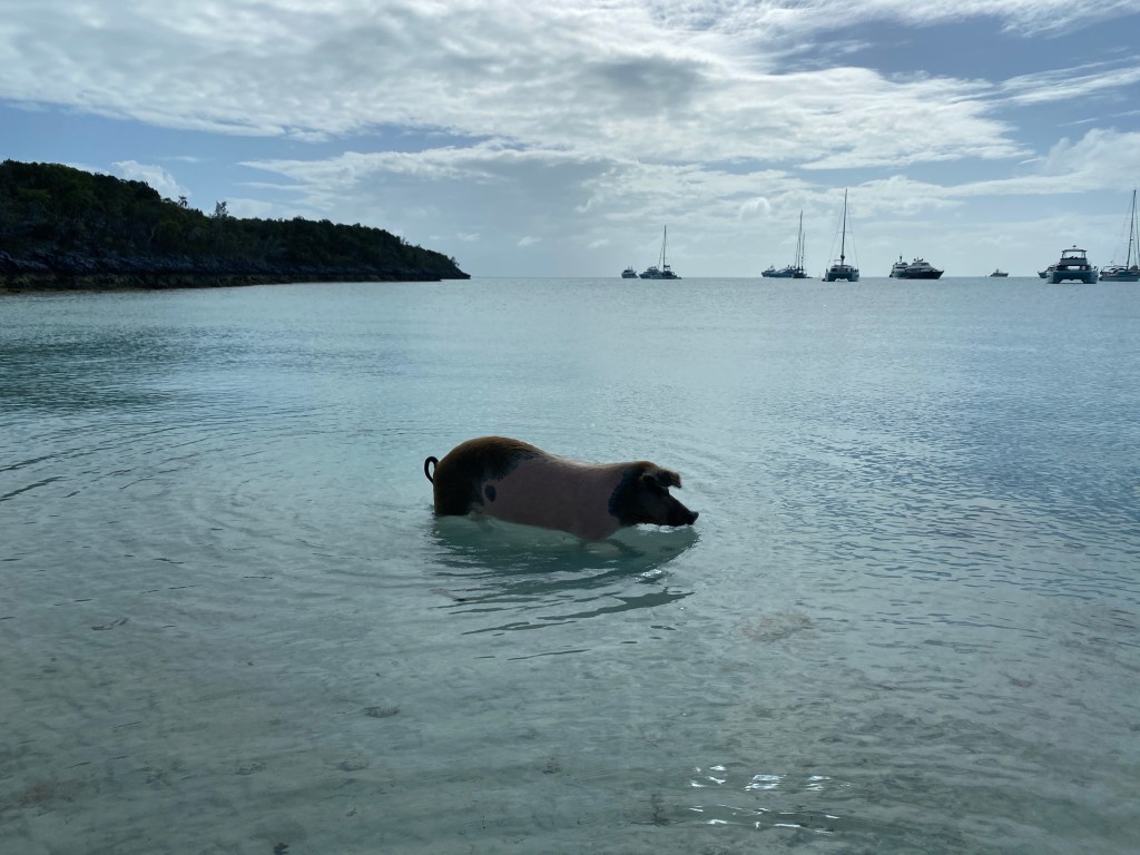
A popular stop for cruisers, tourists and even locals is to visit the once wild pigs at Big Majors. Sailors of old dropped off breading pairs of pigs to fend for themselves on several Bahamian islands. These sailors planned to return for fresh meat as needed. They did the same with goats as we’ve witnessed in the Ragged Islands and perhaps with roosters and chickens as we hear them everywhere!
Pigs on the beach at Big Majors
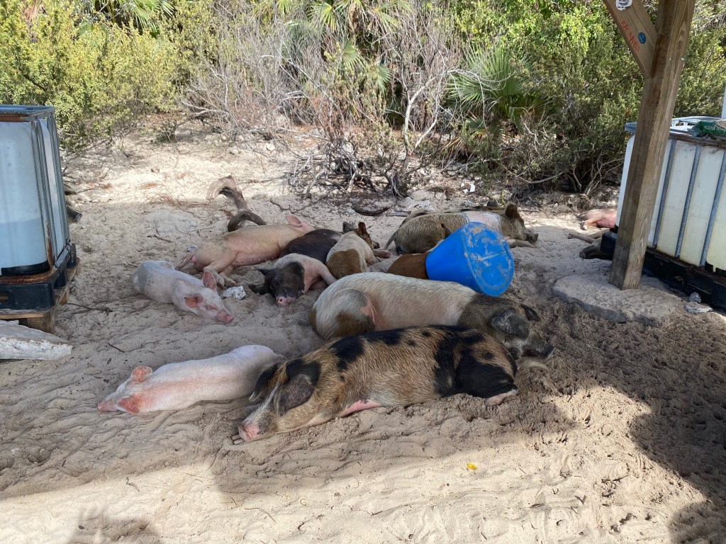
In current times, the pigs are well cared for by locals. Fed and watered twice a day and ample shade provided.
Funny way to guard the pigletsShady spot for the pigs to rest Yes, pigs can swim!Big Major’s anchorage From pig beach on Big Majors
From Big Majors we went 13 miles south to Black Point for protection from south winds. Good opportunity to drop off the garbage and grab a few groceries. Early the next morning we headed around the corner to Little Harbor to get protection from north winds. We didn’t leave quite early enough. Left in fog, dropped the anchor while it was raining. No problem, the rain is warm. At least we had a quiet anchorage last night. Boats that anchored here yesterday had a bouncy night in waves. We spent 4 nights here. Met up with a group of 7 other boats from Georgetown and enjoyed a potluck and bocce ball game on the beach when the weather finally cleared.
Bocce ball on the beach at Little Harbor, Great Guana
Wild Iris pulled in to the anchorage. After Cat Island they and UJAM’n had gone further south to Rudder Cut in the Exuma’s. UJAM’n leaped ahead of us to join cruising friends in the Land and Sea Park.
Blow hole at low tide is not impressive
The next day we enjoyed a long walk to the blow hole and through the town at Black Point. Fresh cinnamon bread from the bakery! So good to stretch our legs.
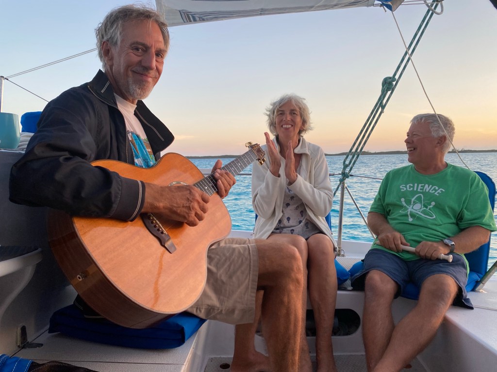
Singing at sunset
So much fun to sing and make music while the sun goes down. Mark learned a couple new songs at Tom’s suggestion: Bimini and Sail Away from the Kingston Trio. We spent the next week sailing in company with Wild Iris. Next up we sailed north to Big Majors. This time we anchored on the southeast side closer to Thunderball Grotto.
Thunderball Grotto, zoom in to see boats
Tom went snorkeling in the grotto and cave with Mark and Lisa. Anita did laundry and read. She does not have a wetsuit yet, it’s on the list of things to purchase.
Roof of Thunderball cave
Next day we sailed to the west side of Pipe/Fowl Cay. Two things we want to see here: Rachel’s Bubble Bath at high tide, and some underwater caves at low tide. Mark and Lisa joined us on Lone Star and we motored 1.6 miles up to Compass Cay and immediately went to Rachel’s bath. We were a little past high tide so the bubbles weren’t very frothy, but we saw the leftover froth on the approach. Must be very impressive with an east wind and astronomical high tide. We had lunch together then went snorkeling at the caves.
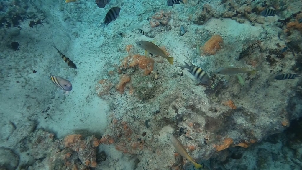
A variety of fish seen in the aquarium in Exuma park
Next we sailed together to the Bahamas Land and Sea Park. We chose to anchor up a sandy river near Compass Cay. There are a couple neat things to see here. A crashed airplane in shallow water and an underwater aquarium. That same day we walked on a nice beach and up a bit of a hill to glimpse the ocean.
Beach walk and snorkeling with friends
One day Anita invited Mark and Lisa over for a baking afternoon. Our oven is very good and will heat well over 400 degrees Fahrenheit. They made pizza, dinner rolls, and a cinnamon roll. We baked corn muffins and brownies.
Baking with friends on Lone Star
We rejoined UJAM’n at Highborne Cay. Stayed in Fishing Bay on the northwest coast. East winds were predicted. A cold front came through with a one two punch 12 hours apart. We had no idea the first one would result in northwest winds immediately, it was rather bouncy after the strong thunderstorms blew through in the late evening. It was a sleepless night for our cruising friends as they were anchored near two mega yachts. One dragged in the high winds and fouled their own propellor with their tenders very long tow line. We all moved around the corner the next day for more protection.
Beach games with friends, our boats in the background
Added bonus: nice beach to play games on!
Anchored together
This cruising lifestyle is a lot of fun when we cruise in company and get to know other people. We all sailed north together. More about that in the next blog.