This was our very first time sailing the US east coast south of Beaufort, North Carolina. We did not have a time line or a plan, although we did not plan to motor down the ICW. We sailed down the coast as weather permitted. We considered options for the next port based on weather and appeal of the town. We also considered inlet conditions after the Winyah Bay saga that was described in the last blog.
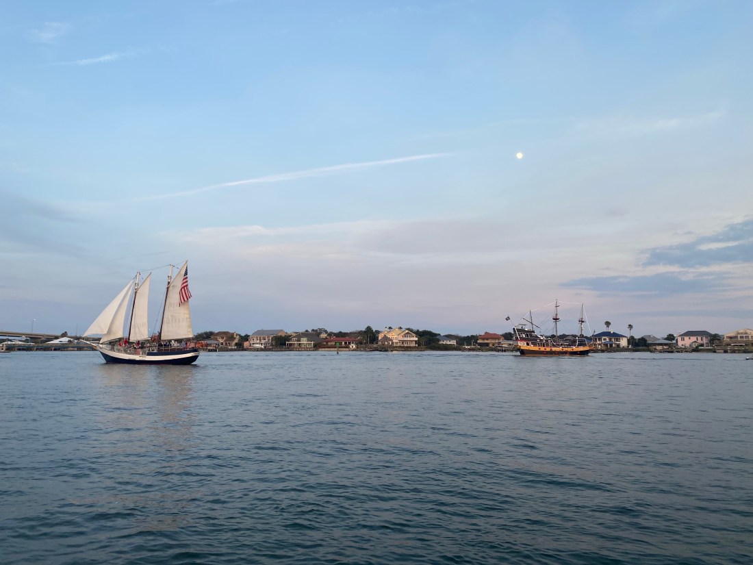
St. Augustine, Florida
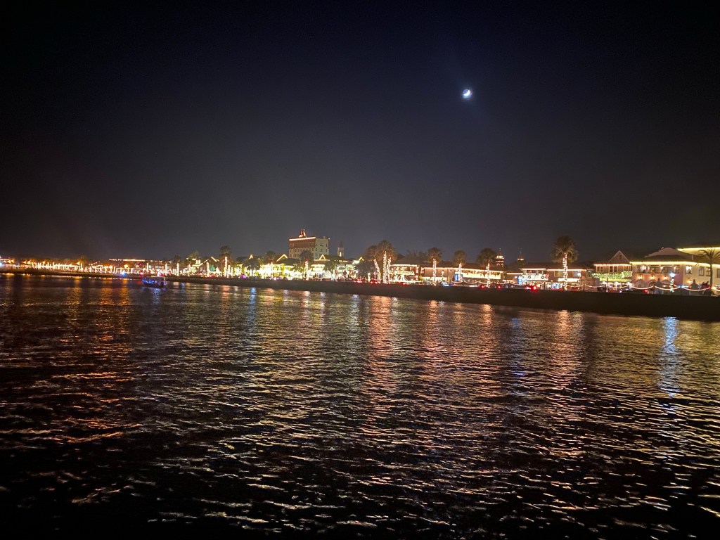
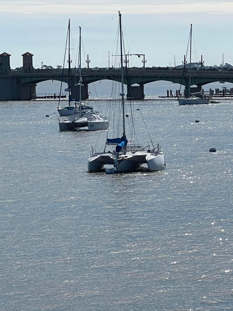
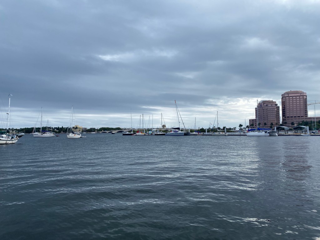
Lone Star moored north of the bridge of Lions in St. Augustine, FL
The 60 mile sail from Cumberland Island, Georgia to St. Augustine, Florida was longer than a day sail. As we wanted to arrive in daylight, we chose to leave in darkness. St. Mary’s Inlet is well lit and wide. We left with the out going current and had no problems. Wild Iris sailed with us and quickly sailed past us. We motored through the inlet, then enjoyed an easy sail the rest of the night.
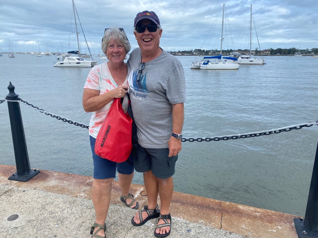
Walking around St. Augustine with friends
We spent six nights on a mooring. The Intercoastal Waterway (ICW) is just beyond the boats. Many boaters stop here! St. Augustine is said to be the oldest settlement in North America. We found it to be a very welcoming and interesting place to visit. There were so many things to see and do that it was difficult to choose.
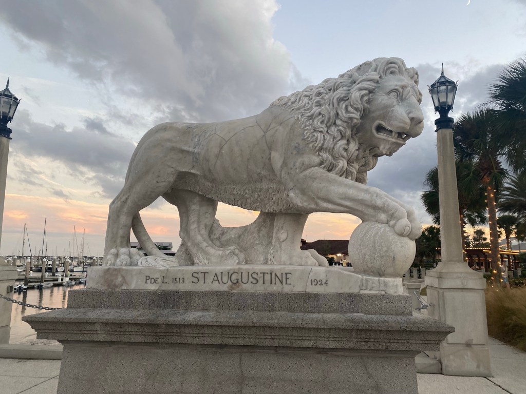
A pedestal on the Bridge of Lions
We enjoyed meeting up with cruising friends at various musical events around town. Stopping for a nibble, drink, or famous pizza. Yes, it was justifiably good!
Walking to Castillo de San Marcos at sunset. The occasional cannon blasts from their tourist demonstrations were close enough to our mooring that we jumped a few times.Christmas lights of St. Augustine. They had a large generator in a trailer to run all these beautiful lights.Swinging to the wind on the mooring, often we swung with the current and against the wind.
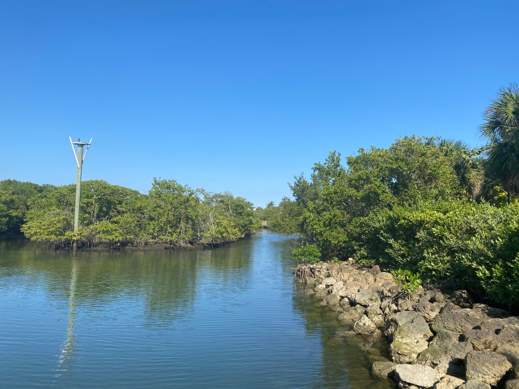
The weather was not good enough to head south. So when our mooring stay ended we motored north a few miles and anchored just south of Vilano Bridge. We found a beautiful beach to explore on the Eastern shore of the river. We also found a Publix supermarket for fresh supplies.
Public dinghy dock with access to Vilano Beach.
The following day we took the dinghies to Vilano Boat Ramp on the western shore.
We found this museum during a hike on the western shore. It was too late in the day to wander in. There are steep fees for all the attractions in this historical town. Best to start early!Interesting history!
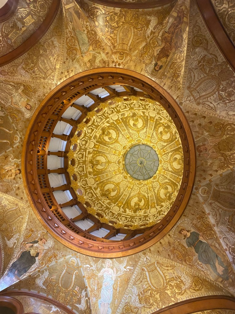
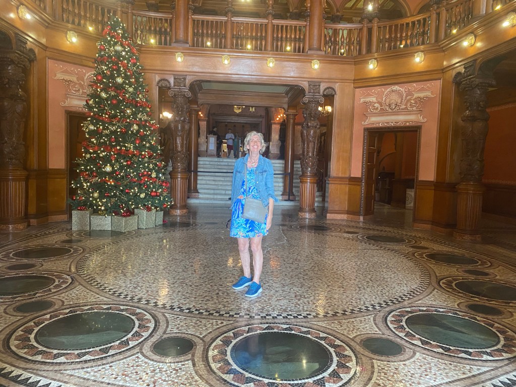
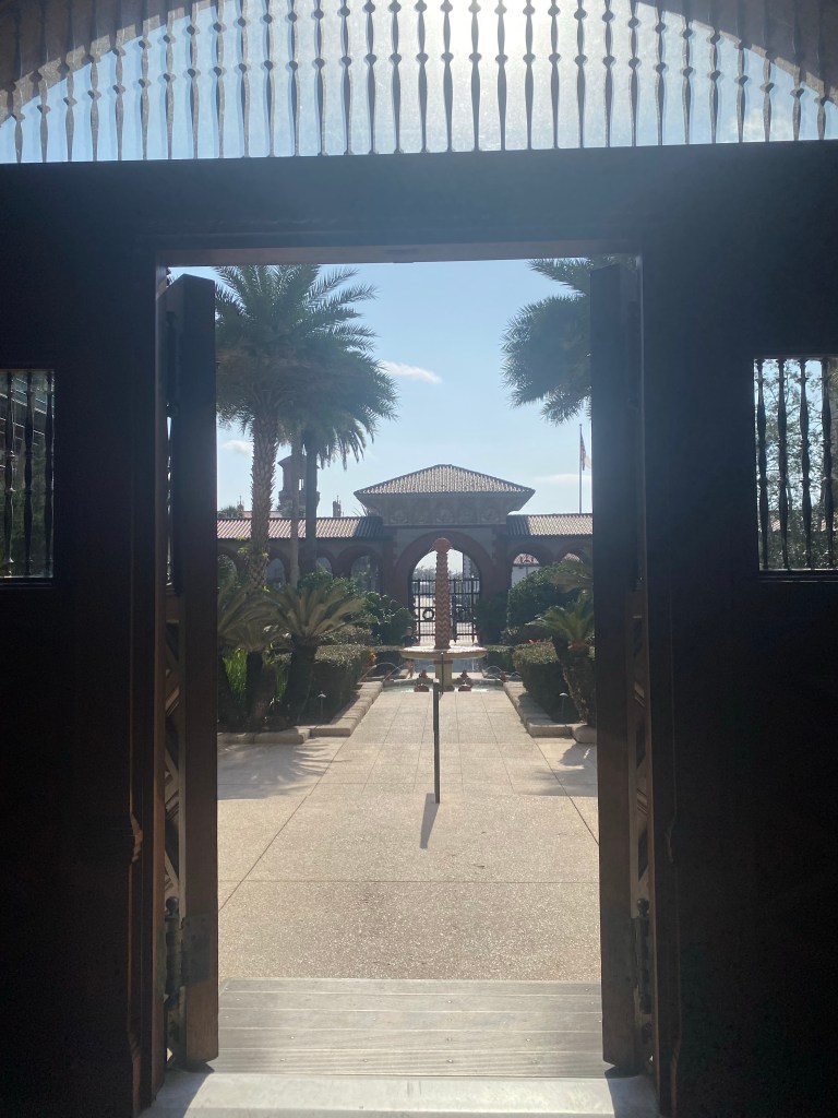
Our hike took us all the way back into the Old City of St. Augustine where we found more historical treasures to explore.
Ceiling of a very old Spanish building, now part of St. Augustine CollegeLisa admires the beautiful tile work in St. Augustine CollegeLooking back through the entrance at St. Augustine College. The fountain was lovely.
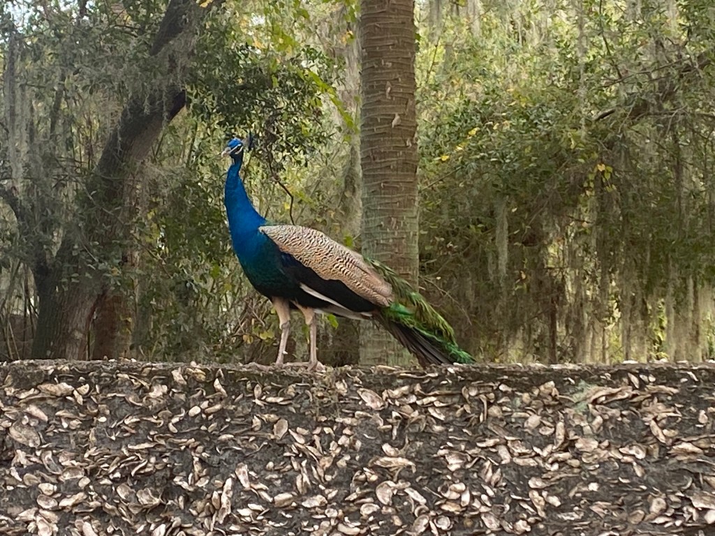
And on our hike back we saw this lovely Peacock on a unique border fence made of local materials.
Wild Peacock on a fence
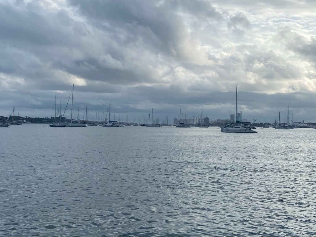
West Palm Beach, Florida
Our sail from St Augustine area to West Palm Beach was 209 miles. This ended up being a very slow passage with too much motoring: 52 hours total with 23 hours of motor-sailing. I sure wish we had a faster engine and/or a big light air sail!
Tom and I had a great time hiking around Peanut island. Gorgeous views and nice paved walking paths.Majestic palms line a park in West Palm Beach
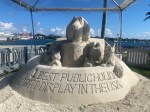
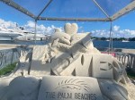
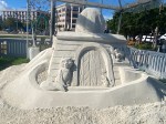
Sand Castles in West Palm Beach, Florida
Part of the winter festival is to have a sandcastle contest. Here are a few of our favorites.
In mid December we decided to motor 3.5 miles south down the InterCoastal Waterway (ICW) and through the Flagler Bridge to a very secure anchorage across from West Palm Beach.
Lone Star at the public dock in West Palm.
We had scheduled a serviceman to come aboard for our water maker. They recommended we pull in to the public dock.
We enjoyed wandering around this open air market in West Palm BeachWe’ve endured a lot of cloudy, cool weather this Autumn. The locals said it has been unusually cold for this time of year.
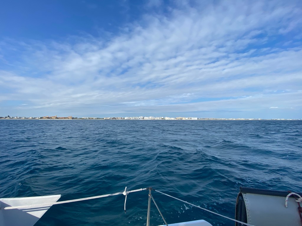
Marathon, Florida
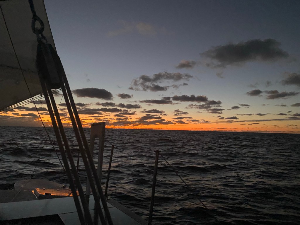
We enjoyed a beautiful 30 hour, 160 nautical mile offshore sail to Marathon on Boot Key. It was a downwind run on the tails of yet another cold front.
Next morning, underway toward Marathon, Florida
We heard Marathon was a cruiser’s must stop as their is an organized group here similar to George Town in the Bahamas and featuring things like a morning radio net, activities, assistance, etc. There is a large protected inner anchorage that is filled with moorings. Tom called several times to reserve a mooring. They needed to see us in person to make the reservation. We motored 2 miles by dinghy into the dinghy dock at the cruiser’s marina headquarters. They charged $22 a day to land the dinghy, and for each day you are on the waiting list. After the paperwork for landing the dinghy was handed to us, we changed our minds and did not reserve a mooring. Too many rules and too expensive to wait. We won’t have that much time here anyway. Marathon seems to be a place for boaters to stay put for the entire winter season. It’s not set up for cruisers just passing through. Thankfully the weather was calm enough to stay outside the harbor for a few days. We took showers and did laundry here and walked to a local grocery. Package pickup was very convenient, although the system for finding your packages and mail was confusing.
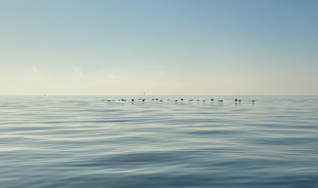
Key West, FL
A flock of birds on a calm sea
The 42 miles to Key West was accomplished under motor. We rendezvoused with Wild Iris once again. They had picked up their son Jack in Miami. We were all looking forward to celebrating Christmas together.
Arrival in Key West
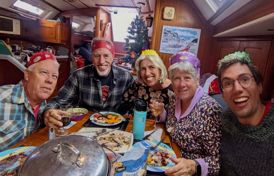
The weather was beautiful when we arrived. However, a 3 day front kept us on our boats in windy weather. We still managed to gather for Christmas Day dinner and games (Monopoly Deal).
Festive Christmas dinner on Wild Iris
2022 Year End Statistics
4,310 nautical miles traveled (16,782 nm since we started cruising in 2018) 18 nights at sea 230 nights at anchor 22 nights on a rented mooring 87 nights on our own mooring 3 nights at a dock 5 nights hauled out on land, still on board 8 States in the USA: NC, VA, CT, RI, NY, SC, GA, FL 3 Island groups in the Bahamas: Exumas, Eluethera, Abaco’s 5 Countries and territories: Puerto Rico, Dominican Republic, Bahamas, USA, Mexico
Farewell to our homeland. We are off to visit Mexico and the Honduras Bay Islands this winter.
Does anyone recognize this 1980’s song by The Clash? The line: if I stay there will be trouble, if I go it will be double, may be particularly poignant for us this month.
It’s November, the clocks have been turned back, daylight is diminishing, cooler weather is here. Yikes, we need to escape winter! Should we stay in Hampton, VA to wait for the next offshore weather window to the USVI or just go a bit south around Cape Hatteras? Or should we go down the ICW to Beaufort, NC to get warmer weather and wait for the next weather window?
Can’t leave without a trip to the Bakery for a couple cinnamon buns, and one Boston cream donut. All those little ones were free, honest!
Our friends on Wild Iris and U’Jamin picked November 8th as their weather window to head offshore for the Caribbean. They left from Deltaville, VA; the former heading for Dutch Ste Maarten, the latter for Puerto Rico. A cold front had just blasted through for days and the seas were higher than we wanted, plus the forecast was for multiple days of light or no wind, and some south winds. Not our kind of window, but we were really bummed to give it a pass. Note: both boats arrived safely at their destinations after 11+ days at sea.
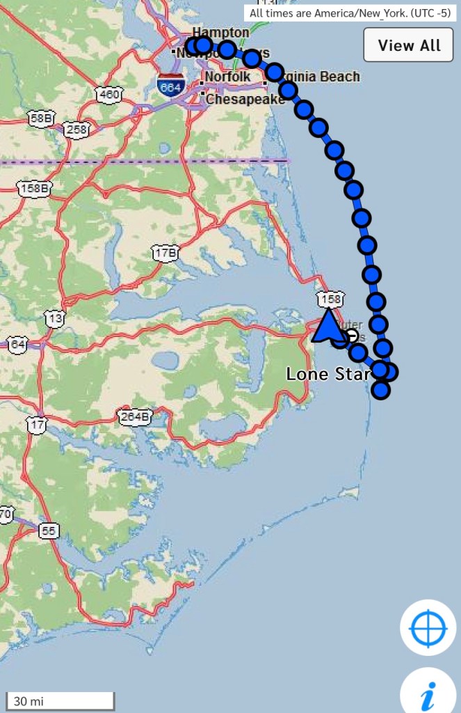
Go outside around Hatteras
We saw an opportunity to go offshore 240 miles to Beaufort, NC by leaving the following morning. We had a prediction of a whole day of pretty good winds, then light winds for 12-24 hours, then building winds from the south. We hoped to get around Cape Hatteras before the wind died, motor around the next corner, then use those south winds to sail into Beaufort.
Becalmed near Oregon Inlet
Five and a half hours out of Hampton, we had exited the Chesapeake. It’s 8:30 at night. Tom had just settled into the bunk for a rest. Anita was contemplating setting sails. The engine oil alarm blipped, then beeped. Anita immediately shut it down and started raising sails. Tom took a peak in the engine room and saw black engine oil in the bilge. The bottom of the oil pan was wet and slippery. He turned the automatic bilge switch off, so we don’t accidentally discharge this small amount of oil. Then Tom helped finish raising the sails and heading south. Tom wondered aloud if we should head back to Hampton, but the wind was dead against us for that scenario. We sailed 104 miles in the first 24 hours, but we’d lost the wind about 12 miles south of Oregon Inlet.
The afternoon of our second day at sea, Tom called the Coast Guard to advise them of our non-emergency predicament, becalmed near Oregon Inlet with a disabled engine. They commented that they could assist with arranging a tow if required. We were still hopeful the wind would fill in overnight to get us around the cape. It didn’t.
Sipping my morning coffee and watching Dolphin frolic in the fog off Oregon Inlet
Trouble
Due to the expected south east winds, we decided that it would be unsafe to continue to try to round Diamond Shoals at Cape Hatteras. For the first time in 43 years of ocean sailing, we called for a tow. We also want the help of a mechanic, not something we do very often as Tom is very handy mechanically.
Starting the tow, we centered the boom right after this picture was taken
Anita was hand steering to keep Lone Star centered behind the tow boat.
Oregon Inlet is a massive sand bar with 65’ bridge clearance, we need 55’
The breaking surf heading in the inlet was nearly a solid line. Our Sea Tow captain Stuart, at one time informed the coast guard via VHF that he may need them to take us through the surf and under the highway bridge where he would pick up the tow. However, Stuart persevered and we made it through. As we were driving just 100 feet off a beach, his comment over VHF, “My pits are dripping (sweat) to my waist,” made me laugh and broke my tension and the strong grip I had on the steering wheel.
Quick video clip right after the worst part
Stuart switched to a working VHF channel after the bridge. In the next 2 hours of this tow, he provided an awesome tour of our surroundings. The first tidbit of news is that the rusty metal bits of the old bridge that was being deconstructed and removed was dumped in the exact location he picked us up. Next was how the islands on either side of this narrow channel were created by dredge spoils. Some of these man made islands were 20 feet high covered with flora and fauna and a home for multiple species of wildlife. There were a few more stories, you get the picture.
Safely docked in Manteo on Roanoke Island, Sir Walter Raleigh ship replica and Lost Colony museum across the channel
Having never experienced a tow before, I was very impressed by the professionalism and helpfulness of both the Coast Guard to engage a tow and the Sea Tow Captain who arranged the Marina dock and provided recommendations for a mechanic. A few days later, we received another big dose of southern hospitality when our Tow Captain brought us a couple Carolina barbecue dinners from a local fund raiser on Sunday. Pulled pork, crispy fried chicken wings, cole slaw, baked beans and a dinner roll. Delicious!
Track of Lone Star on this passage, Beaufort, NC is at the southern tip of this map
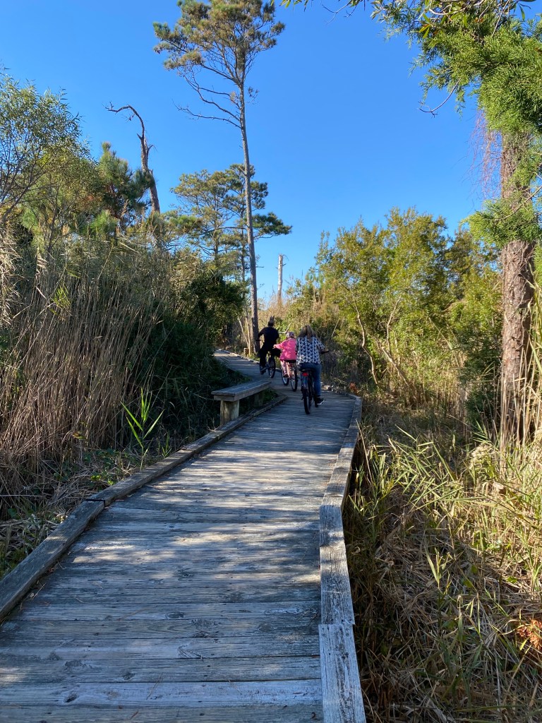
We arrived in Manteo on Thursday, Veterans Day. The earliest we could schedule a mechanic was the following Monday. That gave us time to hike, explore the town, do laundry, and catch up on computer logging and blogging 😁.
Fabulous miles of boardwalks around Manteo
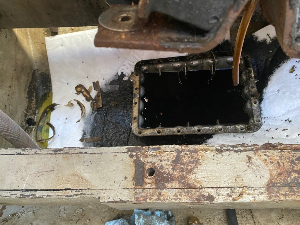
Tom had purchased a new oil pan, gasket and hardware this summer as he noticed some corrosion in the area. We engaged a mechanic and helper to lift the engine and replace the oil pan. There was no proof this was the source of the oil leak, just a strong suspicion. Raising the engine off its mounts then tipping it to one side allowed easier access to the oil pan. There were 21 fasteners and a few were rusty and hard to remove. It took the mechanics 3 hours to remove the old oil pan.
Surprise! The oil pan is still half full
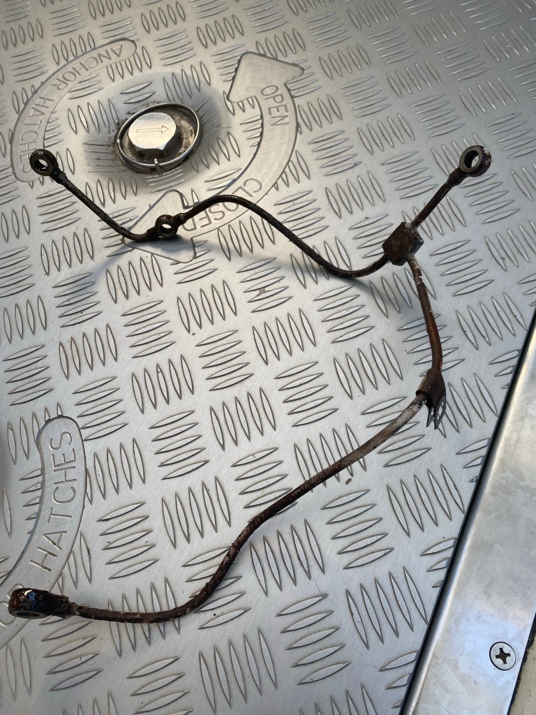
After lunch, they installed the new oil pan, remounted the engine and hooked everything back up, topped up engine oil and coolant, primed the filters, then started her up. Uh oh, she’s squirting clean engine oil from a high pressure metal tube that wraps around the back of the engine. We immediately ordered the new part and requested overnight shipping.
The leaky part!
Go inside
Two days later, the new part was installed. The engine runs with no leaks, although shifting into reverse is a little difficult. We elected to continue our journey south via the Intercoastal Waterway (ICW). Winds were too strong and from the wrong direction to go south and west through Pamlico sound, so we went north, west, then south. We left Manteo early Thursday morning, a week after we arrived.
Manteo Town dock, playground, and shopping
We had a pretty tough first day of ICW traveling. There is a super shallow channel leaving Manteo, Anita remembered going aground briefly here 3 years ago. There were more crab pots on this northwest stretch than Casco Bay Maine. The crab pots plagued us all the way to the Alligator river entrance. Many were small, dark in color and hard to spot. Thankfully, we didn’t hit any. Just lots of hand steering to avoid them all. We were definitely making a snake wake, not something I’m proud of. Next we had to motor-sail all the way south directly into the wind in the Alligator river. However, on the positive side; we are 41 miles closer to Beaufort, NC. We made it to our chosen destination for the night. The anchor was down just after sunset. We saw a mini 🌈 as we entered the harbor.
Enjoying the autumn colors in the Alligator-Pungo river canal
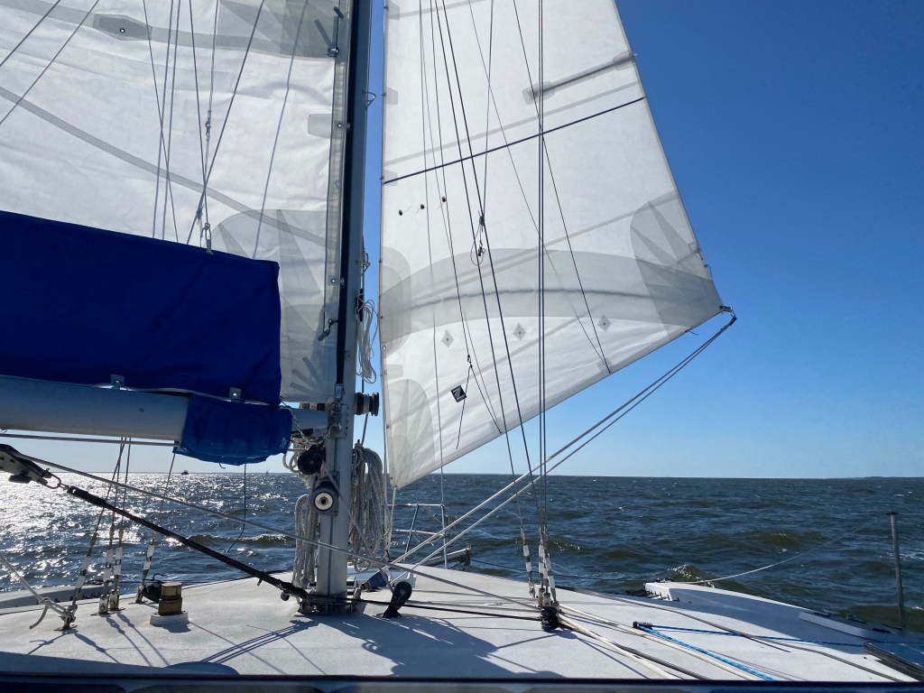
The next day was very close to ideal conditions. We raised the jib right after the anchor. In the less sheltered area of the canal it gave us an added 1-2 knots of boat speed; 5-7 knots is acceptable.
It was actually a very windy day, not in the canal.
Double Trouble
Beautiful sailing conditions continued past Bellehaven, crossing the Pamlico river, and south down Goose Creek, 49 more miles done. As we turned upwind to drop the mainsail in our chosen Gale Creek anchorage, the engine was revving, but we had no forward momentum? “Tom, drop the anchor now, no propellor or forward thrust from engine!” He lowered the anchor, then finished the mainsail. Turns out the transmission cable broke. It was bent by the mechanic stepping on it. Bending it back only works for a little while. Tom was up until 1AM replacing that cable. Yes, we had a spare on board.
Sailing in Pamlico Sound to Oriental, NC
The next day we enjoyed another beautiful 19 mile sail to Oriental. We assembled our Pota-bote dinghy and went ashore to walk around and shop in the Provision Company. Then stopped for refreshments at the coffee shop.
Anchored in Oriental
Our final 21 miles to Beaufort was under motor. Light to no winds and mostly through narrow bodies of water. We chose a more direct route this time through Town creek to Taylor creek rather than around Radio Island. Nice shortcut, much less traffic too. We had scheduled appointments for a drive through COVID test, required for USVI entrance. So soon we were on shore calling Old Town Taxi and on our way to Walgreens and Lidl for our final stock up.
Anchored in Beaufort, NC, final stock up done
We Should Go
The temperature was 39 this morning, November 23rd and predicted 33 on the 24th. We should go south. The weather apps we use and our weather router agree there is a good weather window to head for the USVI starting tomorrow morning. We should be warmer as soon as we cross the Gulf Stream. We and Lone Star are ready for a passage to escape winter and enjoy the Caribbean this season. Please no more trouble. As you can see like the ocean, we roll with whatever comes our way.
Tom really wanted to sail offshore around Cape Hatteras to avoid the long hours at the helm through the Virginia Cut. The weather forecast only had south winds or no wind in the forecast. so a motoring we will go toward Beaufort. NC
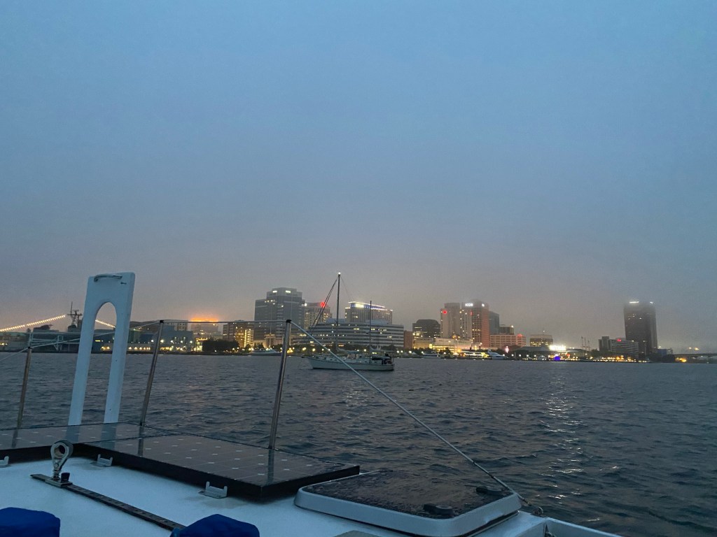
Early morning look at Portsmouth, VA
We have seen very few cruising boats thus far. We have heard many cruisers are moving onto land until COVID is under control. The boat is a better option for us. We do a lot of research before venturing ashore and avoid hot spots completely.
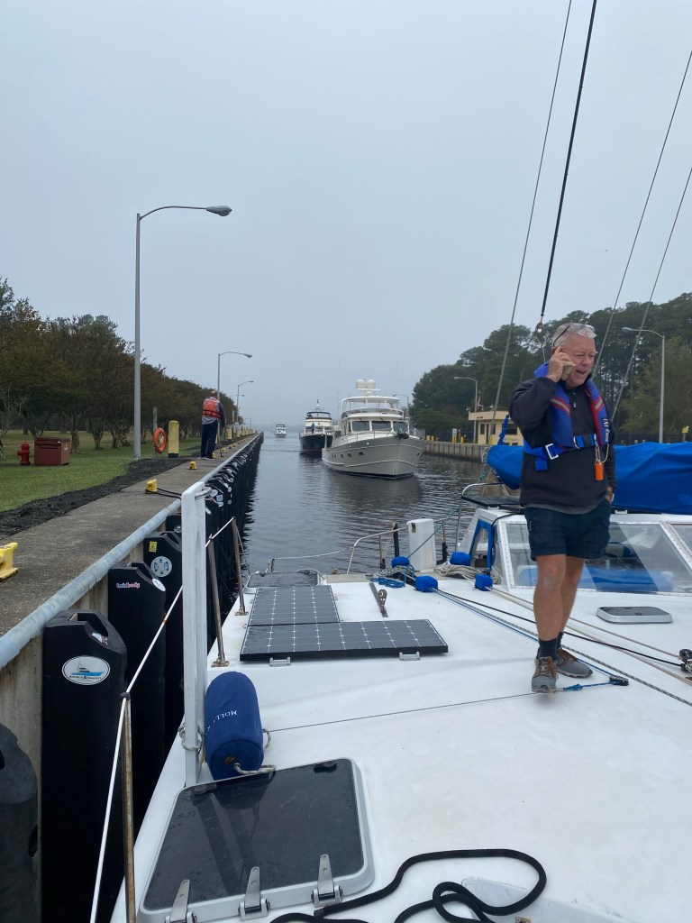
First boat in the lock, Tom at work as a yacht broker
We left Hospital Point in Norfolk, VA rather early and it paid off as we were first in the lock. The water was lowered less than 2 feet. Cloudy day with lots of birds around.
Motoring through the Virginia Cut
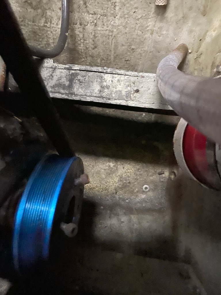
We motored 3.5 miles past Coinjock and anchored to the side of the channel just before sunset. Tom checked the engine before we started out the next morning and found a most unpleasant surprise.
Loose bolts are broken; of four only one remains
The Serpentine belt drive shaft cover plate was attached by only one bolt out of four. He spent a couple of hours taking things apart and analyzing how to fix it. A few phone calls later the necessary parts were ordered, to be delivered next day to Coinjock Marina. The folks at the marina also gave us a phone number for a diesel mechanic and Tom arranged for him to meet us the next day to remove the old drive shaft pulley and install a new one. Amazingly, Tom was able to put the pulley back together with only one bolt(!) so we could motor slowly under our own power back to Coinjock. We stayed on the west side docks away from the restaurant and marina. So glad we hired the mechanic! He worked really hard to remove the nut holding the drive shaft pulley. He finally used a four foot long wrench! Not a tool we have on board. One boat unit ($1,000) later all was repaired and we were ready to move on.
Dockside in Coinjock
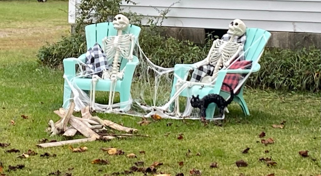
We enjoyed some walks around the local neighborhood and never saw anyone outside. Unless you count the Halloween decorations.
Happy Halloween!
We left Coinjock Marina in the late morning so we didn’t travel far; perhaps 20 miles. A cold front was approaching that evening. The next day we used those North winds to sail downwind across the shallow Albermarle Sound. It was a fun day despite gale warnings. We were very lucky to make it through the Alligator River bridge during a lull in the wind. The bridge can’t open under some wind conditions. After traveling 50 miles, we anchored for the night at the beginning of the Alligator Pungo River Canal. The next day we traveled another 50 miles and stopped for the night just north of Bay River in Bayboro, NC.
Sunset at a private anchorage in Bayboro, NC
We chose to skip one of our favorite ports, Oriental, NC due to an impending cold front with strong NW winds. We hid in Adam’s Creek for a couple of nights. Then we made the final inland journey to the Taylor Creek anchorage in Beaufort, NC.
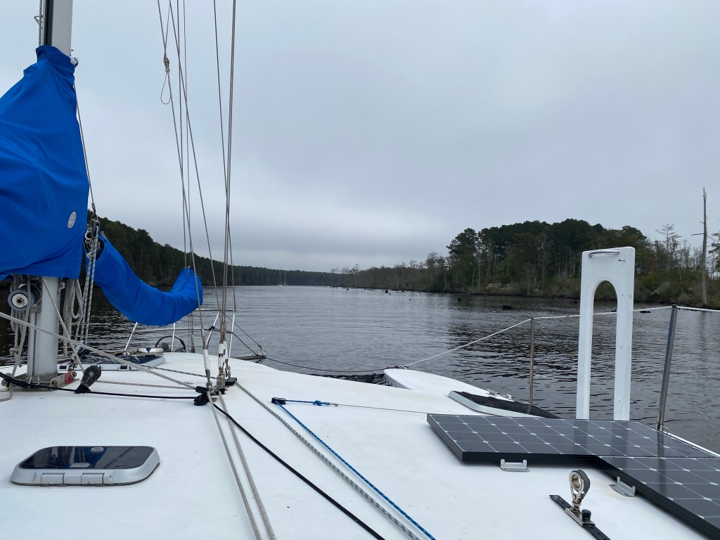
Our route through the ICW, with anchorages noted
We like to celebrate the end of a journey with something special, like a meal out or something hidden away in our own lockers for a special occasion. There are so many nice restaurants in Beaufort and they were allowing very limited dining in. We chose to go to a Mexican restaurant, Mezcalito for burritos. We took half home for lunch the next day. Very tasty, and good strong fresh iced tea!
Yummy burritos at Mezcalito in Beaufort, NC
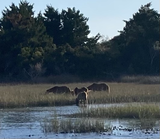
We finally spotted some of the wild horses on nearby Shackleford Island!
Wild horses on Shackleford Island
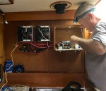
As there was no weather window in sight for at least 10 days; Tom decided to do the wiring and relocation of the solar controllers to the galley bulkhead. It took about four days, but he finished! We now have 1000 watts of solar panels to charge our lithium battery bank.
Tom working on the solar panel wiringA kilowatt of solar finished
We finished all those numerous last minute details that need done before leaving the country via sailboat along with some new ones due to the Pandemic. Things like: laundry, food shopping, pay bills or setup bill pay, fill fuel tanks and jerry cans, setup cell service for overseas etc. All while being extremely cautious: wear masks, wash hands, stay away from people.
The Bahamas has protocols for the Pandemic. We ordered PCR COVID test kits from Everlywell.com and had them shipped to us at Beaufort Docks. They took 4 days to reach us. We used them the day we left, then sent them off via UPS Drop Box. A link to our results will be emailed to us. We completed our Bahamas Health Visa profiles; we’ll add the International Trip when we have our test results. They only give us five days from time of test to arrival in the Bahamas so we must go! Time to go sailing in the big blue Atlantic Ocean.
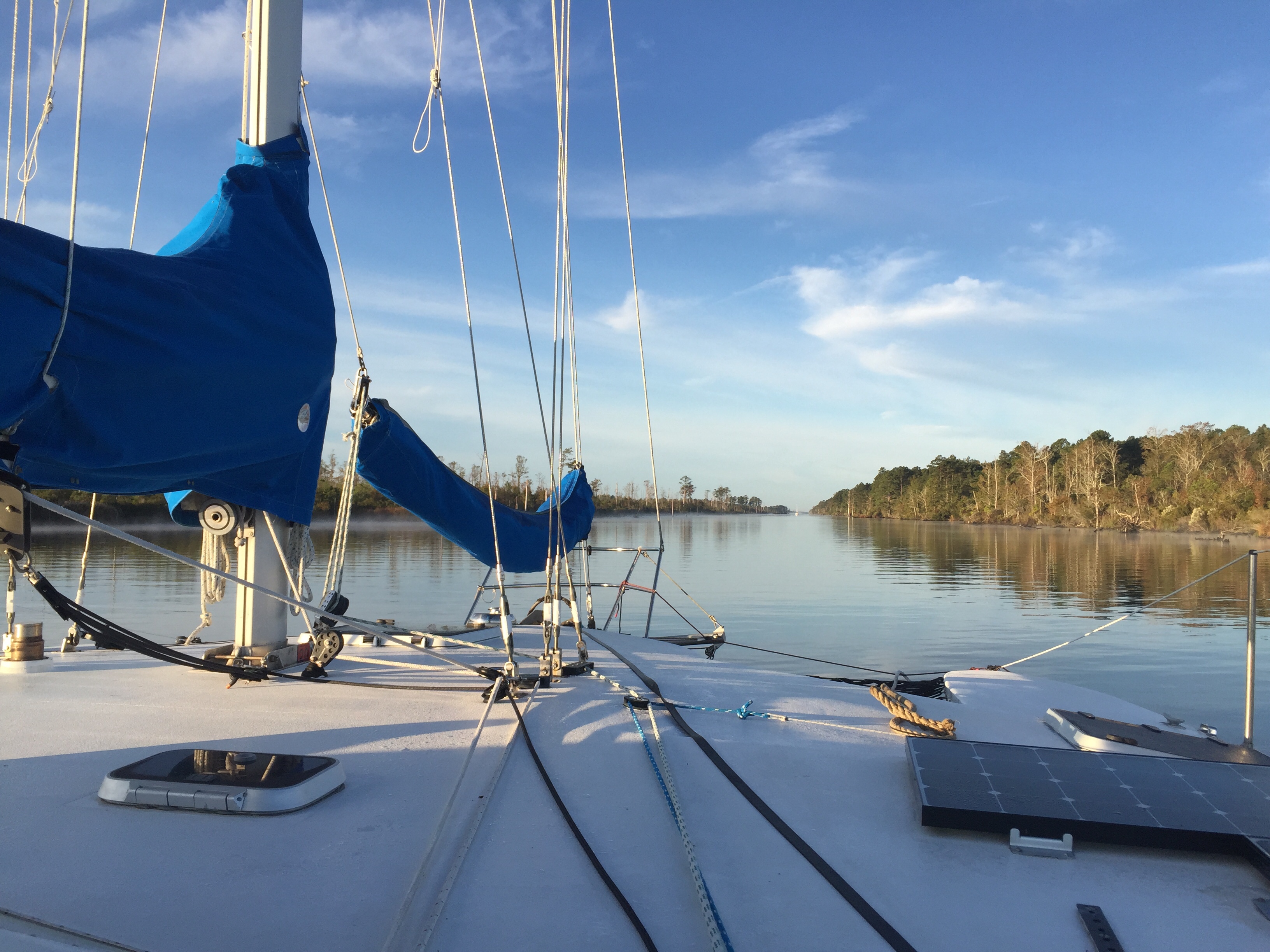
October 16th dawned cloudy with the promise of rain. A cold front was predicted with strong winds behind it. We elected to motor through the rain for two hours to find a more protected anchorage than Hospital Point in Portsmouth, VA. We were the only boat to anchor in a small cove at statute mile marker 10 in Chesapeake, VA. The highest wind we saw in this protected anchorage was less than 20.Picture courtesy of Tammy Merritt from her house
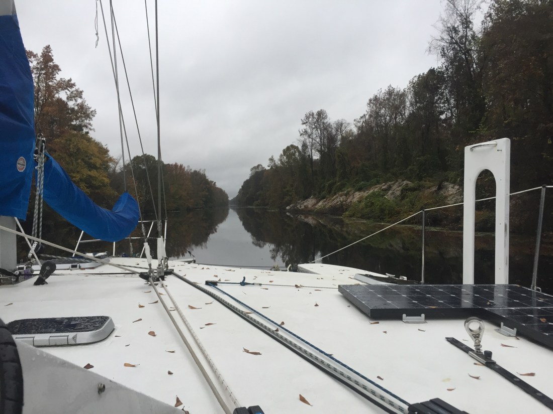
There are two routes south at the beginning of the Intracoastal Waterway or ICW. You may recall last year we chose the Dismal Swamp and suffered propellor damage when a thirty foot tree was kicked up by the wake (waves created by a boats forward motion) of the boat in front of us. The depth of this man-made canal has shrunk over the years from ten feet to perhaps six foot deep as there are years of debris from the overhanging trees.Dismal Swamp 2018
The width seems narrow in spots, especially for sailboats with masts; due to the overhanging trees. We’ve read that there is a large amount of duck weed floating in the swamp this year. Engine raw water filters have to be cleaned often.
This year we chose to transit the ever so slightly shorter route, sometimes referred to as the Virginia Cut. We found depths from 10-16 feet most often and the shorter canals merged with rivers and were often quite wide. There were a lot more birds this year as well. Larger flocks and more of a variety of species. Great Bridge Lock is only a 2 foot rise, quick and painless.Great Bridge LockLooking back to the lock entrance, this crane was dredging near the entrance. Don’t you think the below picture of the winding North Landing River looks wider than the Dismal Swamp?North Landing River
We anchored in Shiloh, NC after nearly 9 hours and 50 miles. It was a long day at the helm, too narrow and many twists and turns to use autopilot. We had the engine on all day. Though the jib gave us a boost with the wind behind us for about 10 miles in Currituck Sound. I was surprised that there were so few boats migrating south at this time of year. However, our night time anchorage had about a dozen boats.
The next day we sailed downwind across Albemarle Sound and down the Alligator River. This Alligator river swing bridge was closed for a couple weeks this fall. So glad it was repaired by the time we arrived. It’s a long way around this stretch of water! We anchored for the night just before the Alligator/Pungo canal and enjoyed this beautiful sunset.Alligator/Pungo CanalMorning fog in the beginning of the canal.
We chose Pungo Creek rather than Belhaven Marina for our next stop-over as the remnants of a tropical storm was predicted to race by. We found good holding near the Marina and enjoyed a walk on shore before the blow. Locals were extremely friendly and the neighborhood was filled with very friendly dogs.A TriStar 46 docked in Pungo Creek. Similar design to our Lone Star which is a TriStar 39.
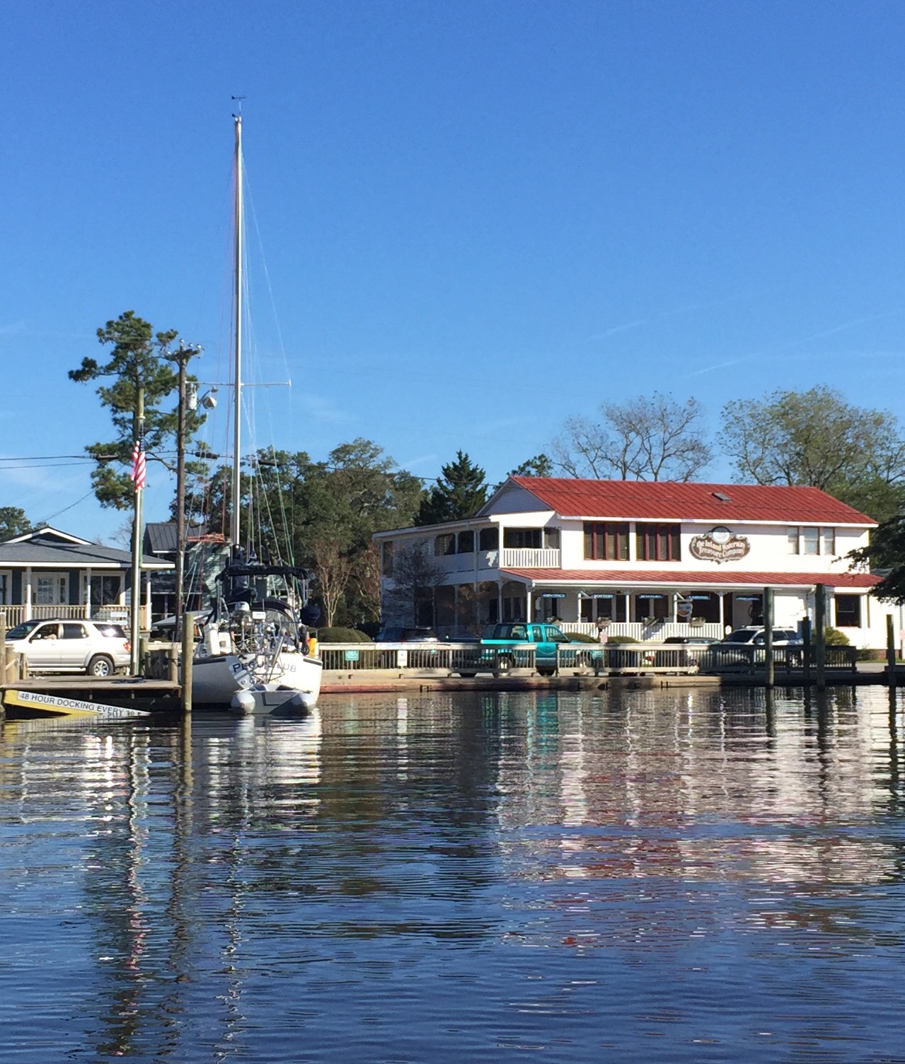
On Monday, October 21 we sailed south to one of our favorite spots: Oriental, NC. This historic town is so welcoming and we love the unusual and practical supplies at the local consignment store. Last year we sold a Porta-Bote that was too long for our davits. This year we dropped off a gasoline outboard and a series drogue. They were replaced recently by a Torqueedo electric outboard and Shark drogue (sea anchor.)Bringing the Series drogue to the consignment store in Oriental, NC. We also enjoyed a delicious lunch at the restaurant behind Tom.
We motored the remaining 24 miles to Beaufort, NC two days later. We completed our southern trek down the ICW in only a week. So excited to have reached our final destination before heading offshore to sail south to the Bahamas!
Footnote to add to my last blog: We really enjoyed our three day stay in Oriental, NC. The Inland Waterway Provision Company was a favorite stop of ours every time we went ashore. They have an awesome selection of healthy provisions; I could and probably should have spent a small fortune there. They also have a section dedicated to consignment sales of nautical equipment. We were so happy when they offered to sell our 12’ Porta-Bote for us!
Picture: Bringing the old dinghy ashore for consignment sale. Picture courtesy of Kimberly on Pegu Club.
On Tuesday, November 20th we motor-sailed down the ICW to our next destination. We anchored off Moorehead City hoping for one more night of visiting with Pegu Club, but they ended up exiting the waterway onto a shallow bank and were too far away for a dinghy ride. We look forward to catching up with them again in the Bahamas. The next morning, we left at the same time they did, crossing each other as they kept going south and we motored 5 miles east to Beaufort, NC. As tears formed due to this farewell, blurring my vision, dolphins jumped out of the water ahead of us. That brought an instant smile and a soothing feeling that we will cross paths again!
We stayed at Beaufort Docks Marina for 4 days to provision the boat for the next six months. Thank you to cruising friend Marcia on Cutting Class for tips on what to stock up on before heading to the Bahamas! The Marina offers loaner cars for their guests which makes it much easier to shop around town. Their cars are old, but they run. We went to a super Walmart, a hardware store, Piggly Wiggly, and Food Lion, and we had a spare propane tank filled. We spent nearly $1,000 on provisions and filled a lot of nooks and crannies on the boat. Just before leaving the dock we also filled up the diesel and water tanks. Tom had one last task to prepare the boat: change the oil in the engine. He discovered we should buy more engine oil. On Monday, we set out walking together. Anita stopped at a salon to get her hair cut and Tom continued on to the Auto Parts store for 2 gallons of oil. We met up again for the remainder of the walk back to the boat.
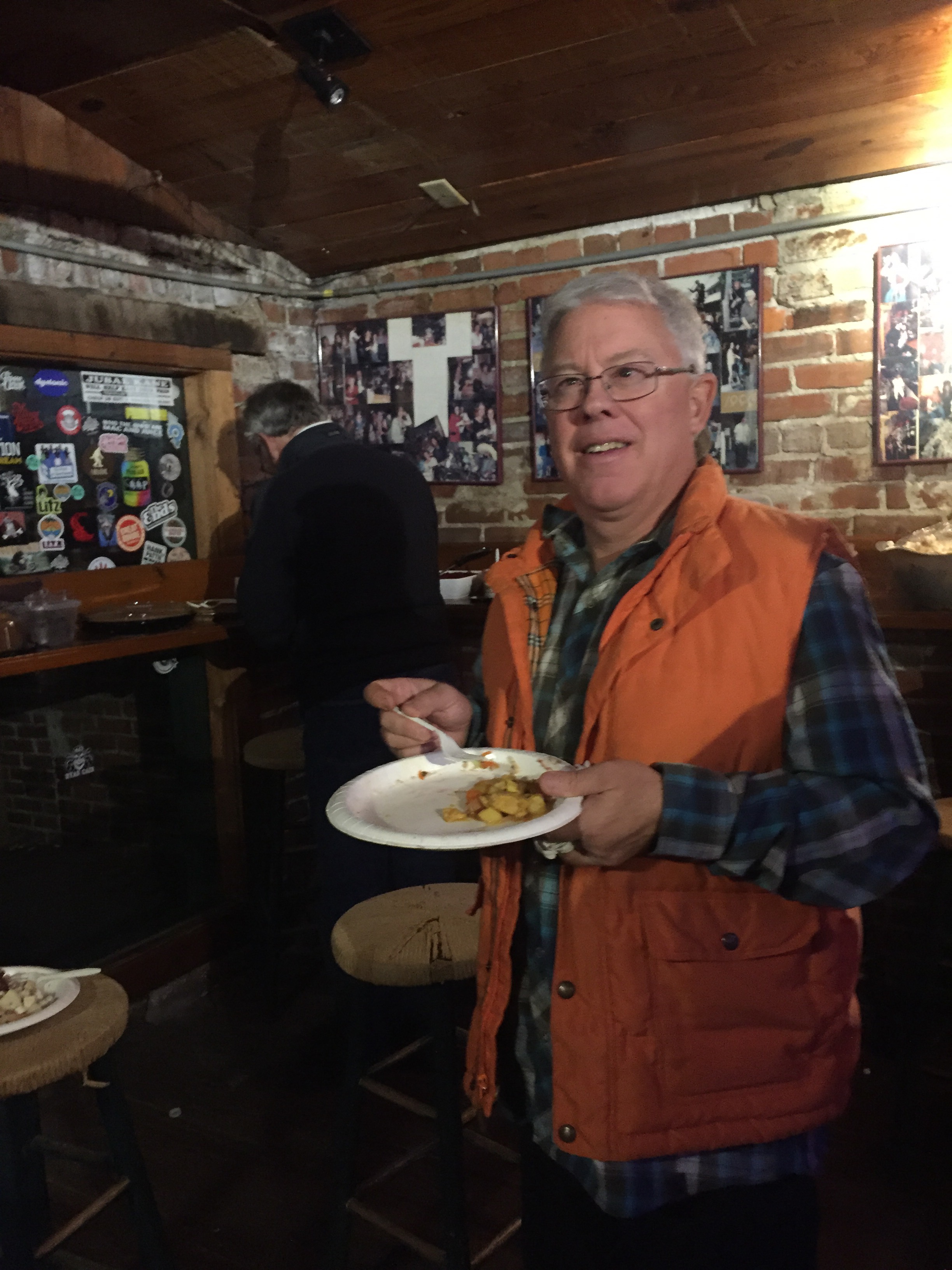
Every Thanksgiving evening the Backstreet Pub hosts a gathering and feast for cruisers and locals. They provided two turkeys: one smoked, one baked, a baked ham, mashed potatoes, and stuffing. Locals and cruisers provide the rest. I brought a cabbage salad and some chocolate fudge.
It was a very yummy and abundant feast and fun to meet both locals and cruisers.
The weather has been a real challenge during this part of our cruise. When we arrived here my first task was doing laundry at the local laundry mat as my winter wear was dirty. I brought about a weeks’ worth of winter clothes and had already stretched that a bit. I did laundry again just before we left as the same occurred. We’ve experienced lows in the 30’s and highs in the 50’s with lower wind chills. We had two gales while in Beaufort; one at the dock and one at anchor. Luckily, we have a good diesel heater to keep the cabin warm. It’s been used so much we actually needed to clean it again. We have been listening to Chris Parker from Marine Weather Center on SSB and subscribed to his weather routing service for our upcoming passage to the Bahamas. This will allow us to speak directly with Chris and his team twice a day to update our location and get advice on course corrections.
One detail we were not able to complete before leaving CT was to sell my 2015 VW Passat. We had advertised twice on EBay Motors with no interest. We called the dealer we bought the car from and they were interested in seeing it. A big thank you to our son, Alex for bringing it to them and finalizing the sale! That’s a big relief to not have it sitting around in a cold New England winter unused. We’ll rent a vehicle when we fly or sail home for visits.
The last bit of preparation before leaving the country was to secure international medical coverage and medical evacuation insurance. Better to be safe than sorry. We are both healthy and do what we can to stay that way.
Our departure was delayed a few days due to Tom getting sick. He had head cold symptoms, but the illness only lasted 3-4 days. It was probably a mild flu as energy loss was also a symptom. The night before we left Anita started showing the same symptoms. The weather window we had included a downwind stretch for the first day or two followed by southerly (SE-S-SW) winds for the next few days. We elected to go when the winds were favorable to cross the gulf stream and leave on November 29th. We informed family of our plans and provided links to the Ham Radio Waterway Net that posts our reported position each day and a link to Chris Parker who also records our position twice a day. We are ready to head south by the faster route, out into the Atlantic, and south to the Bahamas. We really want to escape winter!!
Picture: Fishing vessels in Oriental, where stories of Blackbeard abound
Disclaimer for our non-sailing readers: sorry for the technical jargon in this one. Some of our sailing friends will appreciate the details of the challenges we’ve experienced and how we overcome them.
The fifty-mile excursion from Wanchese, NC (on Roanoke Island) to Ocracoke, NC was uncomfortable yet necessary. The latter because there are few choices of protected anchorages in the broad and shallow Pamlico Sound. We left at first light with a little help from the dock master. The west wind had us pinned to the dock. Our normal backing down with an aft tie spring wasn’t working. Tom asked the dock master to move our one remaining dock line on the starboard stern cleat to the last cleat on the dock and we were able to back into the open space beside the dock and finally head out on our own.
After motoring about 10 miles down the eastern channel of Roanoke, we were able to set full sail and head southwest. We have a small camber spar jib that is self-tacking; so, there is little need for us to be out in the weather tending it. We chose to leave with a windy forecast (West 15-20MPH diminishing to 10MPH as the day progresses) as we didn’t think we could make the 50-mile passage under motor alone in daylight hours. Well, forecasts are not always right, it stayed windy! Furthermore, as it had been windy for some time the waves although not big (1-3 feet) were confused. This made for a very bouncy, corkscrew kind of ride. Like riding a bronco, I imagine. Picture things falling in the cabin and a lot of rocking and rolling in all directions. The windshield was soon covered in salt and difficult to see through. Solution: steer by instruments: chart plotter, compass, speed and depth readings. The sea finally calmed for the last hour as we meandered through the approach channels to Ocracoke. The trip took nine hours and we certainly didn’t eat very well: gingerbread muffins, peanut butter bread and snacks. Too rough to make a sandwich or heat soup!
Ocracoke has a small secure harbor with an active ferry at the curvy entrance. Yes, we met the ferry right at the entrance and waited outside the channel in 5 feet of water for them to pass. Then we motored to the far end of the harbor and anchored near a couple other sail boats. It took a few hours for our brains to realize the boat was no longer rocking. Is that muscle memory? It is a strange and somewhat unsettling sensation.
We checked the distance (36 miles) and forecast (favorable winds and sunny) to our next destination: Oriental, NC; and decided to forego exploring the local wild horses and vicinity in favor of returning to the ICW and our trek south. Temperatures have moderated recently and we are seeing highs in the mid 60’s and lows in the low 50’s. Yet, New England is experiencing snow and freezing temperatures already.
Saturday, November 17th we motor sailed in light winds across the remainder of Pamlico Sound and into the Neuse River. Meal preparation and cleanup not a problem. Much better day!
Oriental is a very small harbor with limited anchoring. So glad we found a spot to anchor inside the breakwater! The two free slips at the public dock were occupied. The marina docks are mostly empty at this time of year, but we had just spent four days at a dock in Wanchese.
The next morning Pegu Club motored into the harbor and began setting their anchor right next to us when I noticed a spot had opened on the public dock. They quickly hoisted the anchor and moved to the free dock. We always enjoy spending time with Jeff and Kimberly on Pegu Club. They also started their cruise from Shennecossett Yacht Club. We chatted animatedly as we walked together to the local Marine consignment and Piggly Wiggly grocery store. Later they came over for dinner, games and popcorn. This is the cruising lifestyle we truly enjoy! The below picture was taken by us as we returned to Lone Star at sunset.
We left Hampton, VA on November 4th in very light winds. Motoring across Hampton Roads on a Sunday was incredibly quiet. Just a few other pleasure boats about, one large container ship, and a couple small tug & barge combinations.
It was such an easy passage that we decided to carry on past Hospital Point; the beginning of the Intracoastal Waterway, referred to as ICW. We were surprised we made such good time and were soon directed into the Dismal Swamp Deep Creek lock just before 2:30.
There were 4 other boats in the lock with us. The lock master was real nice and provided lots of information about the canal and options of places to stay.
We stopped for the night directly after the Deep Creek bridge around 4PM. It now gets dark around 5PM, since the time change today!
This bulkhead tie-up was our first non-anchoring or sailing night since leaving home. We do not often dock as our vessel is a trimaran and too wide (22′ 6″) for most slips. We vastly prefer the freedom and peace of mind of being at anchor versus tied to a dock. However, the canal was quite still and narrow. There is certainly no room to swing at anchor. Street noise was loud, but not bothersome and subsided before bedtime. Tom made a quick run to a local Food Lion for fresh food as this was a very good supply stop and a short walk away.
The next morning, we started at 7:00AM to continue motoring through the Dismal Swamp. We wanted to catch the Mill Creek Lock for the 11:00 AM opening. This part of the man-made canal is straight and often runs right beside a highway. When the road curves away it is so quiet and the only sound is nature. The overhanging trees although contributing to this beauty are also a hazard to navigation when they fall in the canal or when a mast rubs against a low hanging branch and it rains pinecones, leaves and nuts all over the deck. We heard a few bumps from sunken debris as well, truly not a good feeling. The weather was warm and overcast with occasional drizzle or a brief downpour. We were very thankful for our enclosed cockpit. We caught up with two other sail boats around 10:30AM; it was perplexing as they often slowed or stopped. Finally discovered via VHF that they were not sure of the height of the fixed bridge ahead. Six boats arrived at the lock almost a half-hour late. Luckily, the lock master still let us through the lock and the bridge. The lead boat was a catamaran, they were directly ahead of us in the lock when eight feet of water was rushing out of the lock. They managed to get a mooring line jammed under a cleat and had to cut it. Scary to see the boat scrape along the lock wall and suddenly drop three feet. Lessons learned: handle your lines continuously and have a knife handy.
Very shortly after the lock, we heard another thunk under the boat. Anita quickly put the engine in neutral and saw a large submerged log under and moving with Lone Star. We hooked it. After a half minute of drifting Tom suggested trying the engine. It made a loud noise and stalled. We then drifted to the side of the canal and the trees rained down on us. We shouted to the boats following us to pass us as we were disabled. The last boat, Jade East was very kind and threw us a floating line to tow our bow to the center of the canal while we dealt with the 30′ tree. Tom managed to tow it to the side of the canal with our dinghy once it was free. Thankfully the engine did start after that and we were able to get on our way once again. We noted that our speed was slower at the same RPM and the steering was off center, but still responsive. There were no leaks inside the boat and no vibration of the propeller so we continued on with Jade East following. We decided to anchor before the Elizabeth City opening bridge due to the South winds predicted; more protected on the North side of the peninsula. Glad those two motoring days of hand steering in close quarters are over!
A look in the water with the GoPro the next morning revealed blackness; the fresh river water is the color of iced tea due to the tannin from the trees and roots. Tom would need to dive over the side to check if we have any damage from the submerged log. He used his wetsuit and dive tank so it took a while to setup. In the meantime, Anita continued to sweep the debris off the deck. You guessed it! Tom couldn’t see under the brown water either. He felt around and removed small twigs and debris from the rudder and discovered the tips of all three propeller blades were missing. Tom did not feel any dings or dents in the hull or rudder and we are not taking on water anywhere, yeah! The rudder is now back to normal.
We moved through the Elizabeth City opening bridge and anchored off Pelican Marina. We looked at the sea walls that offer free dockage and didn’t like the current wind conditions that would push the boat against the dock.
Pelican has a dinghy dock and let us do laundry and take showers. We also walked to town and had a very delicious lunch at Hoppin’ Johnz; smoked meats with southern barbecue flavors.
We have ordered a new propeller and some spare parts and they will be delivered to a Marina on Roanoke Island about 50 miles south of here. We are scheduled for a short haul next Wednesday morning. We continue to work on our project list. Tom finished the installation of the ham radio and has listened to the waterway and weather nets, but has not transmitted yet. He also installed the EPIRB bracket, the radar reflector, and tidied up some loose wires.
We plan to sail about 40 miles south to Manteo on Roanoke Island tomorrow. Yes, sail! Across Albemarle Sound, a nice stretch of open water.


 Picture courtesy of Tammy Merritt from her house
  Dismal Swamp 2018
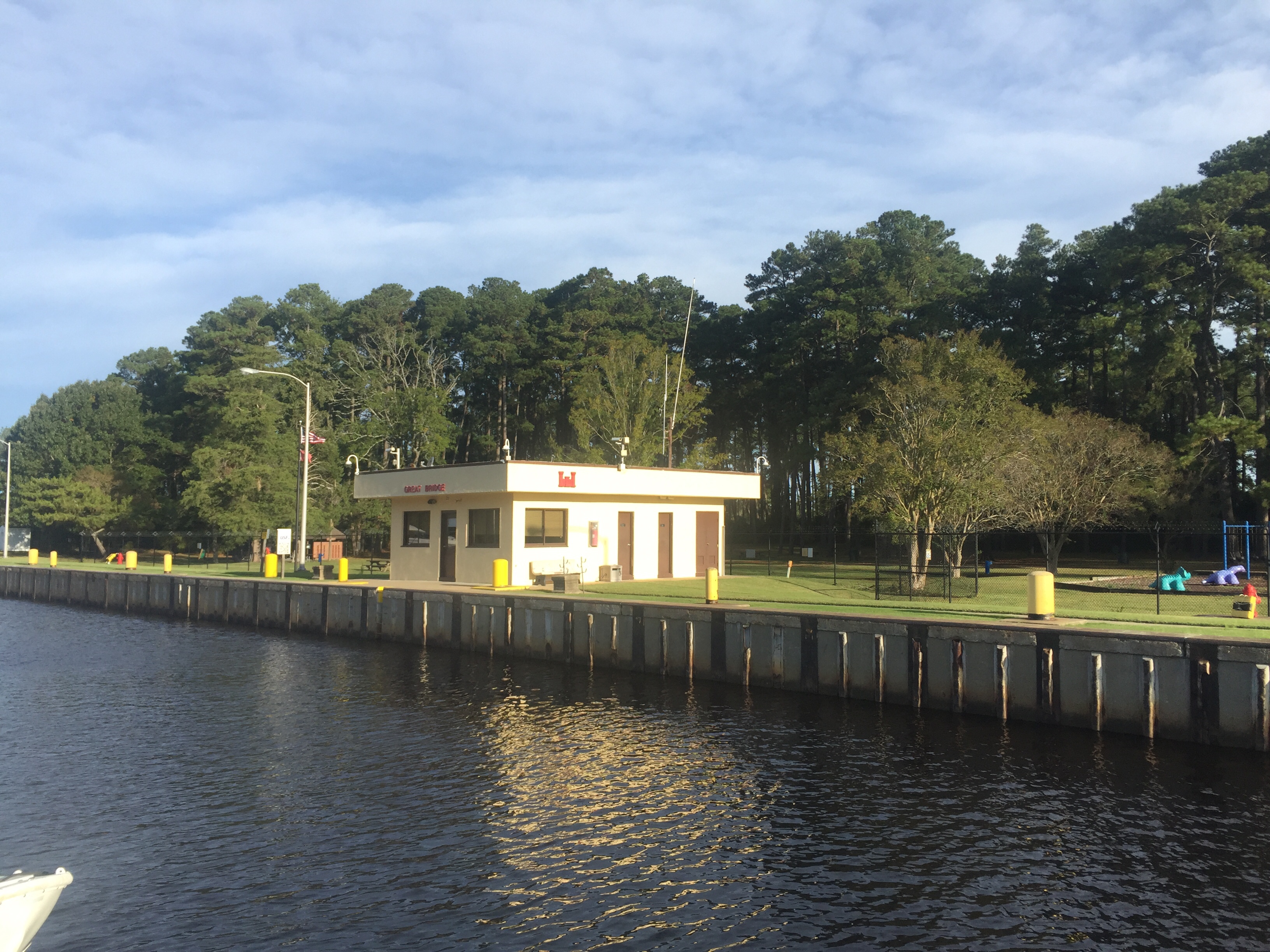 Great Bridge Lock
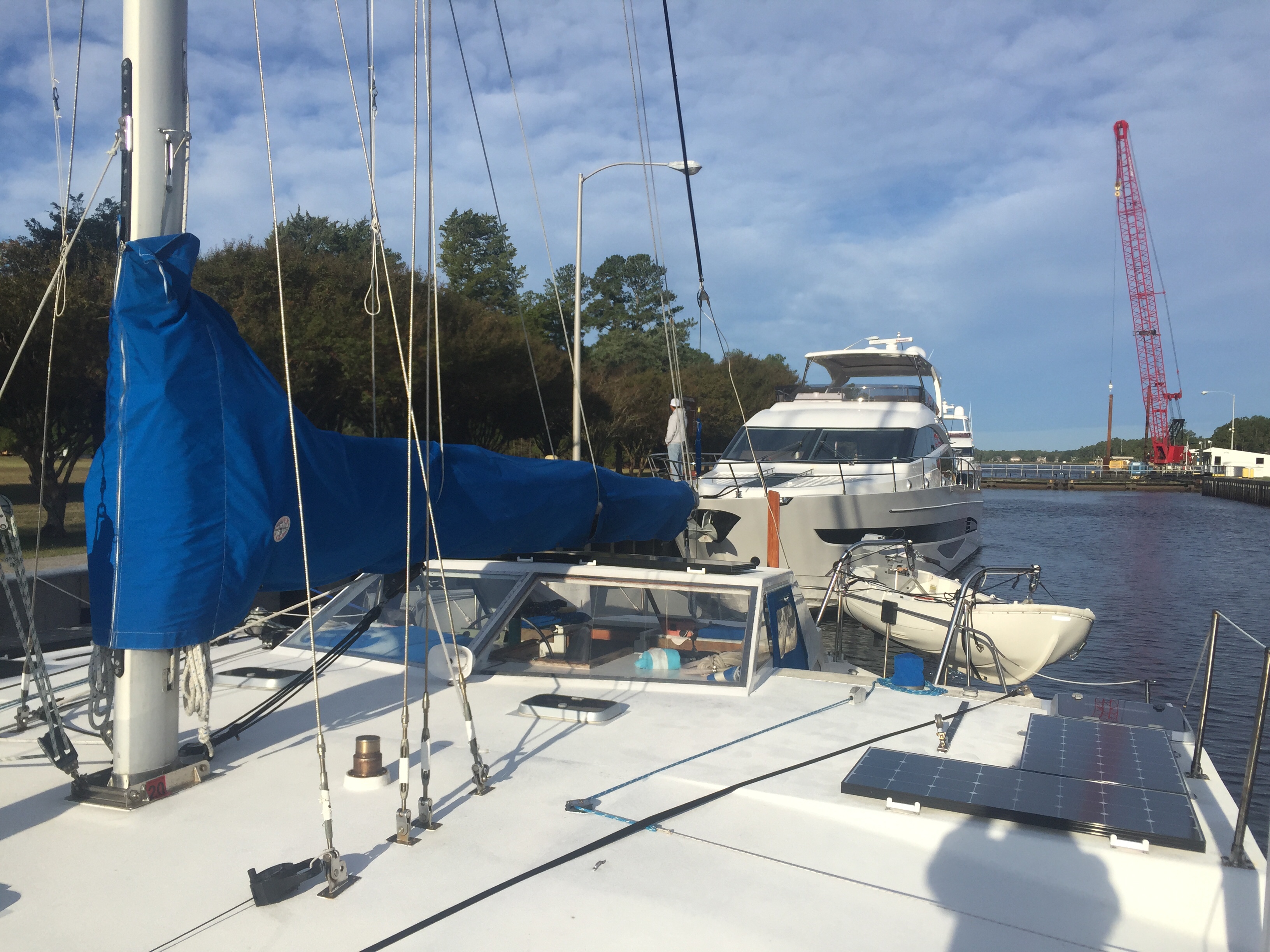 Looking back to the lock entrance, this crane was dredging near the entrance. Don’t you think the below picture of the winding North Landing River looks wider than the Dismal Swamp?
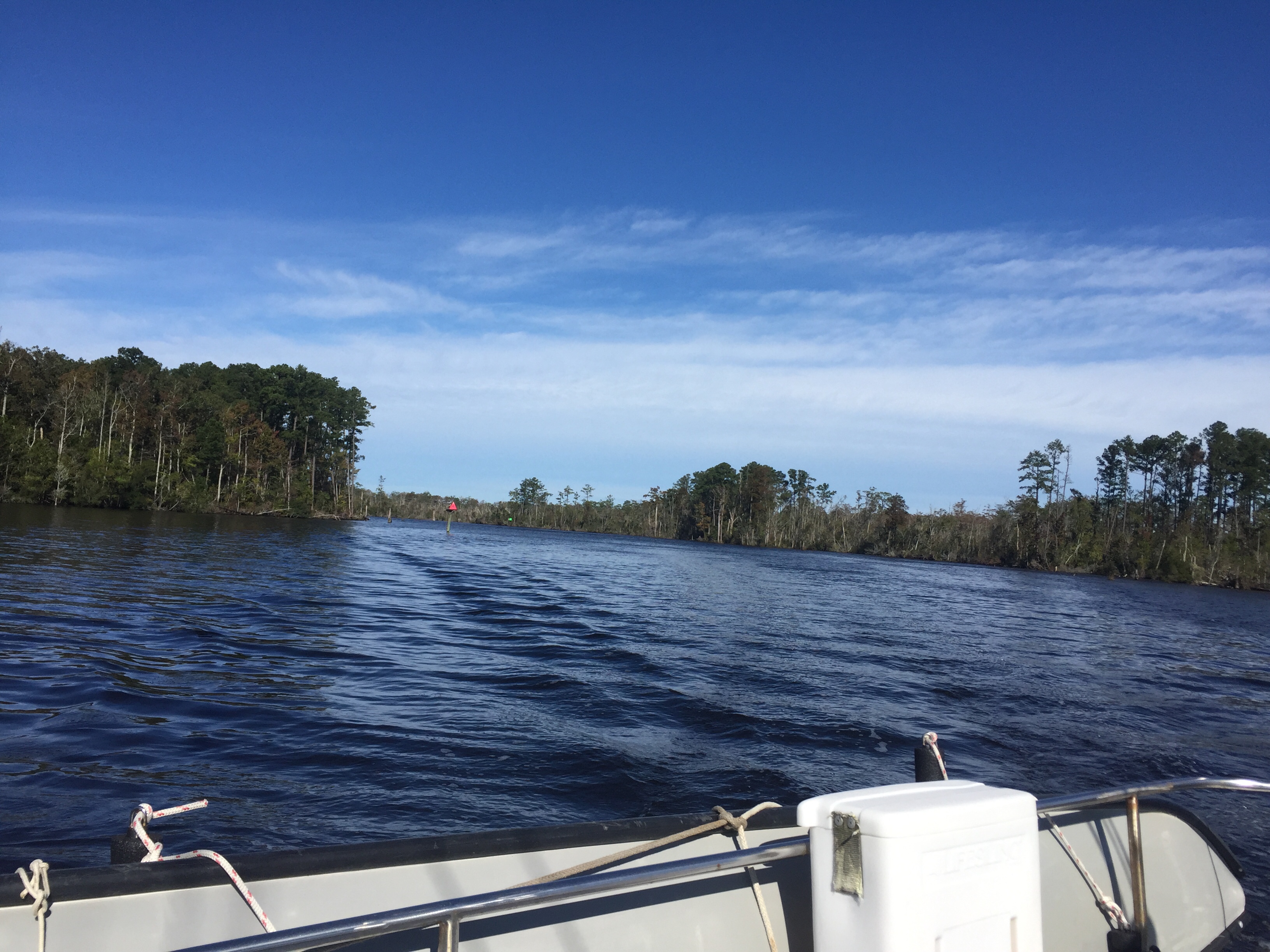 North Landing River
 This Alligator river swing bridge was closed for a couple weeks this fall. So glad it was repaired by the time we arrived. It’s a long way around this stretch of water! We anchored for the night just before the Alligator/Pungo canal and enjoyed this beautiful sunset.
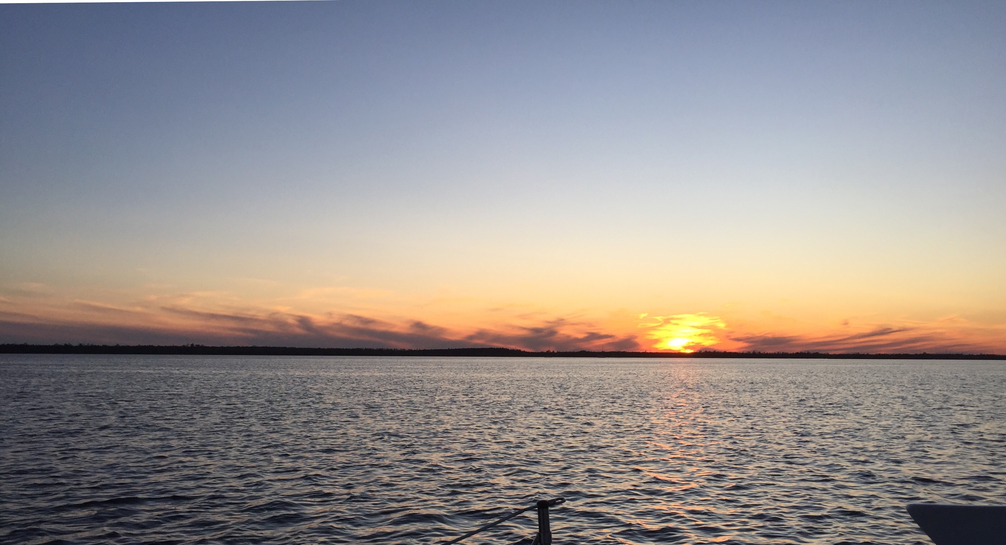
 Alligator/Pungo Canal
 Morning fog in the beginning of the canal.
 A TriStar 46 docked in Pungo Creek. Similar design to our Lone Star which is a TriStar 39.
 Bringing the Series drogue to the consignment store in Oriental, NC. We also enjoyed a delicious lunch at the restaurant behind Tom.
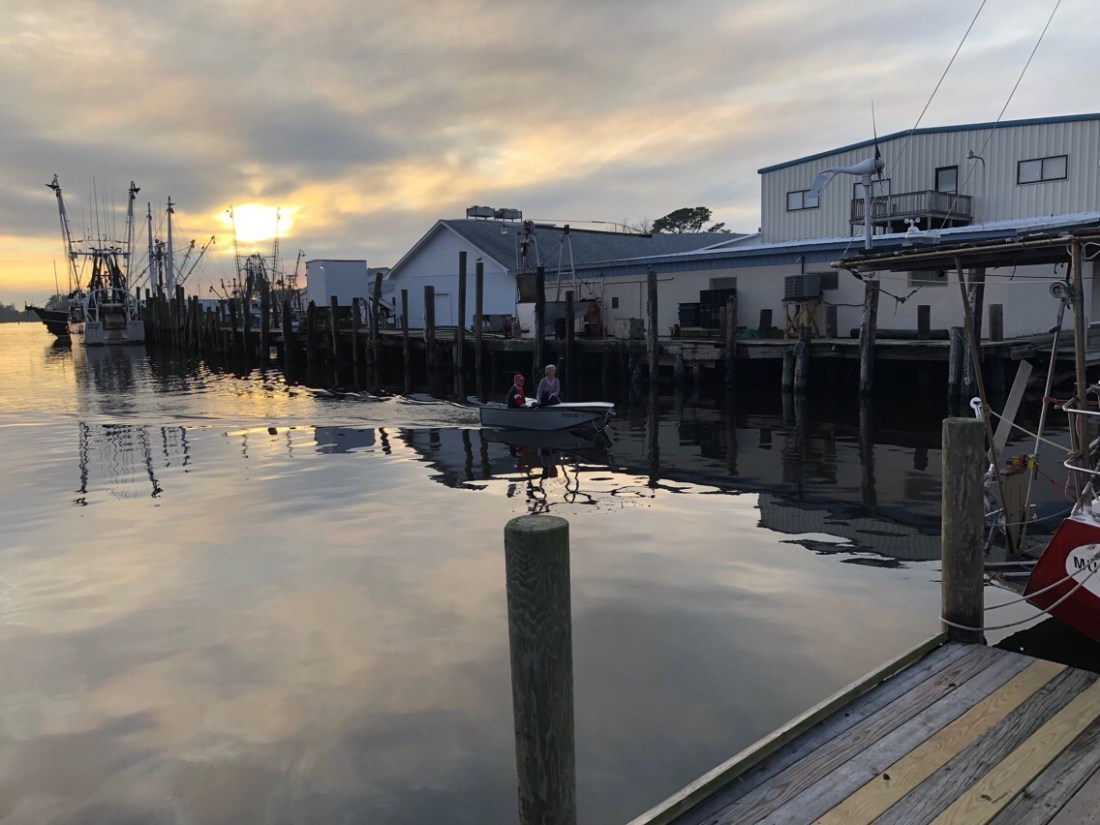

 It was a very yummy and abundant feast and fun to meet both locals and cruisers.
 The next morning Pegu Club motored into the harbor and began setting their anchor right next to us when I noticed a spot had opened on the public dock. They quickly hoisted the anchor and moved to the free dock. We always enjoy spending time with Jeff and Kimberly on Pegu Club. They also started their cruise from Shennecossett Yacht Club. We chatted animatedly as we walked together to the local Marine consignment and Piggly Wiggly grocery store. Later they came over for dinner, games and popcorn. This is the cruising lifestyle we truly enjoy! The below picture was taken by us as we returned to Lone Star at sunset.
 It was such an easy passage that we decided to carry on past Hospital Point; the beginning of the Intracoastal Waterway, referred to as ICW. We were surprised we made such good time and were soon directed into the Dismal Swamp Deep Creek lock just before 2:30.
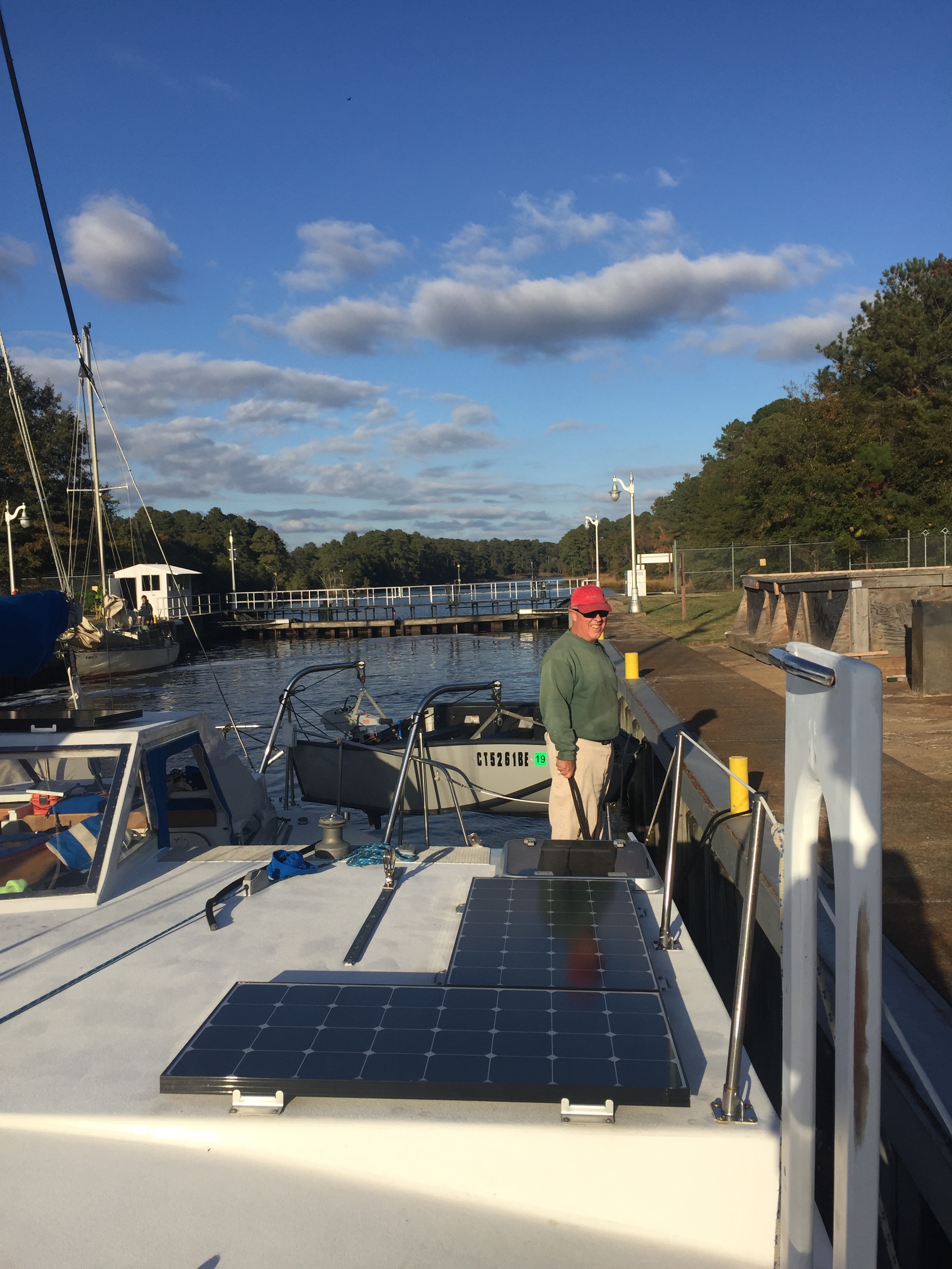
 There were 4 other boats in the lock with us. The lock master was real nice and provided lots of information about the canal and options of places to stay.
 This bulkhead tie-up was our first non-anchoring or sailing night since leaving home. We do not often dock as our vessel is a trimaran and too wide (22′ 6″) for most slips. We vastly prefer the freedom and peace of mind of being at anchor versus tied to a dock. However, the canal was quite still and narrow. There is certainly no room to swing at anchor. Street noise was loud, but not bothersome and subsided before bedtime. Tom made a quick run to a local Food Lion for fresh food as this was a very good supply stop and a short walk away.
 Pelican has a dinghy dock and let us do laundry and take showers. We also walked to town and had a very delicious lunch at Hoppin’ Johnz; smoked meats with southern barbecue flavors.